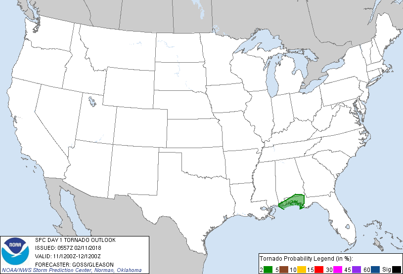
Atlanta, GA...Montgomery, AL...Mobile, AL...Columbus, GA...Sandy Springs, GA...
Probabilistic Tornado Graphic
Probability of a tornado within 25 miles of a point. Hatched Area: 10% or greater probability of EF2 - EF5 tornadoes within 25 miles of a point.
Day 1 Tornado Risk
Area (sq. mi.)
Area Pop.
Some Larger Population Centers in Risk Area
2 %
9,405
1,116,098
Pensacola, FL...Panama City, FL...Ferry Pass, FL...Wright, FL...Brent, FL...
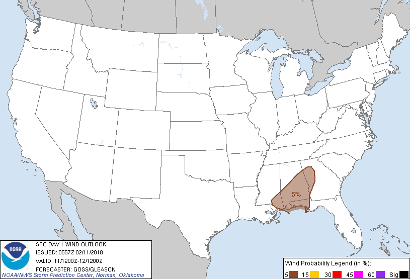
Probabilistic Damaging Wind Graphic
Probability of damaging thunderstorm winds or wind gusts of 50 knots or higher within 25 miles of a point. Hatched Area: 10% of greater probability of wind gusts 65 knots or greater within 25 miles of a point.
Day 1 Wind Risk
Area (sq. mi.)
Area Pop.
Some Larger Population Centers in Risk Area
5 %
55,453
8,138,741
Atlanta, GA...Montgomery, AL...Mobile, AL...Columbus, GA...Sandy Springs, GA...
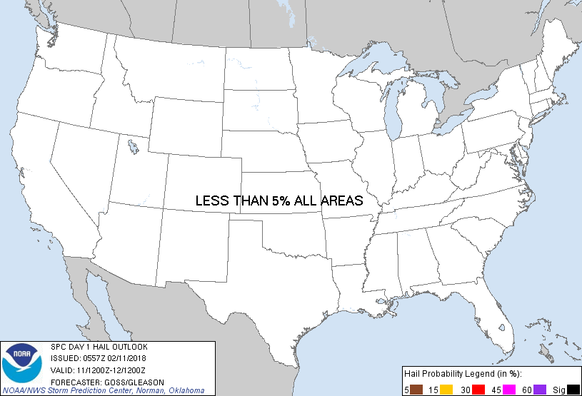
Probabilistic Large Hail Graphic
Probability of hail 1" or larger within 25 miles of a point. Hatched Area: 10% or greater probability of hail 2" or larger within 25 miles of a point.
Day 1 Hail Risk
Area (sq. mi.)
Area Pop.
Some Larger Population Centers in Risk Area
No Risk Areas Forecast
SPC AC 110557
Day 1 Convective Outlook
NWS Storm Prediction Center Norman OK
1157 PM CST Sat Feb 10 2018
Valid 111200Z - 121200Z
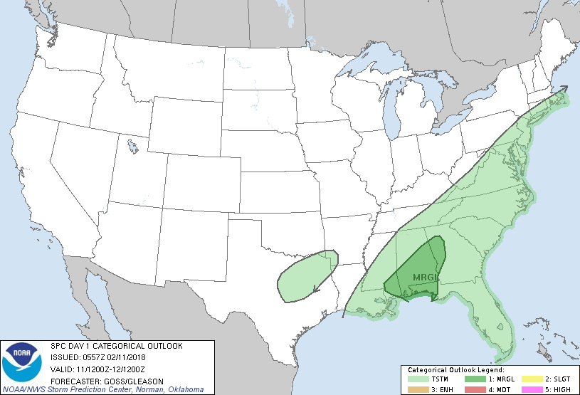
...THERE IS A MARGINAL RISK OF SEVERE THUNDERSTORMS ACROSS PORTIONS
OF THE SOUTHEAST...
...SUMMARY...
Thunderstorms are expected from the Lower Mississippi Valley
northeastward into the Mid-Atlantic, with a marginal risk for a few
strong to possibly severe storms across a portion of the Southeast.
A few thunderstorms might also occur over portions of the east Texas
vicinity.
...Synopsis...
Large-scale upper troughing is forecast to be maintain over the U.S.
this period. While weak short-wave energy over the Southeast shifts
northeastward toward the mid-Atlantic region and a second trough
exits the Plains and crosses the Midwest/Ohio Valley, the overall
larger-scale troughing will be maintained as additional short-wave
disturbances dig southward across the West.
At the surface, low pressure is forecast to move quickly
northeastward across the Appalachians, as a cold front shifts
east/southeast across the mountains and the Southeast states -- and
will be the primary feature associated with the main zone of
convective interest this forecast.
...Parts of southeast Mississippi east to portions of western
Georgia...
Showers and sporadic/embedded thunderstorms will likely be ongoing
at the start of the period, in conjunction with short-wave troughing
crossing the central Gulf Coast region. With the overnight
convection expected to further dilute the already meager inland
instability, severe risk lingering into the start of the period
should remain minimal/isolated -- and probably confined to portions
of the Florida Panhandle.
As the short-wave trough shifts northeastward toward the
mid-Atlantic, weak mid-level height rises and some weakening of the
low-level flow, suggests risk for stronger storms should remain
minimal. As the cold front shifts southeastward through the
afternoon, a few attempts at frontal convective redevelopment may
occur. However, meager instability expected should hinder
convective potential/severe risk. As such, will maintain only
marginal risk centered over the southern Alabama area.
..Goss/Gleason.. 02/11/2018
CLICK TO GET WUUS01 PTSDY1 PRODUCT
NOTE: THE NEXT DAY 1 OUTLOOK IS SCHEDULED BY 1300Z