Probability of damaging thunderstorm winds or wind gusts of 50 knots or higher within 25 miles of a point. Hatched Area: 10% of greater probability of wind gusts 65 knots or greater within 25 miles of a point.
Day 1 Wind Risk
Area (sq. mi.)
Area Pop.
Some Larger Population Centers in Risk Area
5 %
43,482
6,634,096
New Orleans, LA...Baton Rouge, LA...Mobile, AL...Pasadena, TX...Metairie, LA...
Probabilistic Large Hail Graphic
Probability of hail 1" or larger within 25 miles of a point. Hatched Area: 10% or greater probability of hail 2" or larger within 25 miles of a point.
SPC AC 251951
Day 1 Convective Outlook
NWS Storm Prediction Center Norman OK
0151 PM CST Sun Feb 25 2018
Valid 252000Z - 261200Z
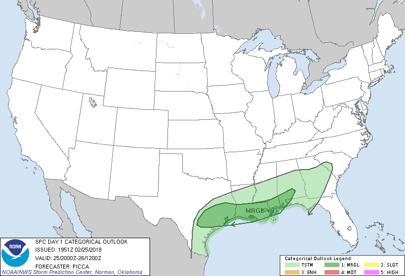
...THERE IS A MARGINAL RISK OF SEVERE THUNDERSTORMS FROM SOUTHEAST
TEXAS TO THE CENTRAL GULF COAST...
...SUMMARY...
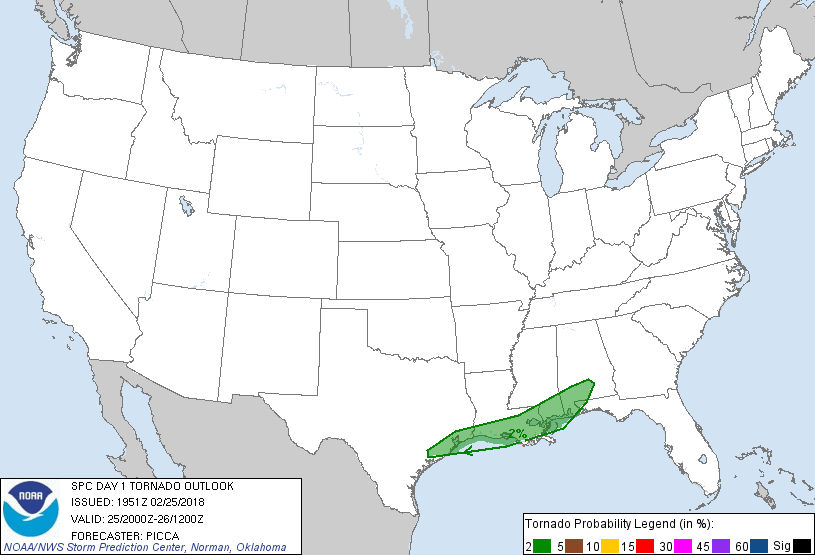
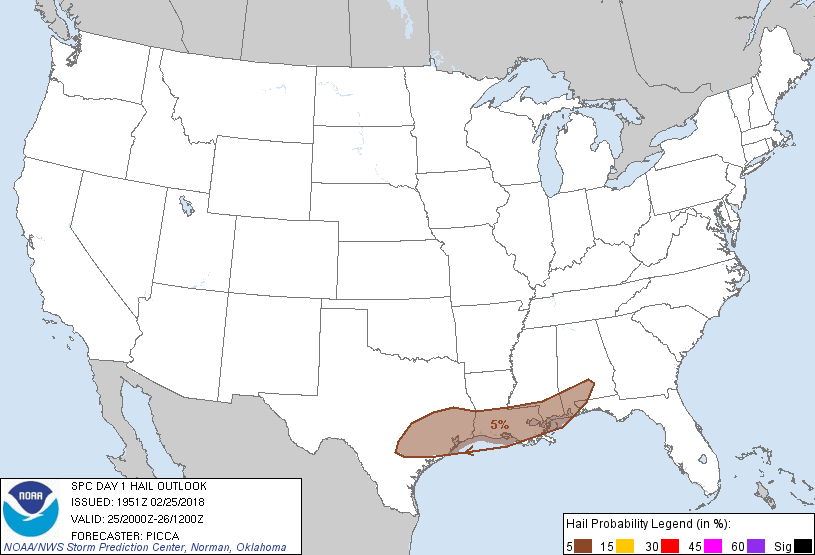
A few storms capable of producing hail, localized wind damage or a
brief/weak tornado are possible across parts of Texas today, and
then across the central Gulf Coast region tonight.
...Discussion...
Thunderstorms continue to form atop a surface stable layer over
southeast Texas this afternoon. Favorable effective shear, evidenced
by recent KEWX/KHGX VWP data and near-term forecast soundings, will
maintain a marginal hail threat into this evening. Indeed, MRMS
CAPPI and mid-level rotational products suggest occasional updraft
organization. Additionally, an isolated storm or two may continue to
pose a hail threat across the central Gulf Coast overnight.
In terms of the wind/tornado threat, with the glancing influence of
a mid-level impulse over the southern Plains and Mississippi Valley,
some weak/brief poleward surface theta-e advection is anticipated,
likely returning a maritime air mass to parts of the central Gulf
Coast. In turn, despite the earlier passage of a composite
outflow/cold front, adequate surface destabilization may occur
across coastal areas for a marginal wind/tornado threat overnight,
and only minor adjustments have been made to the ongoing outlook.
..Picca.. 02/25/2018
.PREV DISCUSSION... /ISSUED 1010 AM CST Sun Feb 25 2018/
...TX today...
Clusters of thunderstorms are affecting parts of central and
southeast TX this morning, ahead of a mid-level shortwave trough and
in region of low-level warm advection. Continued re-development in
this area will likely persist trough the afternoon, with sufficient
elevated CAPE and deep-layer shear to promote rotating cells capable
of hail. The risk of organized severe storms appears marginal.
...Western/Middle Gulf Coast tonight...
Later tonight, the low-level air mass is forecast to slowly recover
along the immediate Gulf Coast from southern LA into the FL
Panhandle. Most 12z model guidance is consistent in the development
of thunderstorms tonight along/north of the retreating warm front
over LA. These storms will track eastward in vicinity of the
boundary and move across parts of MS/AL/FL. While the overall
severe threat appears low, there is some risk of locally
gusty/damaging winds or a brief tornado.
CLICK TO GET WUUS01 PTSDY1 PRODUCT
NOTE: THE NEXT DAY 1 OUTLOOK IS SCHEDULED BY 0100Z