SPC AC 210050
Day 1 Convective Outlook
NWS Storm Prediction Center Norman OK
0750 PM CDT Tue Mar 20 2018
Valid 210100Z - 211200Z
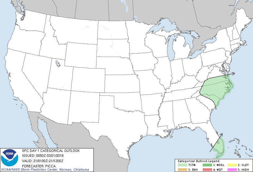
...NO SEVERE THUNDERSTORM AREAS FORECAST...
...SUMMARY...
A strong/marginally severe thunderstorm remains possible over south
Florida this evening, but the risk for organized severe weather
appears to be quite low for the remainder of the night.
...Discussion...
A broken band of convection is sagging southward over south Florida
this evening. Plentiful deep-layer shear and steep mid-level lapse
rates (noted in the 00Z MFL and KEY soundings) may encourage a
stronger cell or two, capable of marginally severe hail and gusty
winds, for the next hour or so. However, a nocturnal increase in
convective inhibition, coupled with cells moving away from deeper
ascent, will continue the downward intensity trend this evening.
Farther north, synoptic ascent along the nose of a mid-level
vorticity max is enhancing convective development near the SC/NC
border, and these cells will push east/northeast through the early
overnight. Brief small hail may be possible, but organized severe
weather is not anticipated.
..Picca.. 03/21/2018
CLICK TO GET WUUS01 PTSDY1 PRODUCT
NOTE: THE NEXT DAY 1 OUTLOOK IS SCHEDULED BY 0600Z
|