Probability of damaging thunderstorm winds or wind gusts of 50 knots or higher within 25 miles of a point. Hatched Area: 10% of greater probability of wind gusts 65 knots or greater within 25 miles of a point.
Day 1 Wind Risk
Area (sq. mi.)
Area Pop.
Some Larger Population Centers in Risk Area
15 %
57,923
8,636,470
San Antonio, TX...Dallas, TX...Austin, TX...Plano, TX...Garland, TX...
5 %
106,858
7,255,746
Fort Worth, TX...Arlington, TX...Shreveport, LA...Little Rock, AR...Carrollton, TX...
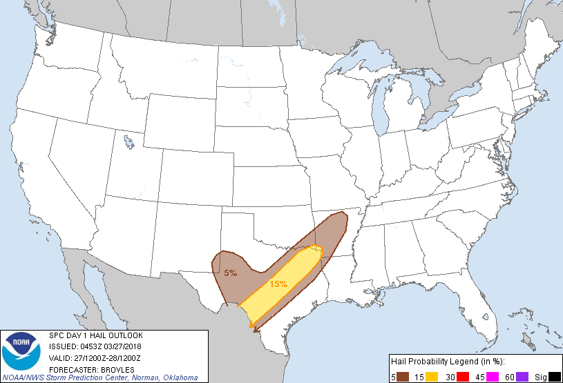
Probabilistic Large Hail Graphic
Probability of hail 1" or larger within 25 miles of a point. Hatched Area: 10% or greater probability of hail 2" or larger within 25 miles of a point.
Day 1 Hail Risk
Area (sq. mi.)
Area Pop.
Some Larger Population Centers in Risk Area
15 %
57,560
8,690,850
San Antonio, TX...Dallas, TX...Austin, TX...Plano, TX...Garland, TX...
5 %
107,547
7,202,849
Fort Worth, TX...Arlington, TX...Shreveport, LA...Little Rock, AR...Carrollton, TX...
SPC AC 270453
Day 1 Convective Outlook
NWS Storm Prediction Center Norman OK
1153 PM CDT Mon Mar 26 2018
Valid 271200Z - 281200Z
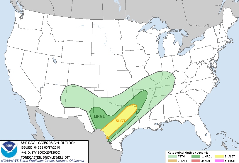
...THERE IS A SLIGHT RISK OF SEVERE THUNDERSTORMS ACROSS PARTS OF
THE SOUTHERN PLAINS INTO THE ARKLATEX...
...THERE IS A MARGINAL RISK OF SEVERE THUNDERSTORMS ACROSS PARTS OF
THE SOUTHERN PLAINS...ARKLATEX AND SOUTHERN OZARKS...
...SUMMARY...
Strong to severe storms with isolated large hail and damaging wind
gusts will be possible today into tonight across parts of the
southern Plains northeastward into the Arklatex and the southern
Ozarks.
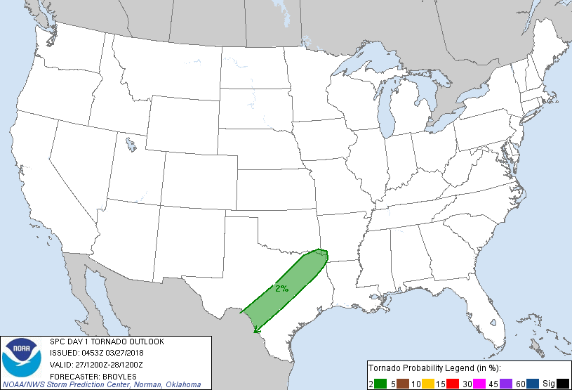
...Southern Plains/Arklatex...
Southwest mid-level flow will remain in place across the southern
Plains as several perturbations move northeastward across the
region. At the surface, a cold front will advance southeastward into
the western Texas Hill Country extending northeastward across north
Texas into southeastern Oklahoma. Numerous thunderstorms should be
ongoing along the front this morning with this convection gradually
spreading eastward during the day. Ahead of the front, a moist
airmass will be in place from eastern parts of the Texas Hill
Country eastward into east Texas where moderate instability should
develop by afternoon. As surface temperatures warm across the moist
sector, new surface-based thunderstorms are forecast to initiate
along outflow boundaries ahead of the front during the mid to late
afternoon. This convection should gradually move eastward across
central and northeast Texas during the late afternoon and early to
mid evening. Other more isolated thunderstorms may develop across
southwest Texas where the strongest instability is forecast to be in
place. Some of the storms ahead of the front will likely become
organized due to strong deep-layer shear. Rotating storms will have
the best potential to produce large hail and isolated wind damage.
Cells that develop into short line segments in areas where low-level
lapse rates become steep may also produce wind damage.
...West Texas/Far Southeast New Mexico...
A positively-tilted upper-level trough will move across the southern
Rockies today with the southern periphery of the system across
northwest Mexico. At the surface, a cold front will advance
southward across the Texas Hill Country today as winds remained
backed to the east across west Texas. In response, a tongue of
low-level moisture is forecast to extend west-northwestward across
west Texas into far southeast New Mexico where surface dewpoints may
reach the lower 50s F. As surface temperatures warm during the day,
a pocket of moderate instability may develop across parts of west
Texas. Convection is most likely to initiate on the northern edge of
the stronger instability near or just to the west of Lubbock this
afternoon. Lapse rates will be quite steep suggesting that hail will
be possible as cells intensify during the late afternoon. A few
marginally severe wind gusts will also be possible.
..Broyles/Elliott.. 03/27/2018
CLICK TO GET WUUS01 PTSDY1 PRODUCT
NOTE: THE NEXT DAY 1 OUTLOOK IS SCHEDULED BY 1300Z