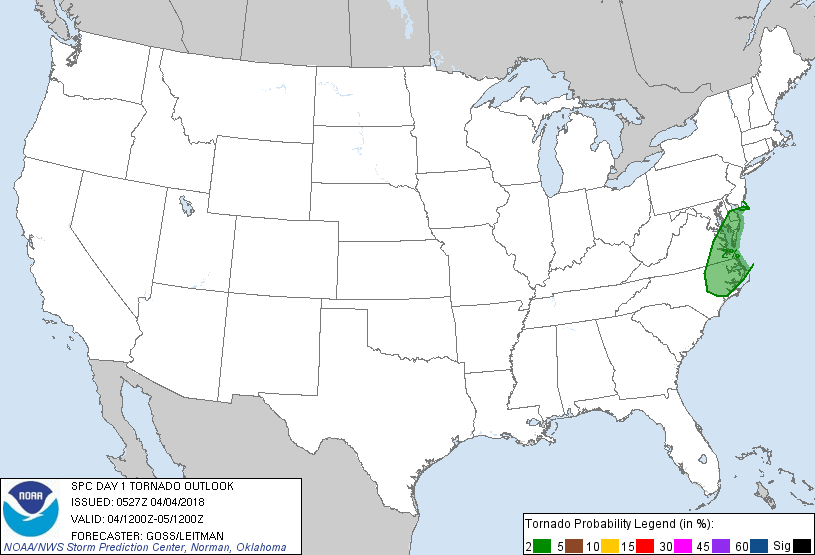
Probability of a tornado within 25 miles of a point. Hatched Area: 10% or greater probability of EF2 - EF5 tornadoes within 25 miles of a point.
Day 1 Tornado Risk
Area (sq. mi.)
Area Pop.
Some Larger Population Centers in Risk Area
2 %
28,524
3,567,192
Virginia Beach, VA...Norfolk, VA...Chesapeake, VA...Newport News, VA...Hampton, VA...
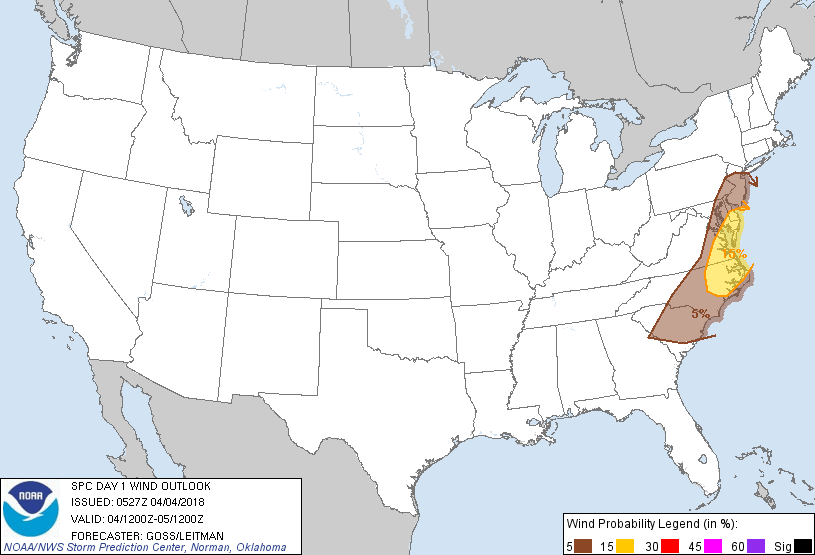
Probabilistic Damaging Wind Graphic
Probability of damaging thunderstorm winds or wind gusts of 50 knots or higher within 25 miles of a point. Hatched Area: 10% of greater probability of wind gusts 65 knots or greater within 25 miles of a point.
Day 1 Wind Risk
Area (sq. mi.)
Area Pop.
Some Larger Population Centers in Risk Area
15 %
28,524
3,567,192
Virginia Beach, VA...Norfolk, VA...Chesapeake, VA...Newport News, VA...Hampton, VA...
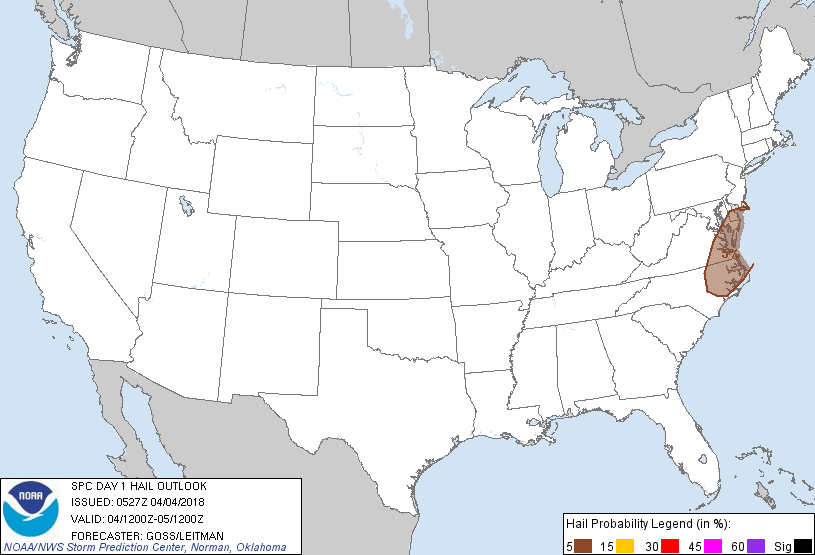
Probability of hail 1" or larger within 25 miles of a point. Hatched Area: 10% or greater probability of hail 2" or larger within 25 miles of a point.
Day 1 Hail Risk
Area (sq. mi.)
Area Pop.
Some Larger Population Centers in Risk Area
5 %
28,524
3,567,192
Virginia Beach, VA...Norfolk, VA...Chesapeake, VA...Newport News, VA...Hampton, VA...
SPC AC 040527
Day 1 Convective Outlook
NWS Storm Prediction Center Norman OK
1227 AM CDT Wed Apr 04 2018
Valid 041200Z - 051200Z
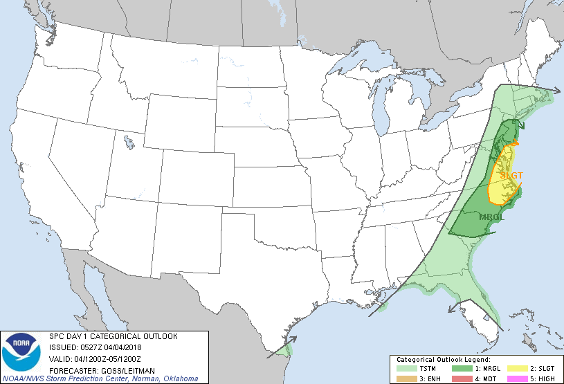
...THERE IS A SLIGHT RISK OF SEVERE THUNDERSTORMS FROM THE DELMARVA
REGION SOUTHWARD TO PARTS OF EASTERN NORTH CAROLINA...
...THERE IS A MARGINAL RISK OF SEVERE THUNDERSTORMS SURROUNDING THE
SLIGHT RISK AREA...AND INCLUDING A LARGER PORTION OF THE EAST COAST
STATES...
...SUMMARY...
Thunderstorms -- a couple of which may become capable of locally
damaging wind gusts -- are expected to develop this afternoon across
portions of the mid-Atlantic region and eastern North Carolina.
...Synopsis...
As a compact but energetic upper low/trough initially over the Great
Lakes shifts northeastward across the Ottawa and St. Lawrence River
Valleys with time, fast but relatively low-amplitude flow will
prevail across most the U.S. today.
At the surface, a cold front associated with the aforementioned
upper system -- likely to lie east of the Appalachian Crest by the
start of the period -- will move quickly eastward across the East
Coast states through the day. By sunset, the front will likely have
shifted off the Atlantic Coast, lingering only across the Florida
Peninsula. The front may focus scattered shower/thunderstorm
development during the afternoon before shifting offshore.
...The Delmarva Peninsula into parts of eastern North Carolina...
Afternoon heating of the pre-frontal warm sector will support modest
destabilization across portions of the Eastern Seaboard, with
mixed-layer CAPE rising to near 500 J/kg locally. Though
veered/southwest surface winds are expected ahead of the front --
reducing both frontal convergence and low-level shear, strong flow
aloft will provide a favorable kinematic environment for organized
updrafts.
Isolated to scattered thunderstorms should develop near the front as
it approaches the coast during the mid to late afternoon hours,
possibly growing upscale locally into line segments before moving
offshore. Given the strength of the deep-layer wind field, a few
strong to severe storms may evolve, with locally damaging wind gusts
the primary risk. Threat should end from west to east through late
afternoon, as the front moves offshore.
..Goss/Leitman.. 04/04/2018
CLICK TO GET WUUS01 PTSDY1 PRODUCT
NOTE: THE NEXT DAY 1 OUTLOOK IS SCHEDULED BY 1300Z