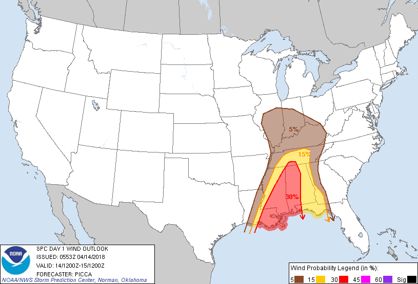
Probability of damaging thunderstorm winds or wind gusts of 50 knots or higher within 25 miles of a point. Hatched Area: 10% of greater probability of wind gusts 65 knots or greater within 25 miles of a point.
Day 1 Wind Risk
Area (sq. mi.)
Area Pop.
Some Larger Population Centers in Risk Area
30 %
81,596
8,006,812
New Orleans, LA...Birmingham, AL...Baton Rouge, LA...Mobile, AL...Jackson, MS...
SPC AC 140553
Day 1 Convective Outlook
NWS Storm Prediction Center Norman OK
1253 AM CDT Sat Apr 14 2018
Valid 141200Z - 151200Z
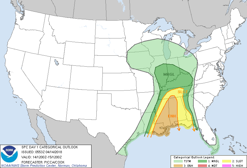
...THERE IS AN ENHANCED RISK OF SEVERE THUNDERSTORMS FROM THE
CENTRAL GULF COAST TO THE TENNESSEE VALLEY...
...THERE IS A SLIGHT RISK OF SEVERE THUNDERSTORMS FROM PARTS OF THE
GULF COAST TO MIDDLE TENNESSEE...
...THERE IS A MARGINAL RISK OF SEVERE THUNDERSTORMS FROM PARTS OF
THE GULF COAST TO THE MIDWEST...
...SUMMARY...
Scattered severe storms are expected from the central Gulf Coast to
the Tennessee Valley today into tonight. The primary threats will be
damaging winds and tornadoes, some of which could be strong.
...Synopsis...
An expansive/amplified mid-level trough and embedded closed low will
slowly shift east from the Plains towards the Mississippi Valley
today. As it does so, it will gradually acquire a more negative
tilt, owing to a secondary jet maximum advancing around the southern
periphery of the trough and reaching the central Gulf by tonight. In
response, a surface cold front will accelerate eastward from the
lower Mississippi Valley, reaching the approximate Alabama/Georgia
border near the end of the period Sunday morning.
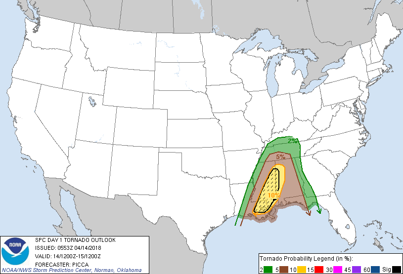
...Central Gulf Coast to the Tennessee Valley...
A pair of convective systems (one across east/southeast Texas and
the other near the Mid-South) are making steady eastward progress
and their evolution through the early morning hours will likely
influence severe potential for the upcoming D1/Saturday period. Each
of these systems are forecast to weaken some by 12Z this morning, as
they push farther into eastern Louisiana and Mississippi. Although
one low-level jet max will be lifting away towards the Ohio Valley
at this time, a secondary enhancement is likely to occur from the
Louisiana coast northward into Mississippi. Focused ascent
associated with this 50-60kt 850mb jet corridor is forecast to
re-intensify a line of storms from Louisiana northward into
Mississippi during the morning hours.
Combined with surface dew points in the upper 60s/lower 70s and
MLCAPE values around 1000-2000 J/kg, strengthening low-level shear
should foster a maturing squall line, composed of embedded bowing
segments and perhaps supercell structures, that pushes east across
parts of Louisiana, Mississippi, and Alabama through the
afternoon/evening. Damaging winds and a few embedded tornadoes will
be the primary threats, and some of these tornadoes could be strong,
considering continued moistening of the boundary layer and 0-1km
shear upwards of 40-45 kt. Some severe threat should then persist
into the overnight hours, as the line reaches eastern Alabama and
the Florida Panhandle.
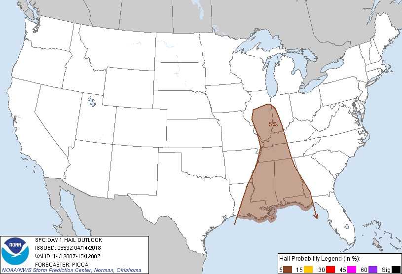
...Mid Mississippi and lower Ohio Valleys...
Cooling temperatures aloft and amplifying large-scale ascent will
yield pockets of convection ahead of the primary surface low and
cold front over southern Illinois this afternoon. While some
destabilization may occur here, overnight convection to the south
and little recovery time ahead of the cold front cast considerable
doubt on the coverage of robust convection. Indeed, 00Z CAMs are
unanimous in showing little in the way of vigorous thunderstorm
activity today. Therefore, slight risk probabilities have been
removed. A few stronger storms, capable of gusty winds and perhaps
isolated large hail, may still develop later today, though.
..Picca/Cook.. 04/14/2018
CLICK TO GET WUUS01 PTSDY1 PRODUCT
NOTE: THE NEXT DAY 1 OUTLOOK IS SCHEDULED BY 1300Z