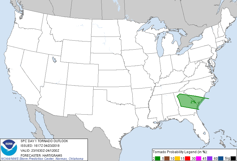
Atlanta, GA...Savannah, GA...Charleston, SC...Sandy Springs, GA...Macon, GA...
Probabilistic Tornado Graphic
Probability of a tornado within 25 miles of a point. Hatched Area: 10% or greater probability of EF2 - EF5 tornadoes within 25 miles of a point.
Day 1 Tornado Risk
Area (sq. mi.)
Area Pop.
Some Larger Population Centers in Risk Area
2 %
39,598
8,092,267
Atlanta, GA...Savannah, GA...Charleston, SC...Sandy Springs, GA...Macon, GA...
Probabilistic Damaging Wind Graphic
Probability of damaging thunderstorm winds or wind gusts of 50 knots or higher within 25 miles of a point. Hatched Area: 10% of greater probability of wind gusts 65 knots or greater within 25 miles of a point.
Day 1 Wind Risk
Area (sq. mi.)
Area Pop.
Some Larger Population Centers in Risk Area
5 %
65,597
8,300,258
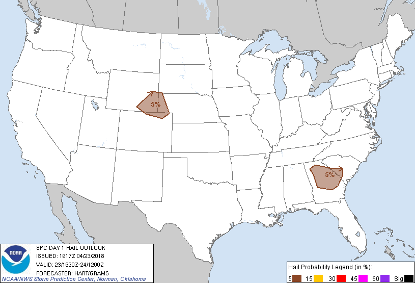
Atlanta, GA...Savannah, GA...Charleston, SC...Sandy Springs, GA...Macon, GA...
Probabilistic Large Hail Graphic
Probability of hail 1" or larger within 25 miles of a point. Hatched Area: 10% or greater probability of hail 2" or larger within 25 miles of a point.
Day 1 Hail Risk
Area (sq. mi.)
Area Pop.
Some Larger Population Centers in Risk Area
5 %
54,353
6,809,533
Atlanta, GA...Sandy Springs, GA...Macon, GA...Roswell, GA...Marietta, GA...
SPC AC 231617
Day 1 Convective Outlook
NWS Storm Prediction Center Norman OK
1117 AM CDT Mon Apr 23 2018
Valid 231630Z - 241200Z
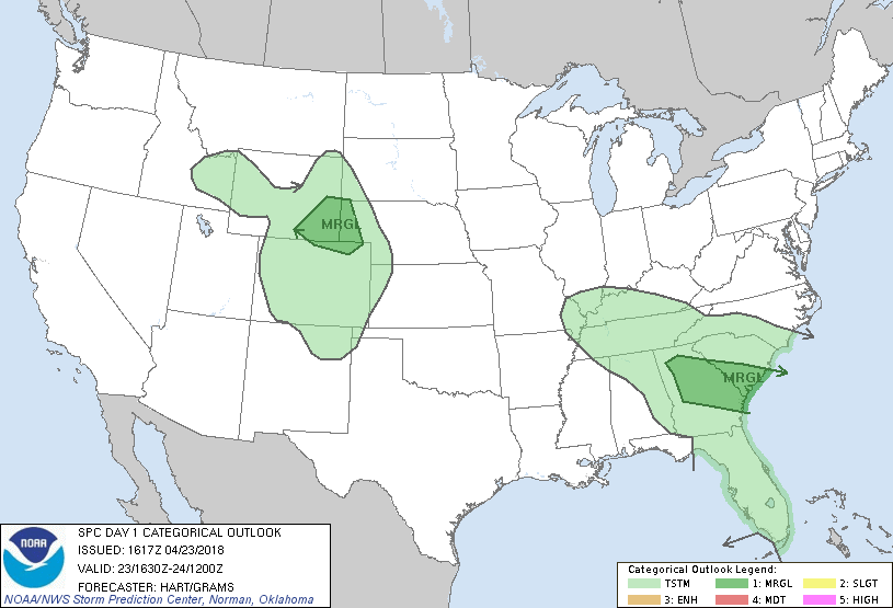
...THERE IS A MARGINAL RISK OF SEVERE THUNDERSTORMS OVER PARTS OF
GEORGIA AND SOUTH CAROLINA...
...THERE IS A MARGINAL RISK OF SEVERE THUNDERSTORMS OVER PARTS OF
SOUTHEAST WYOMING...NORTHEAST COLORADO...AND THE NEBRASKA
PANHANDLE...
...SUMMARY...
A few strong to severe storms are possible across parts of Georgia
and South Carolina, and over the central High Plains.
...GA/SC...
A persistent upper low is centered over west TN, with
west-southwesterly mid level winds across the southeast states. The
primary occluded surface low is beneath the upper low, with an
occluded front extending southeastward into GA. The primary region
of concern for a few strong/severe storms today will be in vicinity
of a warm front extending from its intersection with the occluded
boundary into SC.
Visible satellite imagery shows breaks in the clouds along and south
of the warm front, where dewpoints in the mid 60s will yield
afternoon MLCAPE values around 1000 J/kg. This should result in
scattered thunderstorm development this afternoon. Forecast
soundings suggest that mid-level lapse rates will be rather weak,
limiting updraft strength and overall severe threat. However,
sufficient deep layer shear will promote organized storm structures
capable of hail and/or gusty winds. This threat should diminish a
few hours after sunset.
The strongest low-level shear profiles will be in vicinity of the
warm front over central/eastern SC. Storms in this area would also
have some potential for isolated/brief tornadoes. Current
indications are that the overall setup is sufficiently covered by
the ongoing MRGL risk category.
...WY/CO/NE...
Water vapor loop shows a progressive shortwave trough moving into
western WY. Lift associated with this feature will begin affecting
eastern WY and northern CO this afternoon. Surface dewpoints will
only be in the upper 30s to lower 40s. However, strong heating will
combine with very steep lapse rates to yield just enough CAPE for
thunderstorms later today. Cold temperatures aloft and favorable
effective shear suggest a few rotating storms or bowing structures
capable of hail and/or gusty winds.
..Hart/Grams.. 04/23/2018
CLICK TO GET WUUS01 PTSDY1 PRODUCT
NOTE: THE NEXT DAY 1 OUTLOOK IS SCHEDULED BY 2000Z