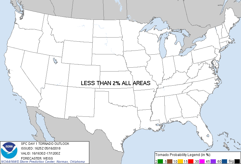
Probability of a tornado within 25 miles of a point. Hatched Area: 10% or greater probability of EF2 - EF5 tornadoes within 25 miles of a point.
Day 1 Tornado Risk
Area (sq. mi.)
Area Pop.
Some Larger Population Centers in Risk Area
No Risk Areas Forecast
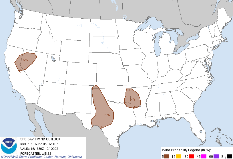
Probabilistic Damaging Wind Graphic
Probability of damaging thunderstorm winds or wind gusts of 50 knots or higher within 25 miles of a point. Hatched Area: 10% of greater probability of wind gusts 65 knots or greater within 25 miles of a point.
SPC AC 161625
Day 1 Convective Outlook
NWS Storm Prediction Center Norman OK
1125 AM CDT Wed May 16 2018
Valid 161630Z - 171200Z
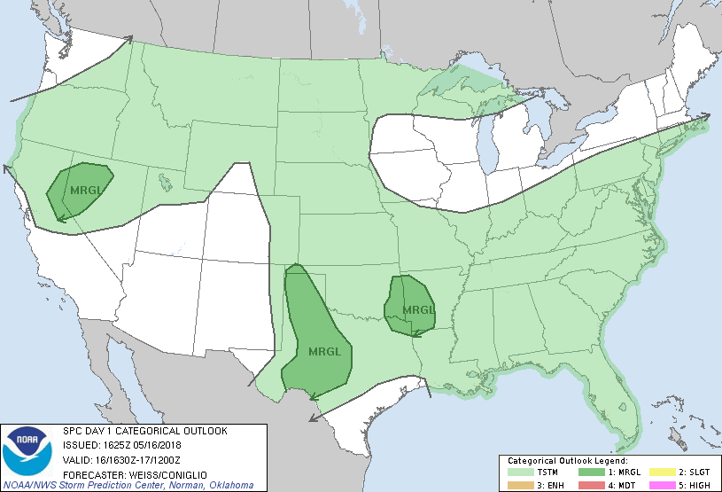
...THERE IS A MARGINAL RISK OF SEVERE THUNDERSTORMS OVER PARTS OF
WEST AND CENTRAL TEXAS...FROM EASTERN OKLAHOMA INTO WESTERN
ARKANSAS...AND FROM NORTHEAST CALIFORNIA INTO NORTHWEST NEVADA...
...SUMMARY...
A few strong to severe thunderstorms, accompanied by a risk for
damaging winds and large hail, are possible over parts of the
southern Plains this afternoon and evening. Other strong to
marginally severe storms will be possible over eastern Oklahoma,
western Arkansas and northeast Texas, and over parts of northeast
California into northwest Nevada.
...Eastern OK into western AR and northeast TX...
A weakening MCS over Oklahoma has generated two MCVs that are
expected to progress eastward into Arkansas this afternoon and
evening. Visible imagery shows limited clouds to the east and
southeast of the system, which will promote strong diabatic heating
and further air mass destabilization within a moist low-level
environment. Stronger west-northwesterly mid-level winds are
observed on the southwest flank of the MCVs, and these are expected
to move eastward toward the Arklatex region this afternoon and
enhance vertical shear, mainly to the immediate south of the MCVs.
Model guidance including morning CAM/HREF simulated reflectivity
forecasts indicate a few strong storms will increase in coverage
this afternoon and evening from eastern Oklahoma into western
Arkansas. Favorable instability with MLCAPE of 1500-2000 J/kg
suggests potential for a few strong to severe storms, with primary
threats for wet microbursts and hail. See Mesoscale Discussion 435
for additional details.
...Northeast CA into northwest NV...
A compact cold upper low is moving northeastward into central
California this morning. Dynamic forcing within the left exit
region of a mid-upper level jet coupled with steep mid-level lapse
rates has resulted in thunderstorm development from parts of the
central valley into the Sierra foothills, with other more isolated
storms extending into western Nevada. Convection is likely to
increase this afternoon as the upper low moves slowly to the
northeast and diurnal destabilization occurs on the periphery of
existing cloudy regions. Steep lapse rates will favor hail
potential in stronger storm cores, while development of a
surface-based well-mixed layer in the lower levels suggests
potential for a few strong wind gusts.
...Western into parts of central TX...
No changes have been to this area. Persistent overnight and morning
convection over the eastern Panhandle and south Plains generated an
outflow boundary that moved westward/southwestward this morning to
near the Texas/New Mexico state line. This has resulted in
temporary convective stabilization over parts of the region.
Visible imagery shows decreasing clouds and the onset of strong
diabatic heating, especially over the south Plains, and
destabilization is likely this afternoon as steeper mid-level lapse
rates persist over the area. Dynamic forcing aloft for large scale
ascent is expected to remain very weak as an upper ridge migrates
eastward over the area, and this is expected to limit coverage of
thunderstorms. However, a few storms are expected to form as the
dry line mixes eastward this afternoon, and favorable lapse rates
coupled with veering winds with height suggest potential for
isolated severe storms to develop. Large hail and strong wind gusts
will be the primary threats.
..Weiss/Coniglio.. 05/16/2018
CLICK TO GET WUUS01 PTSDY1 PRODUCT
NOTE: THE NEXT DAY 1 OUTLOOK IS SCHEDULED BY 2000Z