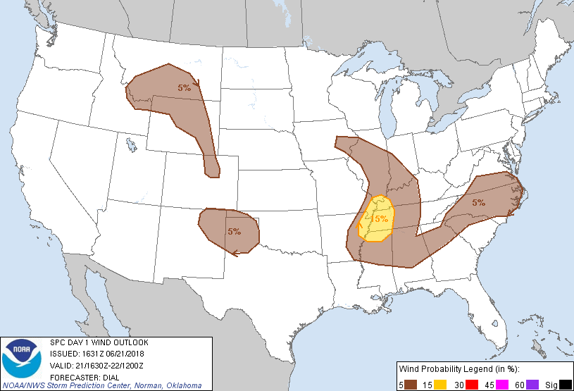
Probability of damaging thunderstorm winds or wind gusts of 50 knots or higher within 25 miles of a point. Hatched Area: 10% of greater probability of wind gusts 65 knots or greater within 25 miles of a point.
SPC AC 211631
Day 1 Convective Outlook
NWS Storm Prediction Center Norman OK
1131 AM CDT Thu Jun 21 2018
Valid 211630Z - 221200Z
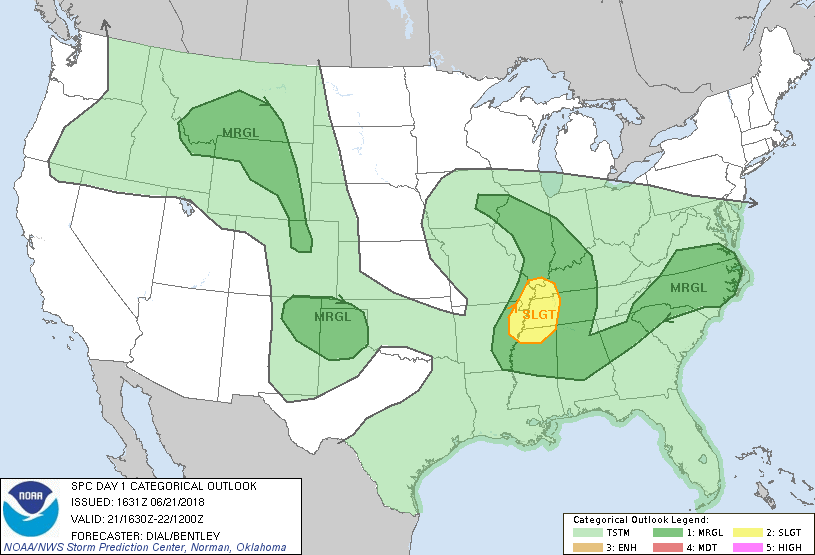
...THERE IS A SLIGHT RISK OF SEVERE THUNDERSTORMS OVER A PORTION OF
THE LOWER MISSISSIPPI VALLEY AND WESTERN TENNESSEE VALLEY REGIONS...
...SUMMARY...
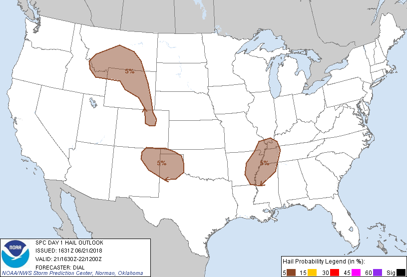
Severe thunderstorms with isolated damaging wind will be possible
today over a part of the lower Mississippi Valley and western
Tennessee Valley. Storms capable of isolated severe gusts and hail
are possible across parts of the High Plains and north-central
Rockies later this afternoon into the early evening. Storms
producing a few locally strong to damaging gusts are also possible
over the lower Ohio Valley as well as the North Carolina/Virginia
vicinity.
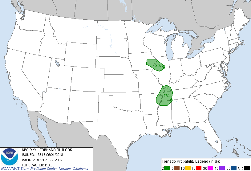
...MO/AR into KY/TN/MS...
Late morning surface analysis indicates an occluded front extending
east from a surface low over southwest IA. This boundary then
transitions to a cold front that stretches across western IL into
south central MO and northwest AR. Partial clearing is occurring
from AR into western TN and southeast MO in wake of morning showers.
Mid-level lapse rates are weak, but diabatic warming of the very
moist boundary layer should boost MLCAPE to 1500-2000 J/kg. Storms
should initiate along the cold front from northeast AR into
southeast MO this afternoon and gradually increase in intensity as
they move through the destabilizing warm sector. A 50 kt mid-level
jet max on the southern periphery of the upper low circulation is
moving southeast and will overtake the frontal zone this afternoon,
resulting in up to 45 kt effective bulk shear supportive of a few
rotating updrafts. Some storms may also evolve into broken line
segments with damaging wind expected to be the main threat. Despite
weak mid-level lapse rates, a few instances of hail are also
possible, especially given possibility of left splits and potential
contribution of pressure perturbations to updraft strength. Though a
brief tornado cannot be ruled out, low-level hodographs are
relatively small which should temper overall tornado threat.
...Northern Rockies and High Plains...
A pronounced shortwave trough is moving across ID late this morning,
and will continue through the northern Rockies this afternoon.
Scattered thunderstorms are expected to form over much of this
region, with development also across eastern WY and southward into
northeast CO this evening. Forecast soundings suggest modest CAPE
in most areas, but sufficient vertical shear to promote the risk of
a few rotating storms. Isolated large hail and locally damaging wind
gusts will be possible in the strongest cells. It remains uncertain
where coverage of severe events will be sufficient for a categorical
upgrade, so will maintain marginal risk this update.
...IA/IL...
An upper low centered over southern IA will track southeastward into
eastern MO today. Strong convergence is occurring along an occluded
boundary wrapping westward into IA. Given the ambient vorticity
under the upper low, and proximity to the surface low/boundaries, an
isolated non-supercell tornado or two is not out of the question in
this zone. However, overall setup does not appear as favorable as
yesterday.
...VA/NC...
Scattered thunderstorms are expected to form over the higher terrain
of western VA/NC as well as in warm sector this afternoon and track
eastward across the MRGL risk area. Ample low level moisture is
present, along with the potential for strong heating and MLCAPE
values of 1000-1500 J/kg. Locally damaging wind gusts will be
possible, although weak mid-level lapse rates may temper the overall
severe risk.
...NM to TX Panhandle...
A few strong thunderstorms are expected to form this afternoon off
the higher terrain of the Raton Mesa, spreading southeastward toward
the TX Panhandle this evening. A few instances of large hail and
damaging winds will be possible with these storms. It still appears
the coverage of storms will remain very isolated, so will maintain
the MRGL risk category this update.
..Dial/Bentley.. 06/21/2018
CLICK TO GET WUUS01 PTSDY1 PRODUCT
NOTE: THE NEXT DAY 1 OUTLOOK IS SCHEDULED BY 2000Z