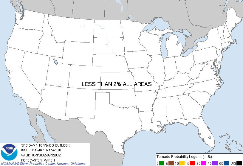
Probability of a tornado within 25 miles of a point. Hatched Area: 10% or greater probability of EF2 - EF5 tornadoes within 25 miles of a point.
Day 1 Tornado Risk
Area (sq. mi.)
Area Pop.
Some Larger Population Centers in Risk Area
No Risk Areas Forecast
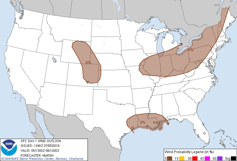
Probabilistic Damaging Wind Graphic
Probability of damaging thunderstorm winds or wind gusts of 50 knots or higher within 25 miles of a point. Hatched Area: 10% of greater probability of wind gusts 65 knots or greater within 25 miles of a point.
SPC AC 051246
Day 1 Convective Outlook
NWS Storm Prediction Center Norman OK
0746 AM CDT Thu Jul 05 2018
Valid 051300Z - 061200Z
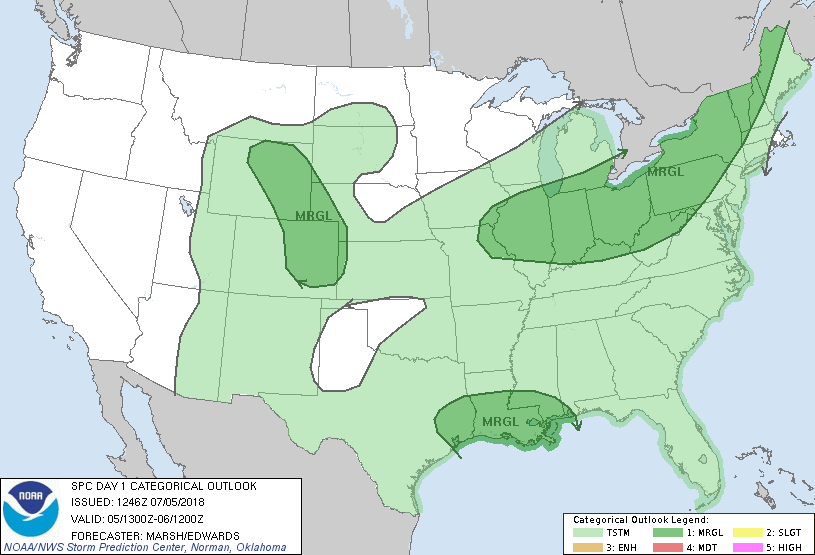
...THERE IS A MARGINAL RISK OF SEVERE THUNDERSTORMS ACROSS PORTIONS
OF THE GREATER SOUTHERN GREAT LAKES REGION INTO NEW
ENGLAND...NORTHERN GULF COAST...AND CENTRAL HIGH PLAINS...
...SUMMARY...
Marginally severe thunderstorms with hail and strong wind gusts will
be possible across portions of the central High Plains and across
the greater southern Great Lakes region into New England. A few
strong wind gusts may also occur across the northern Gulf Coast.
...Synopsis...
In the mid-levels, a seasonably strong short-wave trough will skirt
across the northern Great Lakes today, eventually ending up poised
to sweep across the Northeast on Friday. Large-scale ascent
associated with this trough will begin to lower heights across the
Northeast. At the same time, strong southerly flow around a
high-amplitude trough and cyclone along the Pacific coast will help
raise heights across the Intermountain West. The result will be
earnest westward building of the persistent, zonally-elongated ridge
across the eastern United States, culminating in 500-millibar
heights flirting with 600 decameters across the central Rocky
Mountains this evening.
At the surface, a cold front will move eastward across the
north-central United States and into the Great Lakes region. An
anticyclone is found off the Mid-Atlantic coast, and the flow around
this feature will maintain a very moist airmass to the south and
east of the aforementioned front, with dewpoints in excess of 70F
common.
...Greater Southern Great Lakes Vicinity into New England...
The combination of large-scale ascent from the mid-level trough
skirting the northern Great Lakes, modest low-level convergence
along the front, and a very moist (precipitable water around two
inches) and weakly capped environment will support isolated showers
and thunderstorms today. Deep-layer shear will be weak as the best
mid-level flow will remain north of the Great Lakes. The result will
be poorly-to-loosely organized cellular and multicell clusters, the
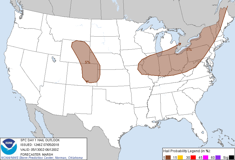
strongest of which may be capable of producing marginally severe
hail or wind.
...Central High Plains...
Despite rising heights through the day, continued moist low-level
upslope on the nose of southeasterly low-level winds, and aided by a
residual front in the vicinity, will support thunderstorms this
afternoon and evening atop the favored terrain areas. These
thunderstorms will be loath to move off the terrain initially, but
with time, sufficient cold-pool development could eventually allow a
few to move into the plains east of the Rockies. Additionally,
strong diurnal heating to the south of the front -- and potentially
on residual outflow boundaries -- may allow isolated thunderstorms
to develop east of the terrain. With both possible areas of
convection, mid-level lapse rates will remain somewhat muted -- only
in the 6-7 C/km range -- but should be sufficient to support a
marginal severe hail risk. Low-level lapse rates should be somewhat
better and may support a marginal damaging wind threat as well.
...Northern Gulf Coast...
This area remains south of the mid-level anticyclone across the
central of the United States. As such, deep easterly flow will
persist today. Embedded within the tropical easterlies will be
several troughs. The first of these is currently located across far
southern Texas and will move westward into northern Mexico through
today. Another such trough is currently over the northeast Gulf of
Mexico and will also move west through the day. Ascent with this
wave will combine with strong diurnal heating of a very moist
(precipitable water approaching two inches), weakly capped
environment to allow numerous showers and thunderstorms. Given the
expected degree of instability (mixed-layer CAPE between 1500-2500
J/kg) and modest deep-layer shear (between 20-30 knots)
thunderstorms may organize into multicell clusters, posing a
marginal risk for wet microbursts this afternoon and evening. A
modestly more substantive damaging-wind threat will be possible with
any westward moving multicell cluster that can grow upscale into
small bowing segments.
..Marsh/Edwards.. 07/05/2018
CLICK TO GET WUUS01 PTSDY1 PRODUCT
NOTE: THE NEXT DAY 1 OUTLOOK IS SCHEDULED BY 1630Z