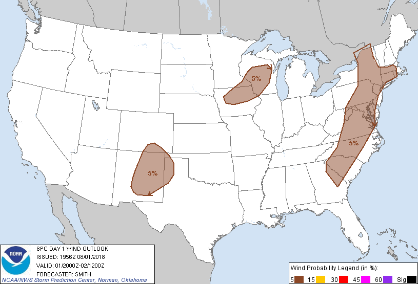
Probability of damaging thunderstorm winds or wind gusts of 50 knots or higher within 25 miles of a point. Hatched Area: 10% of greater probability of wind gusts 65 knots or greater within 25 miles of a point.
Day 1 Wind Risk
Area (sq. mi.)
Area Pop.
Some Larger Population Centers in Risk Area
5 %
296,219
64,189,903
New York, NY...Philadelphia, PA...Baltimore, MD...Charlotte, NC...Washington, DC...
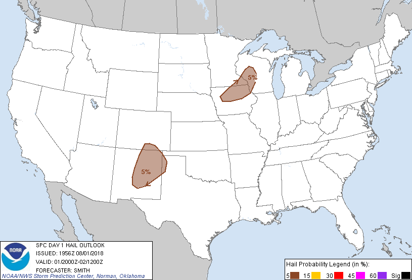
Probabilistic Large Hail Graphic
Probability of hail 1" or larger within 25 miles of a point. Hatched Area: 10% or greater probability of hail 2" or larger within 25 miles of a point.
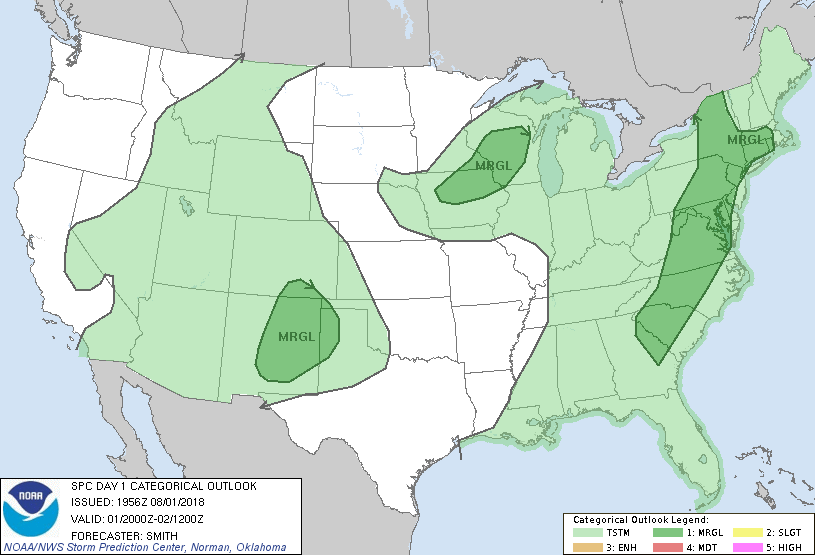
SPC AC 011956
Day 1 Convective Outlook
NWS Storm Prediction Center Norman OK
0256 PM CDT Wed Aug 01 2018
Valid 012000Z - 021200Z
...THERE IS A MARGINAL RISK OF SEVERE THUNDERSTORMS FOR A LARGE PART
OF THE EASTERN U.S....PARTS OF THE UPPER MIDWEST...AND SOUTHERN HIGH
PLAINS/ROCKIES...
...SUMMARY...
Localized damaging gusts are possible across parts of the
Mid-Atlantic and Southeast regions this afternoon and other isolated
strong to locally severe thunderstorms are possible in parts of Iowa
and Wisconsin and New Mexico.
...Discussion...
Main impetus for change from the previous outlook is the lack of
robust thunderstorm development over much of the eastern U.S. within
the marginal and slight risk areas. Have removed the 15-percent
wind (slight risk) areas over the Southeast and Mid-Atlantic states.
This change is based on in part with observed trends
(lightning/radar) thus far and the nimbleness of the convective
signal in absence of strong forcing. Have included a small portion
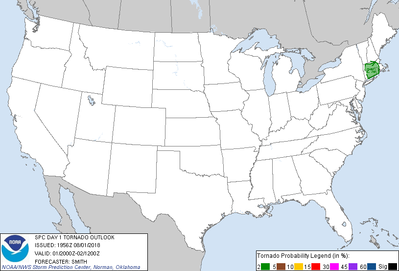
of southern New England into low wind/tornado probabilities to
account for a marginal supercell risk within this area for the next
few hours before this activity diminishes early this evening.
Elsewhere, no change has been made.
..Smith.. 08/01/2018
.PREV DISCUSSION... /ISSUED 1130 AM CDT Wed Aug 01 2018/
...Eastern States...
East of a longwave trough centered across the MS Valley, a belt of
50-60 kt 500 mb south-southwesterlies should exist at 00Z from
western NC northeast towards the New York City tri-state region. In
spite of this strong belt of flow, pervasively poor mid-level lapse
rates peaking only from 5.5-6 C/km along with winds weakening from
the mid to upper levels will serve to curtail the overall severe
threat. The degree of boundary-layer heating will be quite
influential on where the relatively greatest damaging wind potential
will exist. With broken cloudiness evident from eastern WV/western
VA into eastern PA, this corridor appears most likely to have a
couple multicell clusters evolve with 30-50 kt gusts, yielding a
risk of scattered tree damage.
Farther south, a convectively induced impulse over the FL Panhandle
should move northeast and focus scattered storm development from
north FL into parts of GA. Weaker effective shear values compared to
farther north owing to both more meridional and weaker flow should
limit storm-scale intensity/organization. However, comparatively
greater number of storms along with stronger boundary-layer heating
may compensate and thus will maintain Slight Risk damaging wind
probabilities in parts of the Southeast.
...Southern High Plains...
Between a mid-level anticyclone over AZ and longwave trough across
the MS Valley, the western periphery of confluent mid-level
northerlies will persist across eastern NM and adjacent states of
the region. Orographically induced isolated to scattered storms are
expected across the Sangre De Cristos/Raton Mesa south-southwest
across the higher terrain of central NM. 25-35 kt effective shear
amid steep tropospheric lapse rates will support a risk for isolated
severe hail and wind between about 21-01Z.
...Upper Midwest...
While the boundary layer will not be overly moist, a narrow corridor
of moderate destabilization may occur today along a
southeastward-advancing cold front. Relatively weak
deep-layer/low-level shear will limit storm-scale intensity and
organization. But some of the stronger storms between 21-02Z might
produce localized damaging winds and marginally severe hail.
...AZ to Northern Rockies...
Organized updrafts are unlikely this afternoon, especially with
southern extent owing to a stout mid-level anticyclone over central
AZ and a ridge extending north to the northern Rockies. Deeply mixed
thermodynamic profiles will support a risk for dry microbursts amid
scattered orographically forced storms. Given the weak
shear/buoyancy combination, potential coverage of very isolated
severe wind gusts appears insufficient to warrant broad Marginal
risk areas.
CLICK TO GET WUUS01 PTSDY1 PRODUCT
NOTE: THE NEXT DAY 1 OUTLOOK IS SCHEDULED BY 0100Z