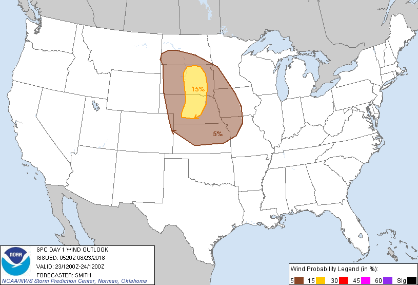
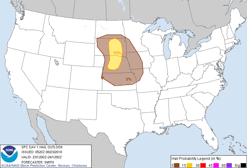
Kansas City, MO...Omaha, NE...Lincoln, NE...Des Moines, IA...Overland Park, KS...
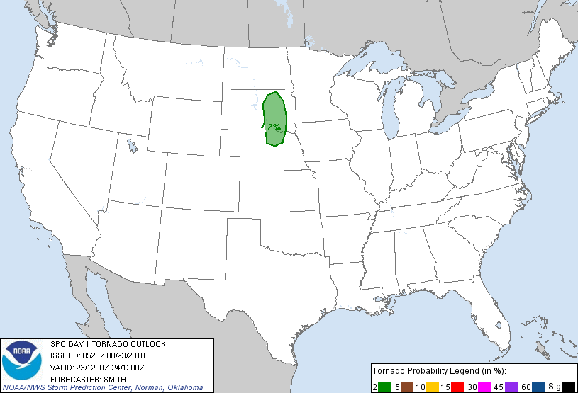
Probabilistic Tornado Graphic
Probability of a tornado within 25 miles of a point. Hatched Area: 10% or greater probability of EF2 - EF5 tornadoes within 25 miles of a point.
Day 1 Tornado Risk
Area (sq. mi.)
Area Pop.
Some Larger Population Centers in Risk Area
2 %
25,572
178,419
Aberdeen, SD...Mitchell, SD...Huron, SD...
Probabilistic Damaging Wind Graphic
Probability of damaging thunderstorm winds or wind gusts of 50 knots or higher within 25 miles of a point. Hatched Area: 10% of greater probability of wind gusts 65 knots or greater within 25 miles of a point.
Kansas City, MO...Omaha, NE...Lincoln, NE...Des Moines, IA...Overland Park, KS...
SPC AC 230520
Day 1 Convective Outlook
NWS Storm Prediction Center Norman OK
1220 AM CDT Thu Aug 23 2018
Valid 231200Z - 241200Z
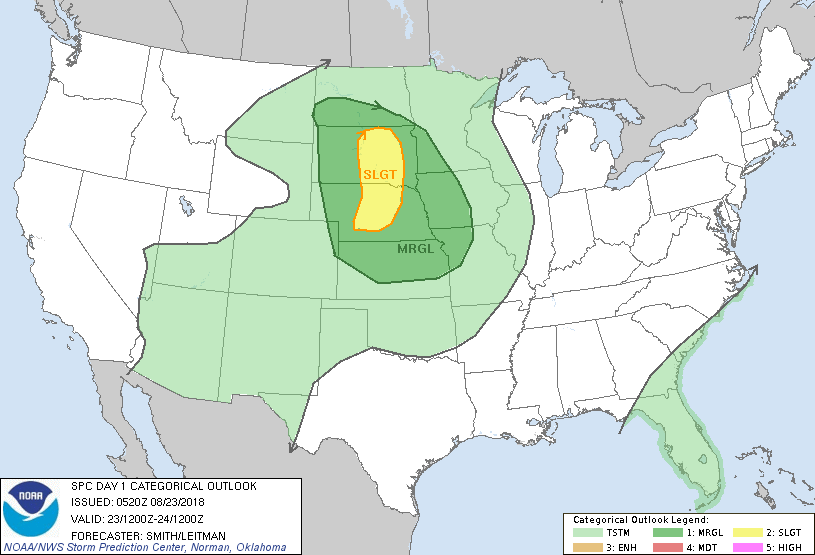
...THERE IS A SLIGHT RISK OF SEVERE THUNDERSTORMS CENTRAL NEBRASKA
INTO CENTRAL SOUTH DAKOTA...
...SUMMARY...
Severe thunderstorms are possible across central and eastern South
Dakota and central Nebraska this afternoon and evening, with some
threat potentially extending into central and eastern Kansas.
...Northern and central Plains into the MO Valley...
A mid-level shortwave trough will move from central WY eastward into
the eastern Dakotas during the period with an attendant belt of
stronger westerly 500mb flow from southern SD into north-central KS.
Showers and a cluster of thunderstorms may be ongoing early this
morning over the eastern half of KS into the MO Valley on the nose
of a southerly LLJ located over the central/southern Plains.
Although an isolated threat for a strong thunderstorm or two is
possible, this activity will likely dissipate by midday as the LLJ
weakens. It is possible a couple of storms may develop later in the
day near residual outflow but mesoscale dependencies of such a
scenario are highly uncertain at this time. The focus for diurnal
thunderstorms will focus farther west near a cool front/trough
expected to extend south from a surface low expected to migrate
eastward into central SD by late in the afternoon. A
moist/instability axis will protrude north from central KS to east
of the surface low where moderate destabilization is forecast.
Models indicate 1000-2500 J/kg MLCAPE will develop by peak heating
with effective shear magnitudes 30-45 kt from central KS into
central SD. Isolated to widely scattered thunderstorms are expected
to develop during the late afternoon/evening with large hail/severe
gusts the primary risks with the stronger storms. Thunderstorm
coverage is expected to be greatest near and north of the low over
central SD with widely spaced thunderstorms possible farther south
into NE/KS. A diminishing severe threat is expected during the
evening as a surface-based to elevated transition occurs.
..Smith/Leitman.. 08/23/2018
CLICK TO GET WUUS01 PTSDY1 PRODUCT
NOTE: THE NEXT DAY 1 OUTLOOK IS SCHEDULED BY 1300Z