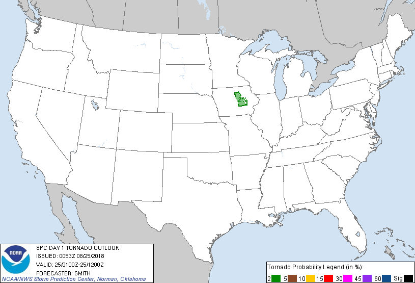
Probability of a tornado within 25 miles of a point. Hatched Area: 10% or greater probability of EF2 - EF5 tornadoes within 25 miles of a point.
Day 1 Tornado Risk
Area (sq. mi.)
Area Pop.
Some Larger Population Centers in Risk Area
2 %
4,307
140,007
Marshalltown, IA...Grinnell, IA...
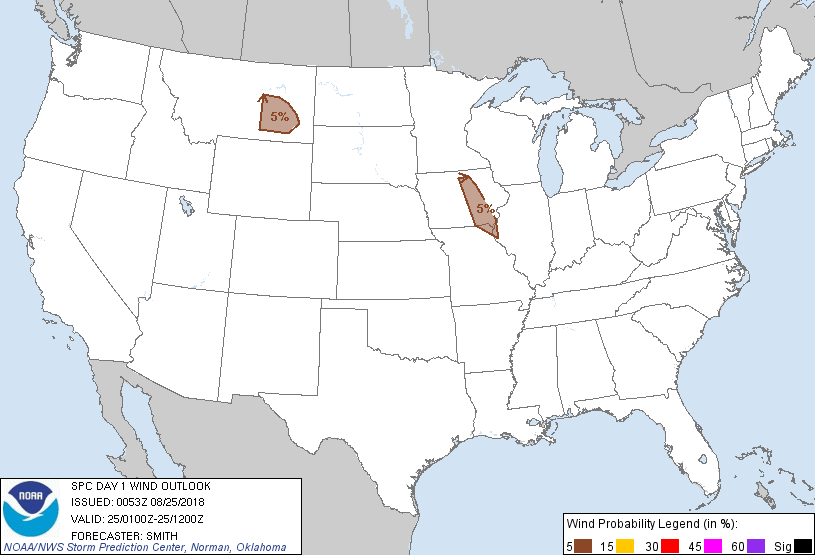
Probabilistic Damaging Wind Graphic
Probability of damaging thunderstorm winds or wind gusts of 50 knots or higher within 25 miles of a point. Hatched Area: 10% of greater probability of wind gusts 65 knots or greater within 25 miles of a point.
Day 1 Wind Risk
Area (sq. mi.)
Area Pop.
Some Larger Population Centers in Risk Area
5 %
27,116
576,380
Waterloo, IA...Cedar Falls, IA...Marshalltown, IA...Ottumwa, IA...Newton, IA...
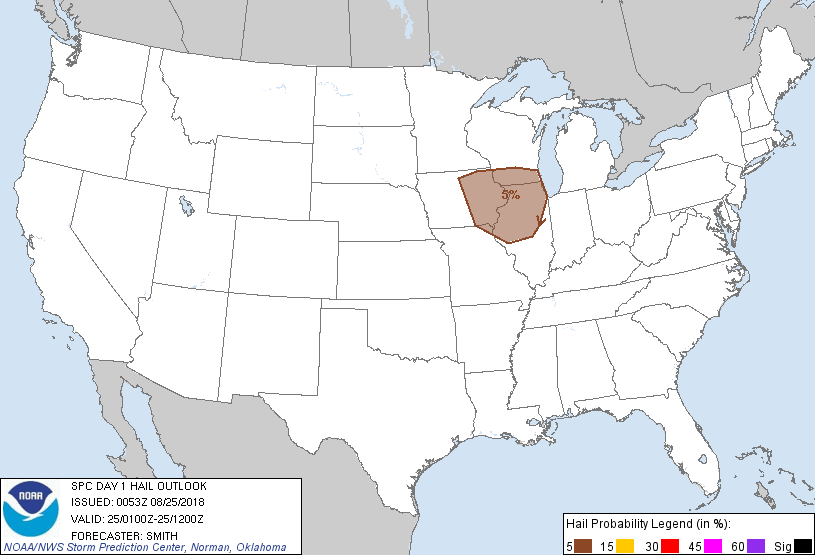
Probabilistic Large Hail Graphic
Probability of hail 1" or larger within 25 miles of a point. Hatched Area: 10% or greater probability of hail 2" or larger within 25 miles of a point.
SPC AC 250053
Day 1 Convective Outlook
NWS Storm Prediction Center Norman OK
0753 PM CDT Fri Aug 24 2018
Valid 250100Z - 251200Z
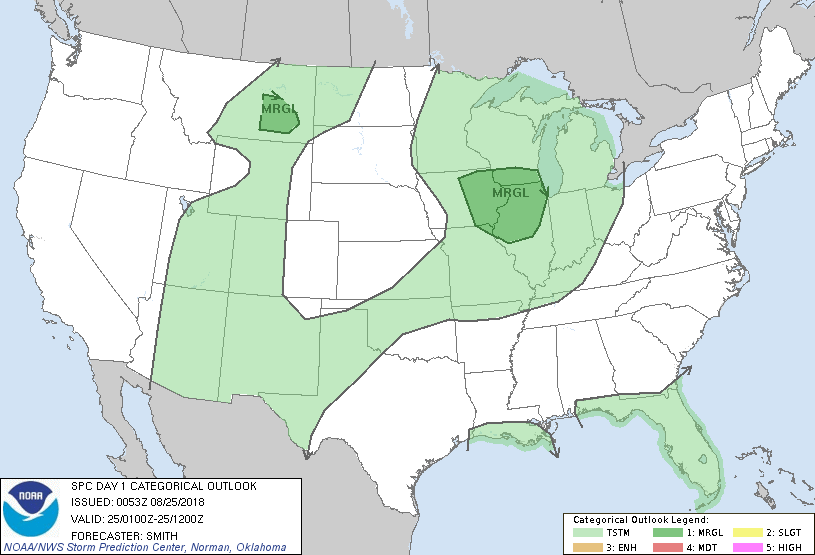
...THERE IS A MARGINAL RISK OF SEVERE THUNDERSTORMS FOR PORTIONS OF
THE MIDWEST AND EASTERN MONTANA...
...SUMMARY...
Isolated strong to severe thunderstorms are possible this evening
and tonight over the eastern Iowa and northern Illinois vicinity.
Other isolated locally severe gusts may accompany a storm or two in
east-central Montana this evening.
...Adjacent parts of IA/IL/WI...
A mid-level low/trough over the Upper MS Valley will move east into
the western Great Lakes tonight. Very little overall movement in
the frontal zone draped from northwest to southeast across eastern
IA is expected. A couple of additional thunderstorms may develop
this evening within a zone of warm air advection with the primary
risk being marginally severe hail with this elevated activity. In
the meantime, if a surface-based storm can develop prior to sunset,
the possibility for a supercell with associated severe hazards may
remain, but this window of opportunity is lessening with time.
...East-central MT this evening...
A broad mid-level trough over the northwestern CONUS will gradually
move east tonight as the primary vorticity lobe moves across
southern Saskatchewan. A few thunderstorms this evening will likely
continue eastward over central and east-central MT within an
environment featuring steep low-level lapse rates. As the boundary
layer cools this evening and storms weaken, the propensity for a
severe gust will correspondingly diminish.
..Smith.. 08/25/2018
CLICK TO GET WUUS01 PTSDY1 PRODUCT
NOTE: THE NEXT DAY 1 OUTLOOK IS SCHEDULED BY 0600Z