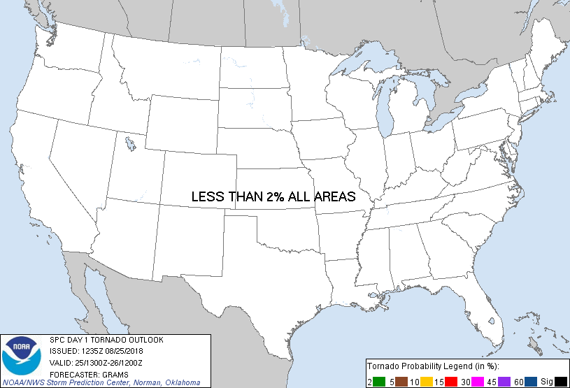
Probability of a tornado within 25 miles of a point. Hatched Area: 10% or greater probability of EF2 - EF5 tornadoes within 25 miles of a point.
Day 1 Tornado Risk
Area (sq. mi.)
Area Pop.
Some Larger Population Centers in Risk Area
No Risk Areas Forecast
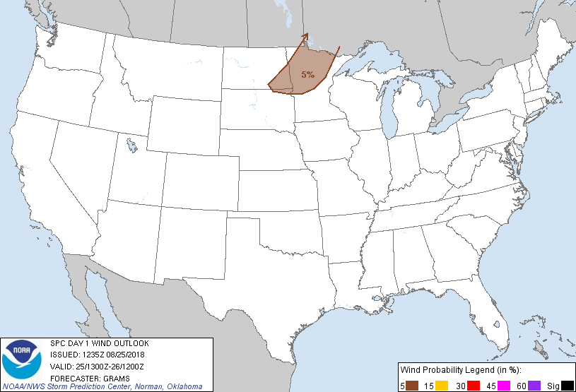
Probabilistic Damaging Wind Graphic
Probability of damaging thunderstorm winds or wind gusts of 50 knots or higher within 25 miles of a point. Hatched Area: 10% of greater probability of wind gusts 65 knots or greater within 25 miles of a point.
Day 1 Wind Risk
Area (sq. mi.)
Area Pop.
Some Larger Population Centers in Risk Area
5 %
49,499
865,844
Fargo, ND...Moorhead, MN...West Fargo, ND...Hibbing, MN...Fergus Falls, MN...
Probabilistic Large Hail Graphic
Probability of hail 1" or larger within 25 miles of a point. Hatched Area: 10% or greater probability of hail 2" or larger within 25 miles of a point.
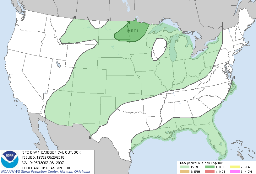
   SPC AC 251235

   Day 1 Convective Outlook
   NWS Storm Prediction Center Norman OK
   0735 AM CDT Sat Aug 25 2018

   Valid 251300Z - 261200Z

   ...THERE IS A MARGINAL RISK OF SEVERE THUNDERSTORMS NORTHERN MN AND
   SOUTHEAST ND...

   ...SUMMARY...
   Isolated severe hail and locally strong gusts are possible between
   about 4 pm to 12 am CDT in northern Minnesota and southeast North
   Dakota.

   ...Red River Valley of the North...
   A shortwave impulse will move from the Prairie Provinces towards
   Hudson Bay. A trailing surface cold front will slow its eastward
   advance and stall across northwest MN and far southeast ND by this
   evening. Rich boundary-layer moisture is confined well south of this
   region in southern portions of the Corn Belt. Modified
   boundary-layer moisture characterized by upper 50s to lower 60s dew
   points amid steep mid-level lapse rates should yield a corridor of
   moderate buoyancy (MLCAPE near 1500 J/kg) along the front.

   Guidance varies in the degree of convergence on the front given weak
   large-scale ascent. Some models suggest storm development will be
   confined to near the international border in northwest MN during the
   later afternoon. A few others indicate potential development this
   evening north of the front as warm advection increases downstream of
   the low-level thermal ridge nosing towards the central ND/SD border.
   In either case, storm coverage will likely remain isolated.
   Mid/upper-level speed shear will be adequate for mid-level updraft
   rotation. Isolated severe hail and locally damaging winds should be
   the main hazards.

   ...Midwest...
   Low-amplitude shortwave trough over the Great Lakes will decay as it
   moves across central Ontario. Weak mid-level height rises in its
   wake and lack of coherent surface boundaries to focus late day storm
   development render low confidence in reintroducing MRGL risk
   delineation from prior outlooks.

   ..Grams/Peters.. 08/25/2018

   CLICK TO GET WUUS01 PTSDY1 PRODUCT

   NOTE: THE NEXT DAY 1 OUTLOOK IS SCHEDULED BY 1630Z