Probability of a tornado within 25 miles of a point. Hatched Area: 10% or greater probability of EF2 - EF5 tornadoes within 25 miles of a point.
Day 1 Tornado Risk
Area (sq. mi.)
Area Pop.
Some Larger Population Centers in Risk Area
No Risk Areas Forecast
Probabilistic Damaging Wind Graphic
Probability of damaging thunderstorm winds or wind gusts of 50 knots or higher within 25 miles of a point. Hatched Area: 10% of greater probability of wind gusts 65 knots or greater within 25 miles of a point.
Day 1 Wind Risk
Area (sq. mi.)
Area Pop.
Some Larger Population Centers in Risk Area
No Risk Areas Forecast
Probabilistic Large Hail Graphic
Probability of hail 1" or larger within 25 miles of a point. Hatched Area: 10% or greater probability of hail 2" or larger within 25 miles of a point.
Day 1 Hail Risk
Area (sq. mi.)
Area Pop.
Some Larger Population Centers in Risk Area
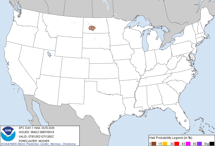
5 %
4,015
112,537
Bismarck, ND...Mandan, ND...
SPC AC 070042
Day 1 Convective Outlook
NWS Storm Prediction Center Norman OK
0742 PM CDT Thu Sep 06 2018
Valid 070100Z - 071200Z
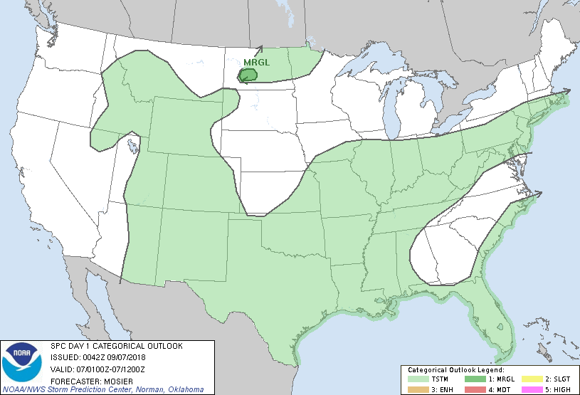
...THERE IS A MARGINAL RISK OF SEVERE THUNDERSTORMS ACROSS CENTRAL
NORTH DAKOTA...
...SUMMARY...
Isolated hail is possible across central North Dakota. No severe
thunderstorms are expected elsewhere.
...01Z Outlook Update...
As discussed in MCD 1433, isolated hail is possible within the
strong thunderstorms west of BIS in ND. These storms formed in a
spatial limited area of moderate instability along the surface
trough and the general expectation is for them to persist for the
next hour or two before dissipating. A small 5% hail area was added
to this outlook to account for the isolated severe risk these storms
may pose for the next few hours.
Additionally, probabilities were removed across the Northeast, where
the outflow has now moved offshore and the general thunder line was
modified based on recent observational trends and the latest
guidance. A few strong gusts were observed across MD but recent
radar trends suggest this activity has now weakened.
..Mosier.. 09/07/2018
CLICK TO GET WUUS01 PTSDY1 PRODUCT
NOTE: THE NEXT DAY 1 OUTLOOK IS SCHEDULED BY 0600Z