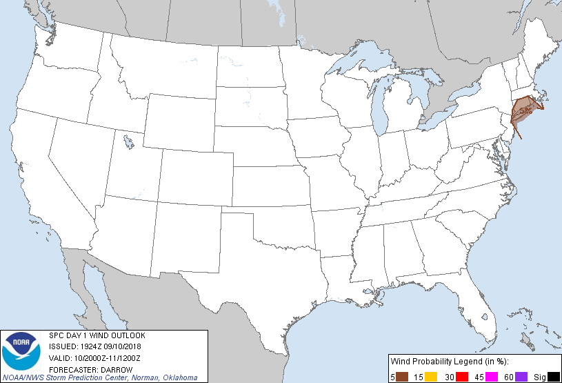
Probability of damaging thunderstorm winds or wind gusts of 50 knots or higher within 25 miles of a point. Hatched Area: 10% of greater probability of wind gusts 65 knots or greater within 25 miles of a point.
Day 1 Wind Risk
Area (sq. mi.)
Area Pop.
Some Larger Population Centers in Risk Area
5 %
9,802
16,029,855
New York, NY...Yonkers, NY...Bridgeport, CT...New Haven, CT...Hartford, CT...
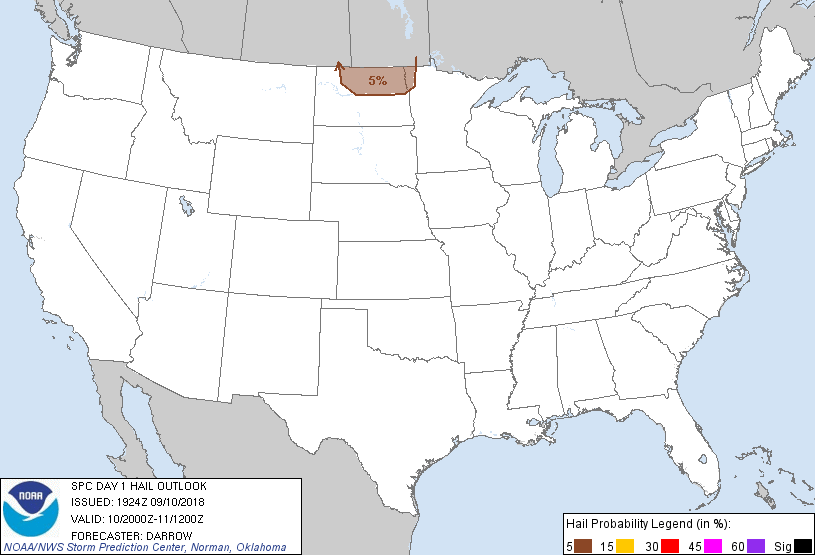
Probabilistic Large Hail Graphic
Probability of hail 1" or larger within 25 miles of a point. Hatched Area: 10% or greater probability of hail 2" or larger within 25 miles of a point.
Day 1 Hail Risk
Area (sq. mi.)
Area Pop.
Some Larger Population Centers in Risk Area
5 %
23,714
236,119
Grand Forks, ND...Minot, ND...Devils Lake, ND...Grafton, ND...
SPC AC 101924
Day 1 Convective Outlook
NWS Storm Prediction Center Norman OK
0224 PM CDT Mon Sep 10 2018
Valid 102000Z - 111200Z
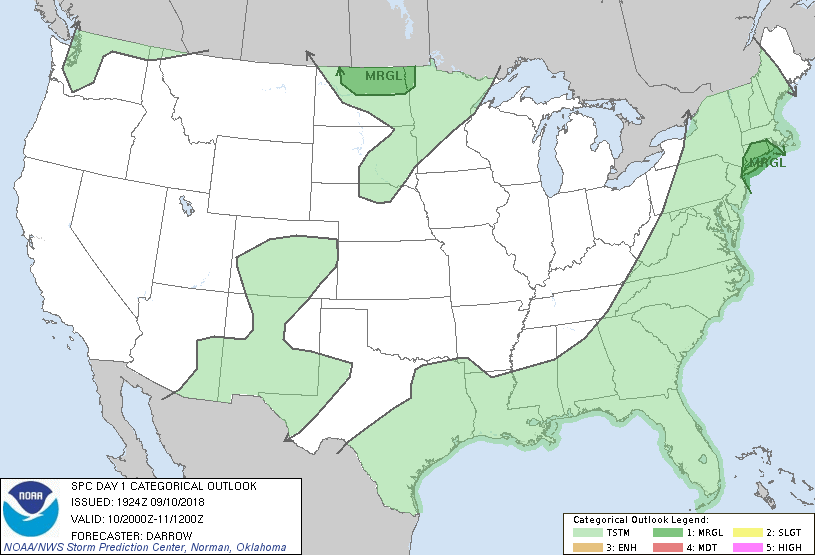
...THERE IS A MARGINAL RISK OF SEVERE THUNDERSTORMS ACROSS NORTHERN
ND AND OVER PARTS OF SOUTHERN NEW ENGLAND AND LONG ISLAND...
...SUMMARY...
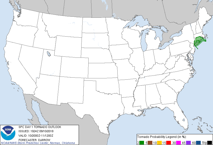
A conditional risk for a brief tornado and locally damaging winds
exists tonight in vicinity of Long Island and Connecticut. Isolated
severe hail may occur over parts of northern North Dakota after 3 am
CDT.
...Discussion...
Earlier thoughts regarding the potential for severe remain. No
changes are warranted to the 1630z outlook.
..Darrow.. 09/10/2018
.PREV DISCUSSION... /ISSUED 1127 AM CDT Mon Sep 10 2018/
...CT/Long Island...
A decaying shortwave trough over southern Ontario will eject
northeast into Quebec. At the surface, ridging from New England to
the Mid-Atlantic States will gradually erode amid persistent warm
advection, resulting in the warm front likely reaching the I-95
corridor from Washington DC to New York City by evening. With
neutral to weak mid-level height rises, storm development within the
warm sector appears rather unlikely. However, there could be enough
overlap of the lingering warm advection on the fringe of weak SBCAPE
across Long Island and CT vicinity to support a few thunderstorms
late evening/tonight. While the stronger low-level shear will
outpace the arrival of the surface warm sector with dewpoints in the
lower 70s, a conditional risk for a couple rotating storms exists in
this region capable of a brief tornado and locally damaging winds.
...Northern ND...
Stalled surface front from northwest MN to the NE Panhandle will
advance north as a warm front tonight in response to lee
cyclogenesis over southern Saskatchewan. This strengthening warm
advection regime will generally result in elevated storm development
north of the border in southern portions of Manitoba, but the
trail-end of development is possible across northern ND in the early
morning. Steep mid-level lapse rates approaching 8 C/km, around
40-kt effective shear, and moderate elevated buoyancy will support a
conditional risk for large hail.
CLICK TO GET WUUS01 PTSDY1 PRODUCT
NOTE: THE NEXT DAY 1 OUTLOOK IS SCHEDULED BY 0100Z