Probability of damaging thunderstorm winds or wind gusts of 50 knots or higher within 25 miles of a point. Hatched Area: 10% of greater probability of wind gusts 65 knots or greater within 25 miles of a point.
Day 1 Wind Risk
Area (sq. mi.)
Area Pop.
Some Larger Population Centers in Risk Area
5 %
25,197
1,042,473
Rochester, MN...La Crosse, WI...Mason City, IA...Winona, MN...Owatonna, MN...
Probabilistic Large Hail Graphic
Probability of hail 1" or larger within 25 miles of a point. Hatched Area: 10% or greater probability of hail 2" or larger within 25 miles of a point.
SPC AC 171556
Day 1 Convective Outlook
NWS Storm Prediction Center Norman OK
1056 AM CDT Mon Sep 17 2018
Valid 171630Z - 181200Z
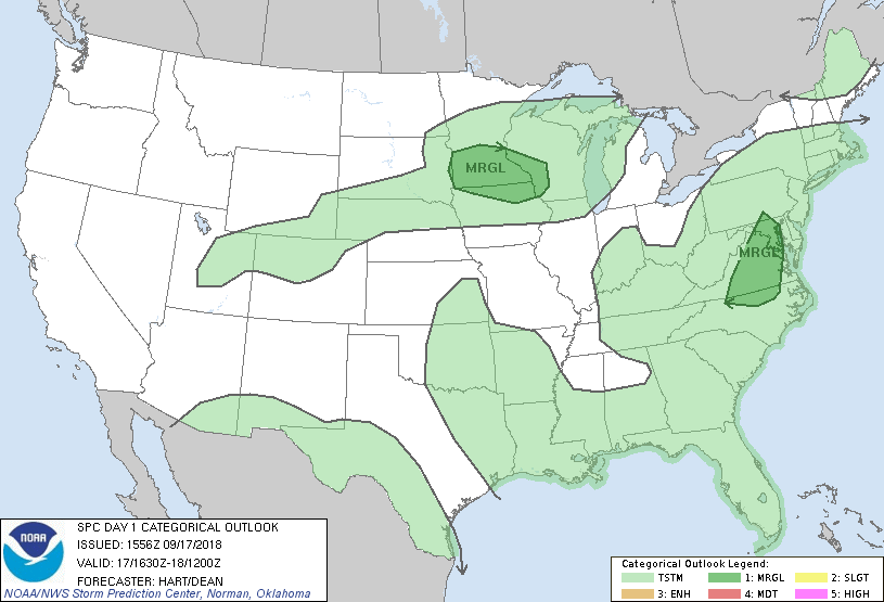
...THERE IS A MARGINAL RISK OF SEVERE THUNDERSTORMS OVER PARTS OF
THE UPPER MIDWEST...AND OVER PARTS OF THE MID ATLANTIC REGION....
...SUMMARY...
A few severe storms may occur across parts of the Upper Midwest
today through this evening. The threat for a brief tornado or two
exists for parts of the Delmarva region into northern North
Carolina.
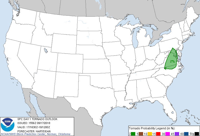
...Mid Atlantic Region...
Scattered showers and thunderstorms continue to affect parts of
VA/NC in the eastern semi-circle of the remnants of Florence.
Occasional low-level rotational couplets continue to be observed,
and will likely continue through the afternoon as the precipitation
shield lifts northward. Models suggest that the low-level shear
profile is slowly weakening with time, and mid-level drying is
spreading into the area from the west. These trends should result
in decreasing convective coverage, and a decreasing risk of
prominent/tornadic couplets. Current thinking remains that the
overall risk of tornadoes is marginal across this area.
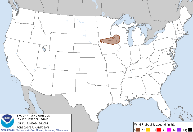
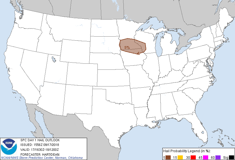
...MN/IA/WI...
Water vapor imagery shows a shortwave trough tracking eastward
across the Black Hills region of SD. Lift in advance of this
feature has resulted in a cluster of thunderstorms over eastern SD.
This convection is currently post-frontal with only a low risk of
hail in the strongest cells. Later today, the convection may catch
up to the cold front extending across MN/WI, allowing stronger
downdrafts to reach the surface. Therefore have maintained the
ongoing MRGL risk of hail/wind across the region.
..Hart/Dean.. 09/17/2018
CLICK TO GET WUUS01 PTSDY1 PRODUCT
NOTE: THE NEXT DAY 1 OUTLOOK IS SCHEDULED BY 2000Z