Des Moines, IA...Sioux Falls, SD...Cedar Rapids, IA...Sioux City, IA...Waterloo, IA...
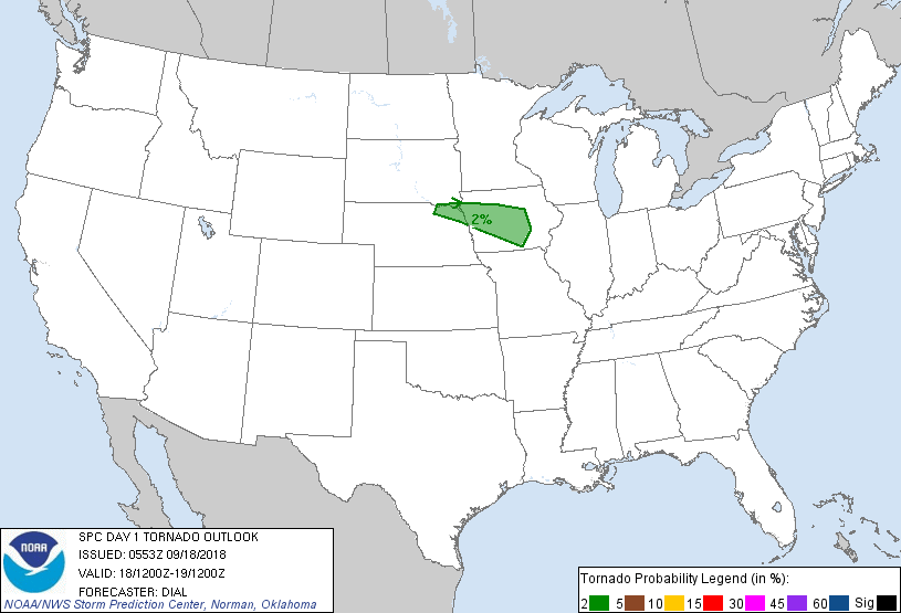
Probabilistic Tornado Graphic
Probability of a tornado within 25 miles of a point. Hatched Area: 10% or greater probability of EF2 - EF5 tornadoes within 25 miles of a point.
Day 1 Tornado Risk
Area (sq. mi.)
Area Pop.
Some Larger Population Centers in Risk Area
2 %
24,932
1,352,897
Des Moines, IA...Sioux City, IA...Ames, IA...West Des Moines, IA...Ankeny, IA...
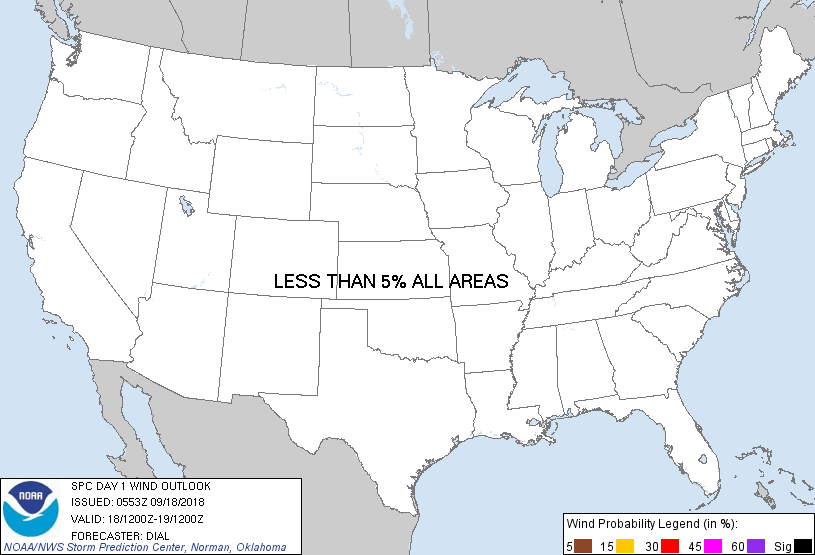
Probabilistic Damaging Wind Graphic
Probability of damaging thunderstorm winds or wind gusts of 50 knots or higher within 25 miles of a point. Hatched Area: 10% of greater probability of wind gusts 65 knots or greater within 25 miles of a point.
Day 1 Wind Risk
Area (sq. mi.)
Area Pop.
Some Larger Population Centers in Risk Area
No Risk Areas Forecast
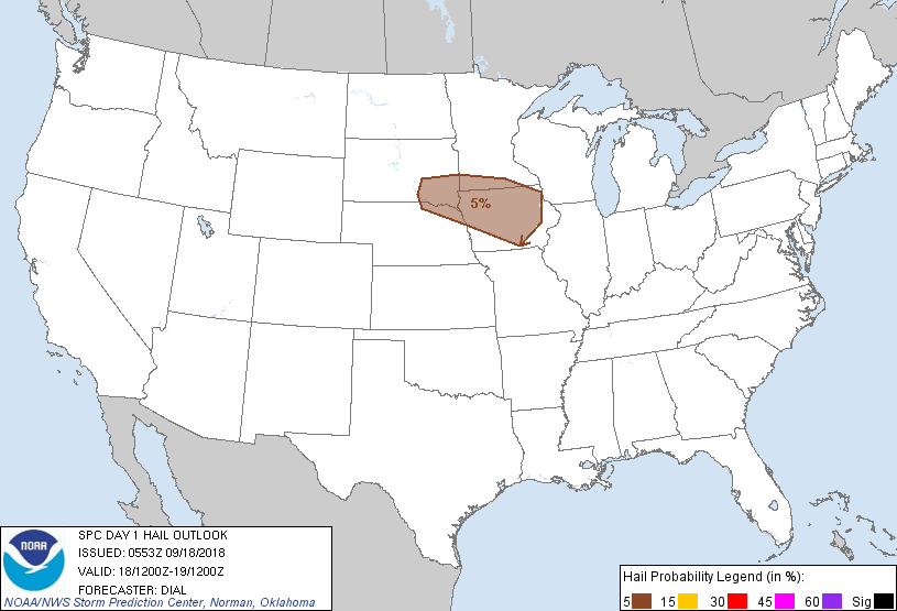
Probabilistic Large Hail Graphic
Probability of hail 1" or larger within 25 miles of a point. Hatched Area: 10% or greater probability of hail 2" or larger within 25 miles of a point.
Day 1 Hail Risk
Area (sq. mi.)
Area Pop.
Some Larger Population Centers in Risk Area
5 %
62,108
2,750,491
Des Moines, IA...Sioux Falls, SD...Cedar Rapids, IA...Sioux City, IA...Waterloo, IA...
SPC AC 180553
Day 1 Convective Outlook
NWS Storm Prediction Center Norman OK
1253 AM CDT Tue Sep 18 2018
Valid 181200Z - 191200Z
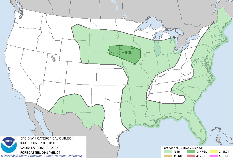
...THERE IS A MARGINAL RISK OF SEVERE THUNDERSTORMS FROM A PORTION
OF THE CENTRAL AND NORTHERN PLAINS INTO THE UPPER MISSISSIPPI VALLEY
REGION...
...SUMMARY...
At least a marginal risk for mainly hail is expected from a portion
of the central and northern Plains into the upper Mississippi Valley
today and tonight.
...Synopsis...
The synoptic upper pattern will be characterized by a positive-tilt
trough moving slowly east through the western states, a low
amplitude ridge across the central U.S. and a weak upper trough
advancing through the Middle Atlantic region. Embedded within the
eastern trough, remnants of Florence will accelerate through
southern New England early in the day. At the surface a
quasi-stationary front will persist from the central Plains into the
Upper MS Valley region.
...Central and northern Plains through the upper Mississippi Valley
region...
Water vapor imagery and RAP analysis indicate a low-amplitude
shortwave trough over the High Plains of southeast WY into western
NE moving through the northern periphery of the upper ridge. This
impulse will continue east, reaching the upper MS Valley region
later this morning. An increase in isentropic ascent in response to
this feature has contributed to the initiation of thunderstorms
north of the front from western NE into southwest SD, and additional
development will occur through the morning farther downstream as
this zone of ascent spreads east. Given 7-8 C/km mid-level lapse
rates, 1500-2000 J/kg MUCAPE, and 35-45 kt effective bulk shear, a
few updrafts may become capable of producing hail. A temporary
decrease in thunderstorm coverage/intensity may occur in wake of the
initial impulse, and a capping inversion may inhibit surface-based
development near the front this afternoon. However, redevelopment of
storms may occur overnight as a strengthening low-level jet augments
isentropic ascent north of the front from SD, northeast NE into
southern MN and IA. Some threat for hail is also expected with this
activity.
...Southern New England...
A 30-40 kt southwesterly low-level jet associated with the remnants
of Florence will spread through southern New England later this
morning contributing to an increase in low-level hodograph size.
While a band of storms will accompany this conveyor belt, limited
potential for boundary-layer destabilization will exist before the
system moves offshore, therefore any tornado threat is expected to
remain low.
..Dial/Wendt.. 09/18/2018
CLICK TO GET WUUS01 PTSDY1 PRODUCT
NOTE: THE NEXT DAY 1 OUTLOOK IS SCHEDULED BY 1300Z