Des Moines, IA...Cedar Rapids, IA...Davenport, IA...Sioux City, IA...Iowa City, IA...
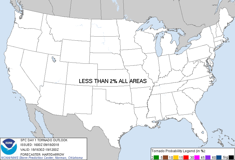
Probabilistic Tornado Graphic
Probability of a tornado within 25 miles of a point. Hatched Area: 10% or greater probability of EF2 - EF5 tornadoes within 25 miles of a point.
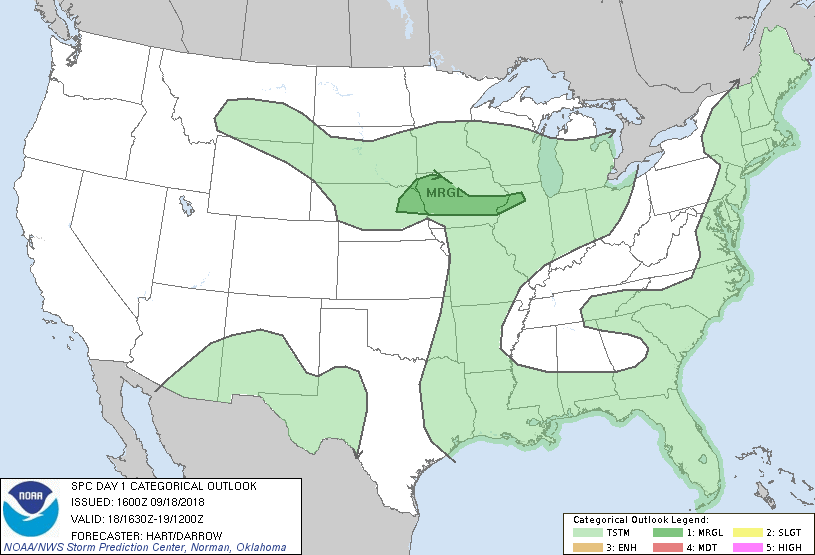
Day 1 Tornado Risk
Area (sq. mi.)
Area Pop.
Some Larger Population Centers in Risk Area
No Risk Areas Forecast
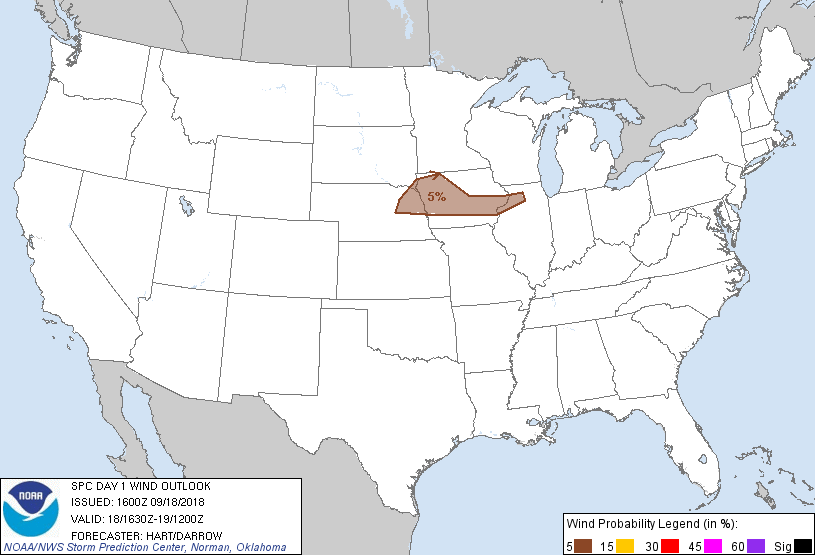
Probabilistic Damaging Wind Graphic
Probability of damaging thunderstorm winds or wind gusts of 50 knots or higher within 25 miles of a point. Hatched Area: 10% of greater probability of wind gusts 65 knots or greater within 25 miles of a point.
Day 1 Wind Risk
Area (sq. mi.)
Area Pop.
Some Larger Population Centers in Risk Area
5 %
39,887
2,505,464
Des Moines, IA...Cedar Rapids, IA...Davenport, IA...Sioux City, IA...Iowa City, IA...
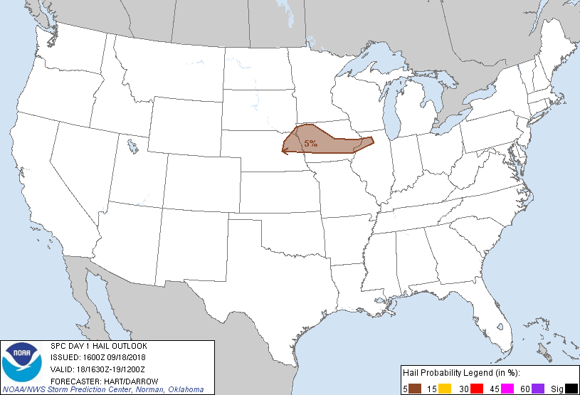
Probabilistic Large Hail Graphic
Probability of hail 1" or larger within 25 miles of a point. Hatched Area: 10% or greater probability of hail 2" or larger within 25 miles of a point.
Day 1 Hail Risk
Area (sq. mi.)
Area Pop.
Some Larger Population Centers in Risk Area
5 %
40,628
2,524,706
Des Moines, IA...Cedar Rapids, IA...Davenport, IA...Sioux City, IA...Iowa City, IA...
   SPC AC 181600

   Day 1 Convective Outlook
   NWS Storm Prediction Center Norman OK
   1100 AM CDT Tue Sep 18 2018

   Valid 181630Z - 191200Z

   ...THERE IS A MARGINAL RISK OF SEVERE THUNDERSTORMS OVER PARTS OF
   THE UPPER MIDWEST...

   ...SUMMARY...
   Isolated hail and damaging wind gusts are possible today over parts
   of the Upper Midwest.

   ...NE/IA/IL...
   A persistent cluster of thunderstorms is affecting much of northern
   IA and adjacent regions this morning, with the leading-edge outflow
   surging southward across eastern IA.  Much of this region has been
   stabilized by the convection, leaving a corridor from eastern NE
   into northwest IL where sufficient heating is possible later today.
   This axis may see storm intensification by mid/late afternoon, with
   the strongest cells capable of hail or locally damaging wind gusts.
   Present indications are that the severe risk will remain isolated
   and marginal in nature.

   ..Hart/Darrow.. 09/18/2018

   CLICK TO GET WUUS01 PTSDY1 PRODUCT

   NOTE: THE NEXT DAY 1 OUTLOOK IS SCHEDULED BY 2000Z