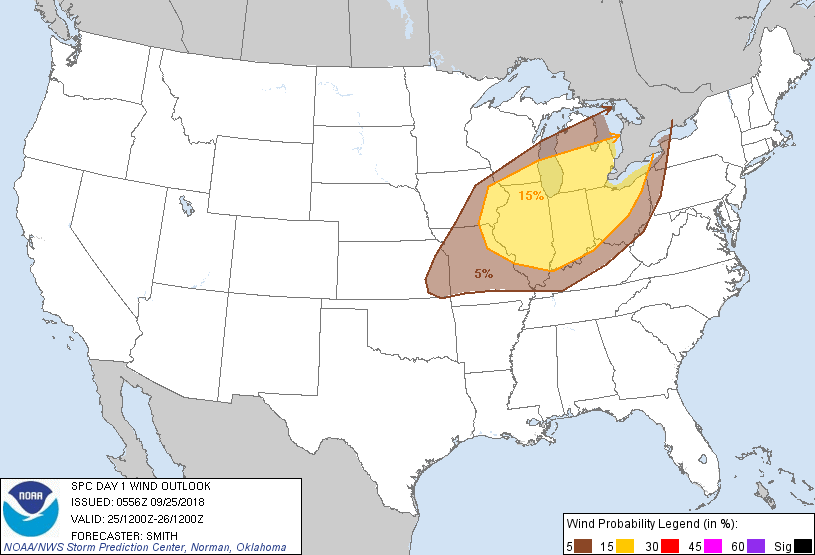
Probability of damaging thunderstorm winds or wind gusts of 50 knots or higher within 25 miles of a point. Hatched Area: 10% of greater probability of wind gusts 65 knots or greater within 25 miles of a point.
Kansas City, MO...Buffalo, NY...Louisville, KY...Lexington-Fayette, KY...Overland Park, KS...
Probabilistic Large Hail Graphic
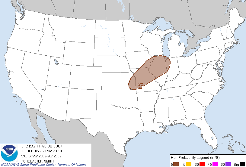
Probability of hail 1" or larger within 25 miles of a point. Hatched Area: 10% or greater probability of hail 2" or larger within 25 miles of a point.
Day 1 Hail Risk
Area (sq. mi.)
Area Pop.
Some Larger Population Centers in Risk Area
5 %
107,452
18,552,315
Chicago, IL...Kansas City, MO...St. Louis, MO...Aurora, IL...Overland Park, KS...
SPC AC 250556
Day 1 Convective Outlook
NWS Storm Prediction Center Norman OK
1256 AM CDT Tue Sep 25 2018
Valid 251200Z - 261200Z
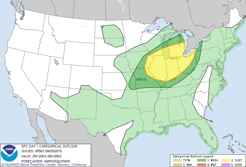
...THERE IS A SLIGHT RISK OF SEVERE THUNDERSTORMS FROM THE MIDDLE
MISSISSIPPI VALLEY INTO THE OHIO VALLEY AND SOUTHERN GREAT LAKES...
...SUMMARY...
Severe thunderstorms are possible this afternoon into tonight across
parts of the middle Mississippi and Ohio Valleys into the southern
Great Lakes region.
...Synopsis...
A mid-level trough moving into the Black Hills this morning will
amplify during the period as a 90kt 500mb speed max develops by
early morning Wednesday over Lake Michigan. The positive to neutral
tilt of the mid-level trough suggests cyclogenesis over the western
and central Great Lakes will remain modest compared to autumnal
climatology. A cold front will extend southwestward from the
developing low over WI southeast KS and into the TX Panhandle. This
boundary will advance east and southeast reaching the lower Great
Lakes and extending southwest through central TX by the end of this
period. A weak disturbance over the central Appalachians will move
into the Northeast during the day. A warm frontal zone will develop
northward through the OH Valley and into the Great Lakes during the
day.
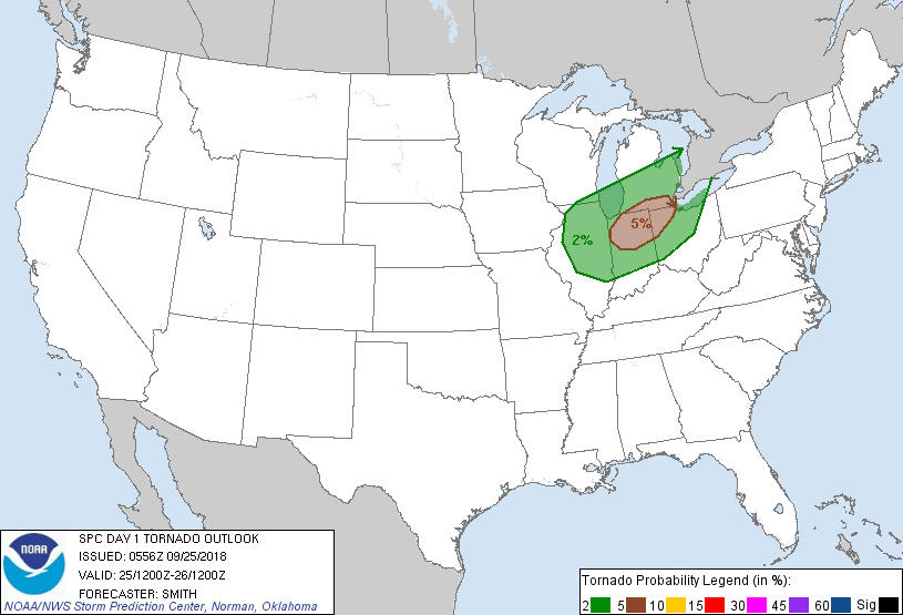
...Middle Mississippi Valley into the Ohio Valley and Great Lakes...
A warm/moist conveyer is forecast over the OH Valley as southerly
low-level flow is maintained during the day across IN/OH into
southern Lower MI. A moisture-rich airmass will gradually
destabilize during the day but strong heating will likely be limited
by extensive cloud cover and intermittent showers at least through
the early afternoon. Models show upper 60s to near 70 degrees F
dewpoints across this broader region to the east of the cold front
over the MS Valley. MLCAPE is forecast to range from 750-2000 J/kg
with a relatively deep moisture profile. As the mid/upper-level
disturbance approaches from the west, deep layer vertical shear will
support organized storms. The primary uncertainty this forecast is
the magnitude of destabilization centered on the area of northern IN
and the hodograph structure. The latest NAM and some of the
convection-allowing models show southerly surface winds and some
enlargement to the low-level portion of the hodograph during the
22-03Z period, whereas the GFS and ECMWF exhibit smaller hodographs.
This would have a consequential effect on the potential for
low-level mesocyclone development from discrete storms forecast by
some of the convection-allowing models. A conditional risk for a
few tornadoes appears centered over northern IN and surrounding
portions of states. Later during the evening, thunderstorms are
forecast to move through the southern Great Lakes states coincident
with the front. The risk for damaging winds may continue as storms
move east during the overnight as a southwesterly LLJ strengthens
over the OH Valley/lower Great Lakes.
Farther west, thunderstorms will likely develop near the front
during the afternoon with upscale development eventually expected
across northern IL during the evening. Damaging winds are the
primary hazard with this activity. A couple of storms may develop
into western MO and southeast KS during the early evening. An
isolated hail/wind threat may accompany the stronger storms before
this activity diminishes during the evening hours.
..Smith/Squitieri.. 09/25/2018
CLICK TO GET WUUS01 PTSDY1 PRODUCT
NOTE: THE NEXT DAY 1 OUTLOOK IS SCHEDULED BY 1300Z