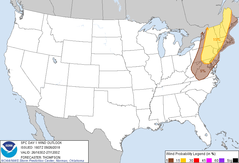
Probability of damaging thunderstorm winds or wind gusts of 50 knots or higher within 25 miles of a point. Hatched Area: 10% of greater probability of wind gusts 65 knots or greater within 25 miles of a point.
Day 1 Wind Risk
Area (sq. mi.)
Area Pop.
Some Larger Population Centers in Risk Area
15 %
117,814
43,549,348
New York, NY...Philadelphia, PA...Baltimore, MD...Newark, NJ...Jersey City, NJ...
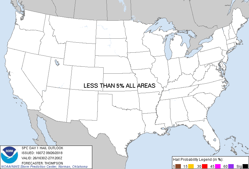
Probability of hail 1" or larger within 25 miles of a point. Hatched Area: 10% or greater probability of hail 2" or larger within 25 miles of a point.
Day 1 Hail Risk
Area (sq. mi.)
Area Pop.
Some Larger Population Centers in Risk Area
No Risk Areas Forecast
SPC AC 261607
Day 1 Convective Outlook
NWS Storm Prediction Center Norman OK
1107 AM CDT Wed Sep 26 2018
Valid 261630Z - 271200Z
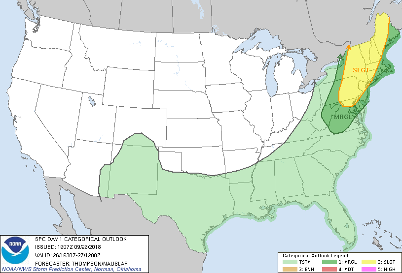
...THERE IS A SLIGHT RISK OF SEVERE THUNDERSTORMS THIS
AFTERNOON/EVENING FROM NORTHERN MD INTO NEW ENGLAND...
...SUMMARY...
Scattered damaging winds are possible across the Northeast States
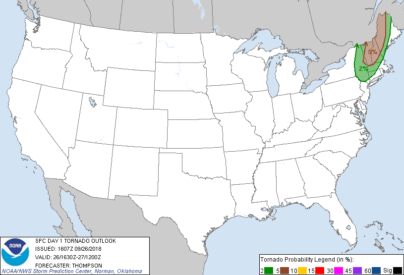
between about 2 to 10 PM EDT. A couple tornadoes may also occur,
mainly centered on western New England between 3 to 8 PM EDT.
...Northeast from roughly 18-02z...
Primary adjustments to the outlook are related to frontal position
and storm initiation across PA/NY, though reasoning remains largely
the same as the prior D1 outlooks. A midlevel shortwave trough over
the Great Lakes will eject east-northeastward over the Saint
Lawrence Valley through tonight, as an associated surface cold front
crosses PA/NY and New England. In advance of the cold front, clouds
are fairly widespread this morning and 12z soundings show midlevel
lapse rates of only 6-6.6 C/km. Still, some cloud breaks
(especially eastern PA into southeastern NY) will allow surface
heating and modest destabilization, with MLCAPE expected to range
from 500-750 J/kg across northern New England to 1500 J/kg across
eastern PA this afternoon.
A gradual increase in thunderstorms is expected from about 17-19z
along the cold front in the moist/weakly capped environment from
Upstate and central NY to central PA. Linear forcing for ascent and
deep-layer flow/shear vectors aligned 30-45 degrees across the front
(toward the warm sector) suggest a mixed mode of line segments and
supercells. Buoyancy will be on the lower margins for the
development/maintenance of supercells across northern New England,
where low-level shear and hodograph curvature will be more favorable
for tornadoes (supercell and embedded QLCS mesovortices) compared to
farther south. The primary severe threat will be damaging gusts
through downward transport of 50 kt low-midlevel flow across
northern New England. Damaging gusts will also be possible farther
to the south with frontal/pre-frontal convective clusters this
afternoon/evening in an environment with weakening vertical shear
with southward extent from southern NY to VA.
..Thompson/Nauslar.. 09/26/2018
CLICK TO GET WUUS01 PTSDY1 PRODUCT
NOTE: THE NEXT DAY 1 OUTLOOK IS SCHEDULED BY 2000Z