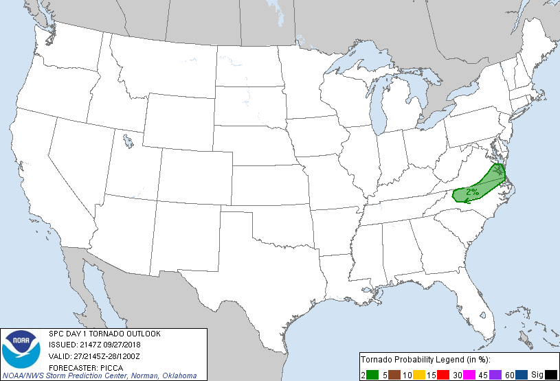
Charlotte, NC...Virginia Beach, VA...Raleigh, NC...Norfolk, VA...Greensboro, NC...
Probabilistic Tornado Graphic
Probability of a tornado within 25 miles of a point. Hatched Area: 10% or greater probability of EF2 - EF5 tornadoes within 25 miles of a point.
Day 1 Tornado Risk
Area (sq. mi.)
Area Pop.
Some Larger Population Centers in Risk Area
2 %
22,626
5,675,793
Virginia Beach, VA...Raleigh, NC...Norfolk, VA...Greensboro, NC...Chesapeake, VA...
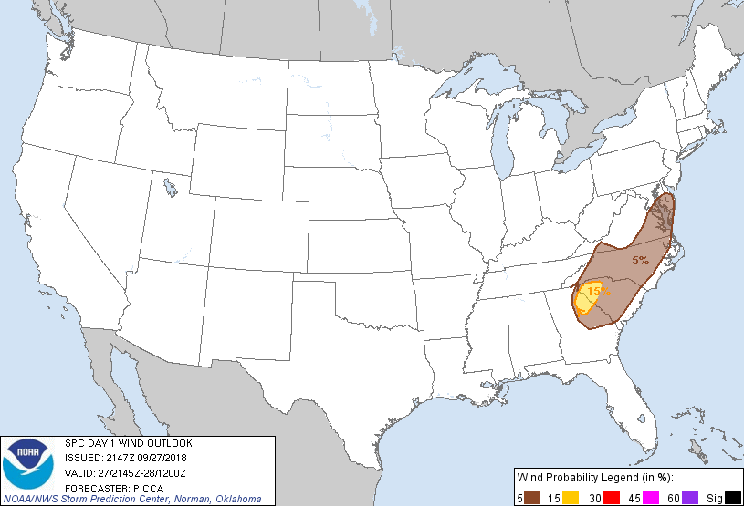
Probabilistic Damaging Wind Graphic
Probability of damaging thunderstorm winds or wind gusts of 50 knots or higher within 25 miles of a point. Hatched Area: 10% of greater probability of wind gusts 65 knots or greater within 25 miles of a point.
Charlotte, NC...Virginia Beach, VA...Raleigh, NC...Norfolk, VA...Greensboro, NC...
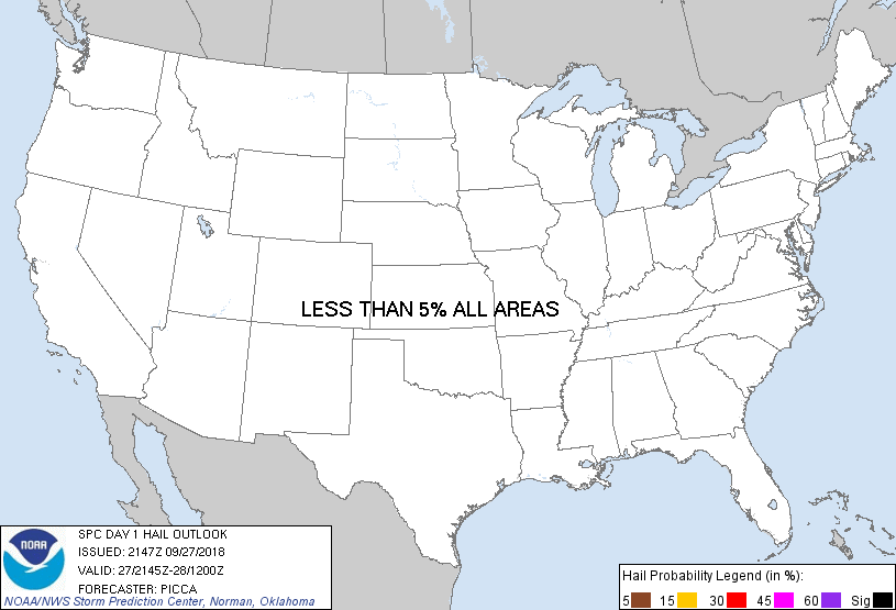
Probabilistic Large Hail Graphic
Probability of hail 1" or larger within 25 miles of a point. Hatched Area: 10% or greater probability of hail 2" or larger within 25 miles of a point.
Day 1 Hail Risk
Area (sq. mi.)
Area Pop.
Some Larger Population Centers in Risk Area
No Risk Areas Forecast
SPC AC 272147
Day 1 Convective Outlook AMEND 1
NWS Storm Prediction Center Norman OK
0447 PM CDT Thu Sep 27 2018
Valid 272145Z - 281200Z
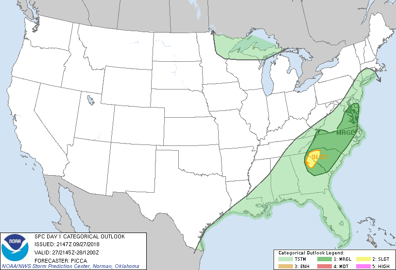
...THERE IS A SLIGHT RISK OF SEVERE THUNDERSTORMS ACROSS FAR
NORTHEAST GA AND WESTERN SC...
AMENDED FOR UPGRADE TO SLIGHT RISK
...SUMMARY...
Isolated/widely scattered damaging winds remain possible this
afternoon into tonight from parts of Georgia into the southern
Delmarva.
...Amendment Update...
Added a small slight risk across northeast GA/far western SC to
account for a locally increased wind threat associated with the
convective complex referenced in the prior discussion. This system
has shown occasional small bowing segments and it should maintain
some focused damaging wind potential as it continues to move
downstream into a moist/uncapped environment.
For more information, see Mesoscale Discussion 1507.
...Discussion...
Current observations indicate a southward-advancing front over the
Piedmont near the NC/VA border. With surface-based convective
potential confined to areas near/south of the front, have removed
severe probabilities from portions of south-central Virginia.
However, wind probabilities were extended northward over eastern
Virginia/southern Delmarva, where some overnight northward advance
of the warm sector may yield a few damaging gusts in stronger
convection.
Otherwise, the southwestern bounds of the marginal risk were
expanded southwestward across Georgia to account for some modest
upscale organization of a forward-propagating line segment.
..Picca.. 09/27/2018
.PREV DISCUSSION... /ISSUED 1121 AM CDT Thu Sep 27 2018/
...Synopsis...
A weak area of low pressure will develop this afternoon across the
southern Appalachians, and will pivot northeast overnight toward
coastal NJ. Preceding the low will be a stationary front, oriented
roughly along the VA/NC border. South of this front, ample moisture
and instability will support scattered daytime thunderstorms. Weak
height falls and increasing winds aloft will overspread the area by
evening, and eastern portions of the front may return northward,
mainly across southeast VA into the Delmarva with a few storms
persisting.
...GA to VA...
Strong heating and 70s F dewpoints will lead to sufficient
instability this afternoon for a few strong storms, from northern GA
into southern VA favoring the higher terrain and surface low
corridor, and across NC into southeast VA in the vicinity of the
stationary front. Increasing southwesterly flow aloft may support a
few small bowing storms with wind damage potential. Other cellular
activity is expected along the stationary front, where a strong wind
gust or briefly rotating storm is possible. In general, severe
coverage is likely to be sparse today.
CLICK TO GET WUUS01 PTSDY1 PRODUCT
NOTE: THE NEXT DAY 1 OUTLOOK IS SCHEDULED BY 0100Z