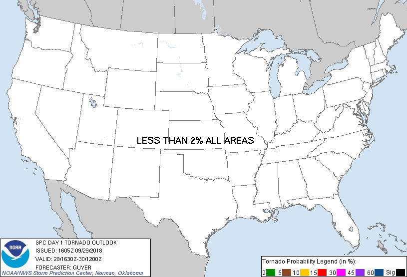
Probability of a tornado within 25 miles of a point. Hatched Area: 10% or greater probability of EF2 - EF5 tornadoes within 25 miles of a point.
Day 1 Tornado Risk
Area (sq. mi.)
Area Pop.
Some Larger Population Centers in Risk Area
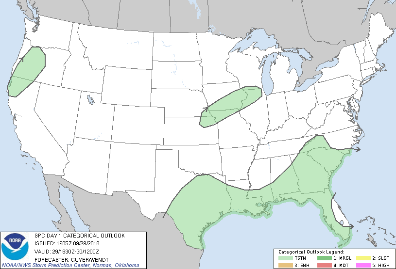
No Risk Areas Forecast
Probabilistic Damaging Wind Graphic
Probability of damaging thunderstorm winds or wind gusts of 50 knots or higher within 25 miles of a point. Hatched Area: 10% of greater probability of wind gusts 65 knots or greater within 25 miles of a point.
Day 1 Wind Risk
Area (sq. mi.)
Area Pop.
Some Larger Population Centers in Risk Area
No Risk Areas Forecast
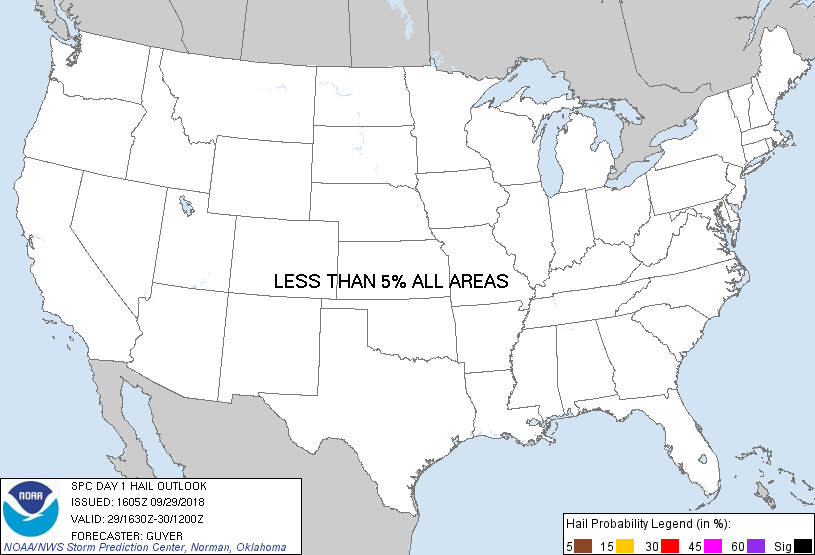
Probabilistic Large Hail Graphic
Probability of hail 1" or larger within 25 miles of a point. Hatched Area: 10% or greater probability of hail 2" or larger within 25 miles of a point.
Day 1 Hail Risk
Area (sq. mi.)
Area Pop.
Some Larger Population Centers in Risk Area
No Risk Areas Forecast
   SPC AC 291605

   Day 1 Convective Outlook
   NWS Storm Prediction Center Norman OK
   1105 AM CDT Sat Sep 29 2018

   Valid 291630Z - 301200Z

   ...NO SEVERE THUNDERSTORM AREAS FORECAST...

   ...SUMMARY...
   Severe storms are not expected through tonight.

   ...Synopsis/Forecast...
   Upper heights will tend to rise through tonight east of the Rockies,
   while an upper low will continue to move inland over OR and northern
   CA through tonight, influencing the potential for at least a few
   thunderstorms across the region.

   Along/south of a residual front, a couple of stronger pulse-type
   storms could occur this afternoon across the coastal Southeast
   States including areas such as far southern SC and eastern/southern
   GA. However, an organized/sustained severe risk is unlikely.
   Elsewhere, isolated elevated thunderstorms may develop across parts
   of the Corn Belt, driven by low-level warm advection.

   ..Guyer/Wendt.. 09/29/2018

   CLICK TO GET WUUS01 PTSDY1 PRODUCT

   NOTE: THE NEXT DAY 1 OUTLOOK IS SCHEDULED BY 2000Z