Detroit, MI...Oklahoma City, OK...Cleveland, OH...Tulsa, OK...St. Louis, MO...
Probabilistic Tornado Graphic
Probability of a tornado within 25 miles of a point. Hatched Area: 10% or greater probability of EF2 - EF5 tornadoes within 25 miles of a point.
Day 1 Tornado Risk
Area (sq. mi.)
Area Pop.
Some Larger Population Centers in Risk Area
No Risk Areas Forecast
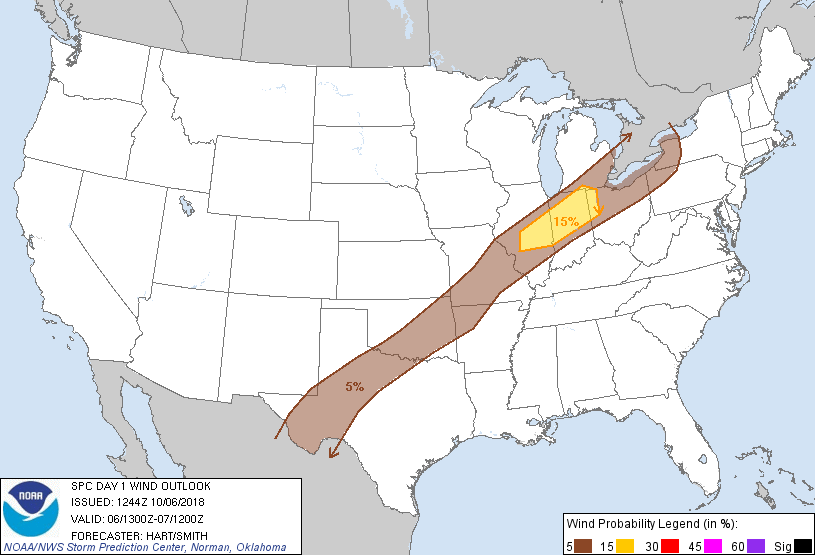
Probabilistic Damaging Wind Graphic
Probability of damaging thunderstorm winds or wind gusts of 50 knots or higher within 25 miles of a point. Hatched Area: 10% of greater probability of wind gusts 65 knots or greater within 25 miles of a point.
Detroit, MI...Oklahoma City, OK...Cleveland, OH...Tulsa, OK...St. Louis, MO...
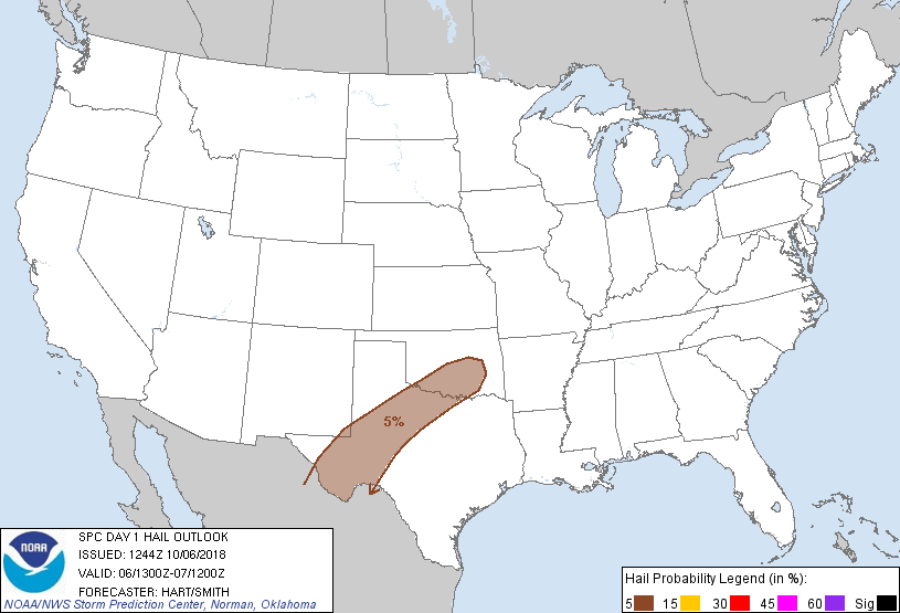
Probabilistic Large Hail Graphic
Probability of hail 1" or larger within 25 miles of a point. Hatched Area: 10% or greater probability of hail 2" or larger within 25 miles of a point.
Day 1 Hail Risk
Area (sq. mi.)
Area Pop.
Some Larger Population Centers in Risk Area
5 %
92,182
2,292,413
Abilene, TX...Norman, OK...Wichita Falls, TX...Midland, TX...Lawton, OK...
SPC AC 061244
Day 1 Convective Outlook
NWS Storm Prediction Center Norman OK
0744 AM CDT Sat Oct 06 2018
Valid 061300Z - 071200Z
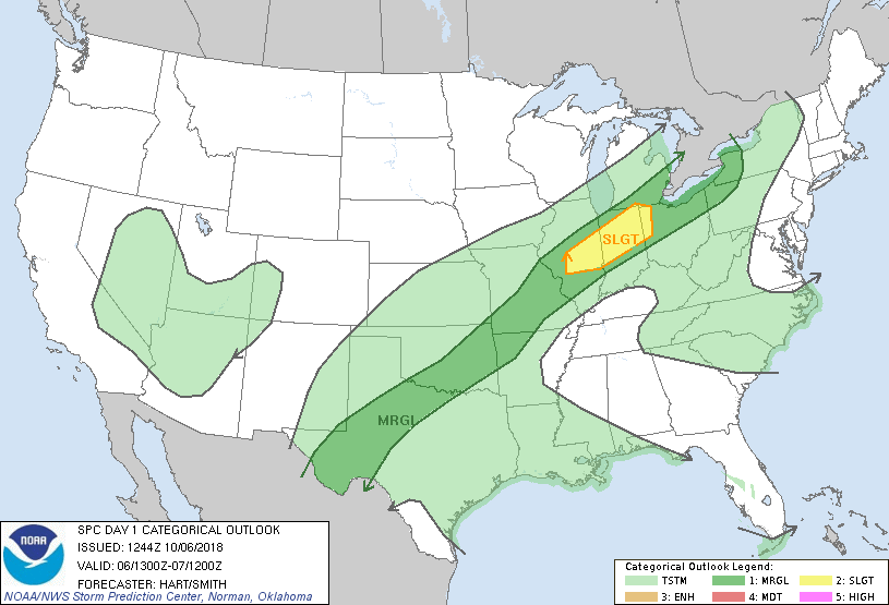
...THERE IS A SLIGHT RISK OF SEVERE THUNDERSTORMS THIS AFTERNOON AND
EVENING OVER PARTS OF CENTRAL ILLINOIS...NORTHERN INDIANA...AND
WESTERN OHIO...
...SUMMARY...
A few strong to severe thunderstorms may impact parts of the Ohio
Valley this afternoon into early evening.
...IL/IN/OH...
A strong shortwave trough is moving across the central/southern
Rockies this morning, with a cold front extending from west TX into
northwest MO. A large area of showers and thunderstorms have formed
along/behind the front over eastern KS/western MO. This activity
will likely persist through the day, spreading eastward into the OH
Valley. Several overnight CAM solutions suggest that a few bowing
structures may develop later this afternoon and evening along the
leading edge of this convection as it tracks from central IL into
western OH. Forecast soundings relatively strong southwesterly wind
fields through a deep layer to support the risk of damaging wind
gusts. Therefore have upgraded this region to SLGT risk.
...West TX...
The aforementioned shortwave trough will move into west TX this
afternoon, helping to initiate thunderstorms. Ample moisture has
advected northwestward into parts of southwest TX, which should
result in sufficient CAPE for vigorous updrafts. Low level wind
fields are only marginal for organized storms, but relatively steep
lapse rates suggest a risk of hail and gusty winds in the strongest
cells.
..Hart/Smith.. 10/06/2018
CLICK TO GET WUUS01 PTSDY1 PRODUCT
NOTE: THE NEXT DAY 1 OUTLOOK IS SCHEDULED BY 1630Z