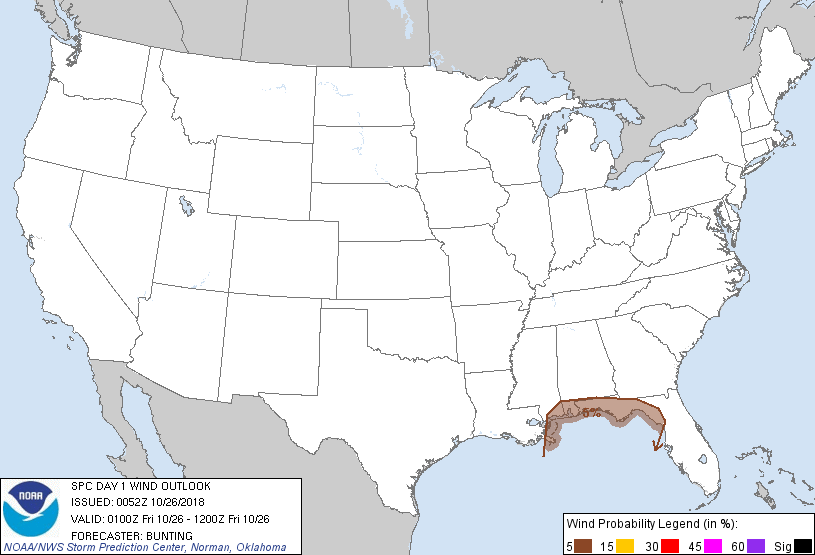
Probability of damaging thunderstorm winds or wind gusts of 50 knots or higher within 25 miles of a point. Hatched Area: 10% of greater probability of wind gusts 65 knots or greater within 25 miles of a point.
Probability of hail 1" or larger within 25 miles of a point. Hatched Area: 10% or greater probability of hail 2" or larger within 25 miles of a point.
Day 1 Hail Risk
Area (sq. mi.)
Area Pop.
Some Larger Population Centers in Risk Area
No Risk Areas Forecast
SPC AC 260052
Day 1 Convective Outlook
NWS Storm Prediction Center Norman OK
0752 PM CDT Thu Oct 25 2018
Valid 260100Z - 261200Z
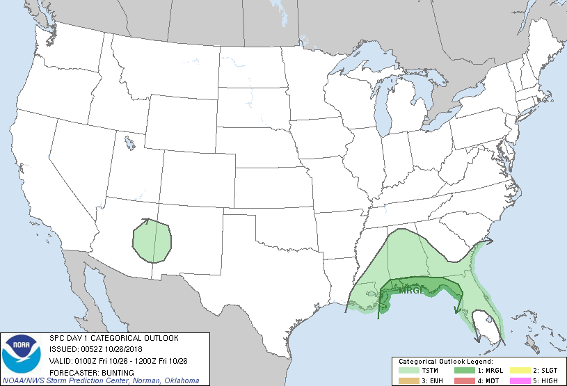
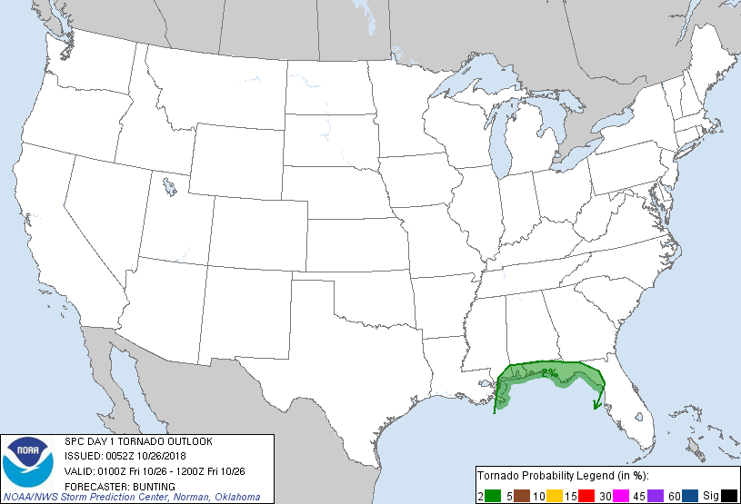
...THERE IS A MARGINAL RISK OF SEVERE THUNDERSTORMS OVER PORTIONS OF
THE CENTRAL AND NORTHEAST GULF COAST......
...SUMMARY...
Showers and embedded thunderstorms are expected across portions of
the Southeast tonight. A low severe risk exists near the coast.
...Southeast U.S....
Evening surface analysis reveals a weak surface low over southern
MS, with a cold front extending southward into the Gulf of Mexico.
A warm front extended from the low east across the central FL
peninsula. Latest mesoanalysis and 00Z upper-air data sampled a
weakly buoyant air mass near the coast and the presence of modest
(around 35 kts) effective shear, with greater instability/stronger
shear farther south over the offshore waters within the warm/moist
sector. Isolated thunderstorms had developed about 50 miles
south/southwest of Panama City FL, and additional thunderstorm
development is expected in response to weak warm/moist advection and
frontal convergence overnight as the surface low and cold front move
east. Enlarged low-level hodographs in latest RAP/NAM forecast
soundings in response to strengthening low-level flow suggests at
least some potential for low-level rotation with isolated stronger
storms near and just offshore of the coast. Gusty winds will also
be possible across the Marginal Risk area.
After 09Z, some increase in thunderstorms is expected near the
northeast FL/GA coast in response to strengthening warm advection as
the warm front lifts northward. The overall severe risk near the
coast still appears low, with any potential for stronger storms
remaining farther offshore.
..Bunting.. 10/26/2018
CLICK TO GET WUUS01 PTSDY1 PRODUCT
NOTE: THE NEXT DAY 1 OUTLOOK IS SCHEDULED BY 0600Z