San Antonio, TX...Austin, TX...Waco, TX...Killeen, TX...Round Rock, TX...
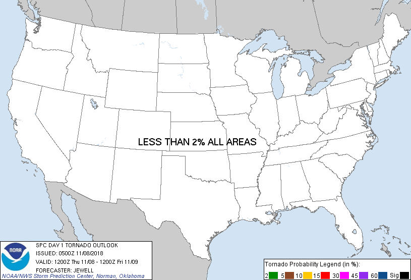
Probabilistic Tornado Graphic
Probability of a tornado within 25 miles of a point. Hatched Area: 10% or greater probability of EF2 - EF5 tornadoes within 25 miles of a point.
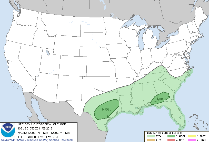
Day 1 Tornado Risk
Area (sq. mi.)
Area Pop.
Some Larger Population Centers in Risk Area
No Risk Areas Forecast
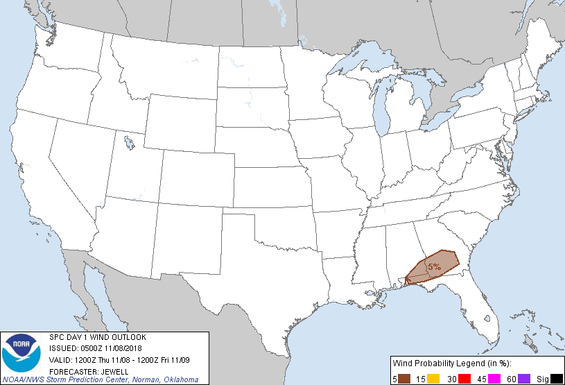
Probabilistic Damaging Wind Graphic
Probability of damaging thunderstorm winds or wind gusts of 50 knots or higher within 25 miles of a point. Hatched Area: 10% of greater probability of wind gusts 65 knots or greater within 25 miles of a point.
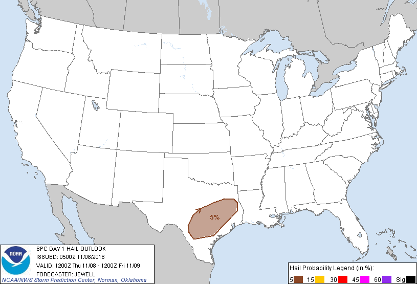
Probability of hail 1" or larger within 25 miles of a point. Hatched Area: 10% or greater probability of hail 2" or larger within 25 miles of a point.
Day 1 Hail Risk
Area (sq. mi.)
Area Pop.
Some Larger Population Centers in Risk Area
5 %
58,070
6,667,951
San Antonio, TX...Austin, TX...Waco, TX...Killeen, TX...Round Rock, TX...
   SPC AC 080500

   Day 1 Convective Outlook
   NWS Storm Prediction Center Norman OK
   1100 PM CST Wed Nov 07 2018

   Valid 081200Z - 091200Z

   ...THERE IS A MARGINAL RISK OF SEVERE THUNDERSTORMS ACROSS SOUTHEAST
   ALABAMA AND SOUTHERN GEORGIA DURING THE DAY...AND ACROSS PARTS OF
   SOUTH-CENTRAL TEXAS OVERNIGHT...

   ...SUMMARY...
   A few clusters of storms are likely from southern Alabama into
   Georgia today, with strong wind gusts possible. Marginal hail is
   possible tonight across south-central Texas.

   ...Synopsis...
   A broad area of cyclonic flow aloft will remain across the bulk of
   the CONUS, with various embedded shortwave troughs. The primary
   upper low will move southward out of Manitoba into MN, with an
   intensifying 80 kt midlevel jet across the central Plains by Friday
   morning. Ahead of this feature, a separate wave will move quickly
   from CO/NM into the mid MS Valley, resulting in gradual height falls
   across the South overnight. To the east, a weaker low-amplitude
   feature will move quickly east across the Gulf Coast states during
   the day. This will occur along and north of a stationary front
   oriented roughly from Houston into southern GA. A moist and unstable
   air mass will remain along and south of this front, with daytime
   thunderstorms across the Southeast and overnight across TX as a cold
   front surges south across the Plains.

   ...Southern AL and GA, and parts of the FL Panhandle...
   Models indicate that a weak surface wave may form along the front,
   from southern AL into GA during the afternoon, and ahead of a weak
   disturbance aloft moving across LA, MS, and AL. Areas of heating are
   possible across GA and FL, and may contribute to destabilization.
   Model consensus is for storms to concentrate across southern AL, GA,
   and the FL Panhandle by 21Z, and a few strong wind gusts will be
   possible due to 1000-1500 J/kg SBCAPE near the stalled front and
   weak upper support. Low-level shear will be weak, with little threat
   of rotating storms.

   ...Texas overnight...
   Although the surface front will remain across southern TX and toward
   the coast, sufficient elevated moisture and instability will remain
   over much of the state as 850 mb winds remain southwesterly.
   Scattered storms are most likely to form after 00Z, along and ahead
   of the deepening cold front as it travels southward across the state
   overnight. Strong deep-layer shear in the effective cloud layer will
   result in long hodographs and may support cellular activity, some of
   which could produce marginally severe hail.

   ..Jewell/Wendt.. 11/08/2018

   CLICK TO GET WUUS01 PTSDY1 PRODUCT

   NOTE: THE NEXT DAY 1 OUTLOOK IS SCHEDULED BY 1300Z