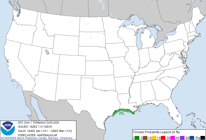
Probability of a tornado within 25 miles of a point. Hatched Area: 10% or greater probability of EF2 - EF5 tornadoes within 25 miles of a point.
Day 1 Tornado Risk
Area (sq. mi.)
Area Pop.
Some Larger Population Centers in Risk Area
2 %
5,576
170,718
Galveston, TX...Texas City, TX...La Marque, TX...Freeport, TX...Clute, TX...
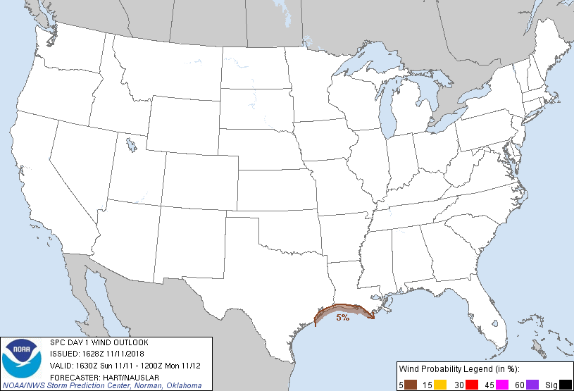
Probabilistic Damaging Wind Graphic
Probability of damaging thunderstorm winds or wind gusts of 50 knots or higher within 25 miles of a point. Hatched Area: 10% of greater probability of wind gusts 65 knots or greater within 25 miles of a point.
Day 1 Wind Risk
Area (sq. mi.)
Area Pop.
Some Larger Population Centers in Risk Area
5 %
5,457
168,755
Galveston, TX...Texas City, TX...La Marque, TX...Freeport, TX...Clute, TX...
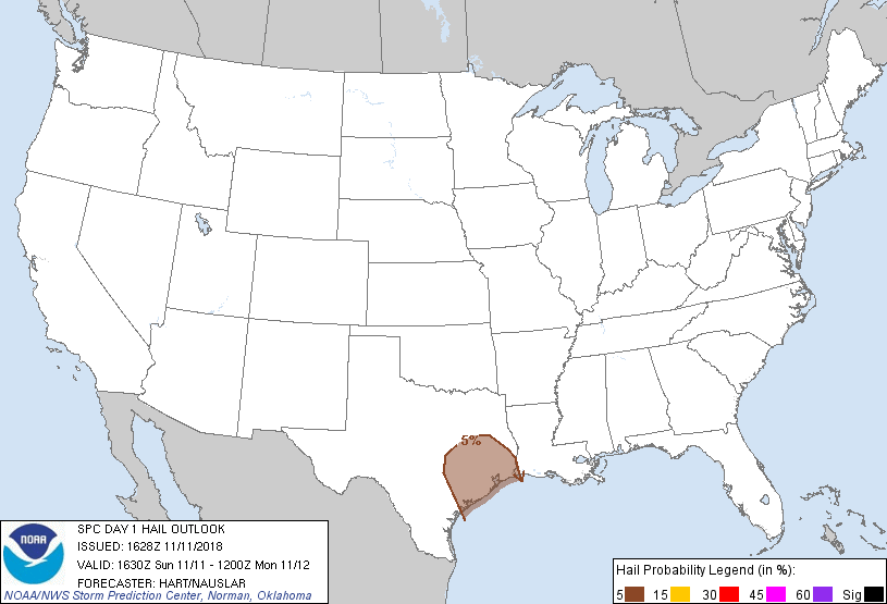
Probabilistic Large Hail Graphic
Probability of hail 1" or larger within 25 miles of a point. Hatched Area: 10% or greater probability of hail 2" or larger within 25 miles of a point.
SPC AC 111628
Day 1 Convective Outlook
NWS Storm Prediction Center Norman OK
1028 AM CST Sun Nov 11 2018
Valid 111630Z - 121200Z
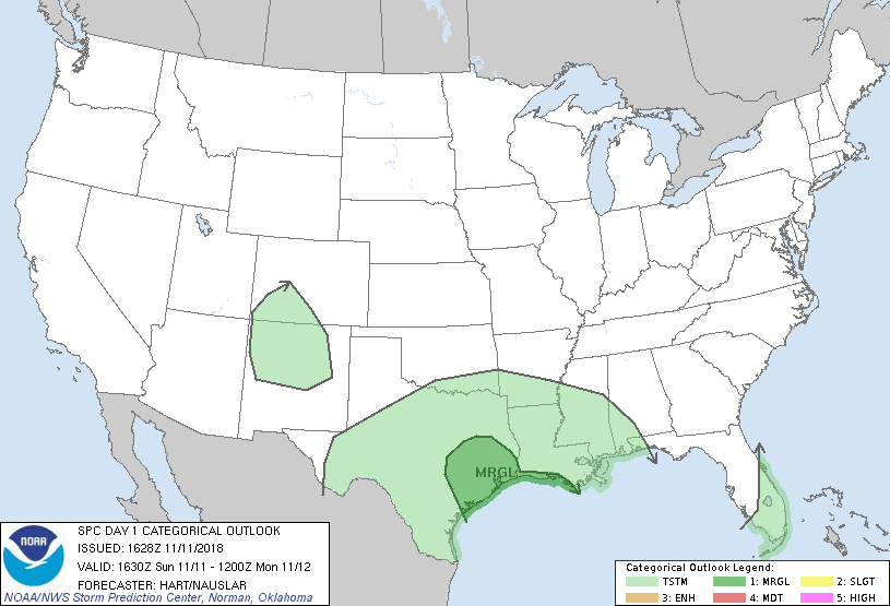
...THERE IS A MARGINAL RISK OF SEVERE THUNDERSTORMS OVER PORTIONS OF
SOUTHEAST TEXAS AND SOUTHWEST LOUISIANA...
...SUMMARY...
Isolated strong to marginally severe thunderstorms are possible
overnight from southeast Texas to far southwestern Louisiana.
...TX/LA...
No changes have been made to the ongoing MRGL risk area.
Thunderstorms are expected to develop across south TX this evening,
spreading into southeast TX and southern LA late tonight.
Convection will be elevated over inland TX, with the strongest cell
showing a risk of hail. Storms right along the coast will have a
low risk of becoming surface-based with some potential for gusty
winds and perhaps a tornado or two. The overall severe risk appears
marginal throughout this region.
..Hart/Nauslar.. 11/11/2018
CLICK TO GET WUUS01 PTSDY1 PRODUCT
NOTE: THE NEXT DAY 1 OUTLOOK IS SCHEDULED BY 2000Z