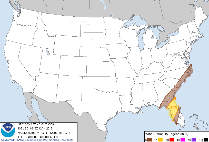
Probability of damaging thunderstorm winds or wind gusts of 50 knots or higher within 25 miles of a point. Hatched Area: 10% of greater probability of wind gusts 65 knots or greater within 25 miles of a point.
Probability of hail 1" or larger within 25 miles of a point. Hatched Area: 10% or greater probability of hail 2" or larger within 25 miles of a point.
Day 1 Hail Risk
Area (sq. mi.)
Area Pop.
Some Larger Population Centers in Risk Area
No Risk Areas Forecast
SPC AC 141613
Day 1 Convective Outlook
NWS Storm Prediction Center Norman OK
1013 AM CST Fri Dec 14 2018
Valid 141630Z - 151200Z
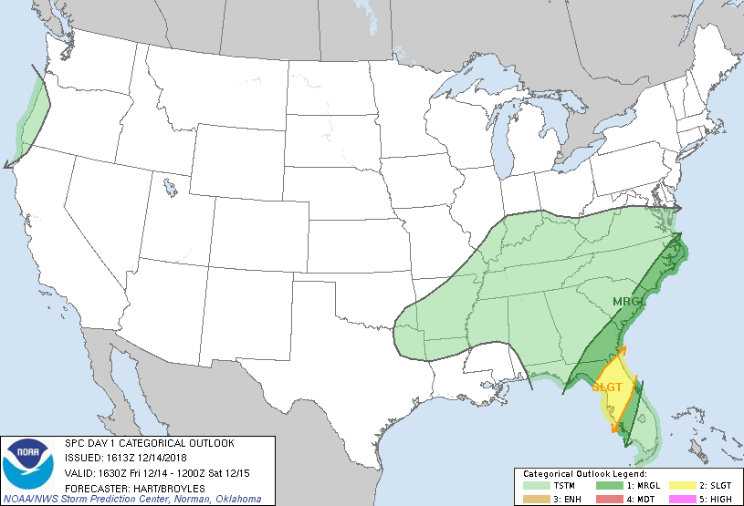
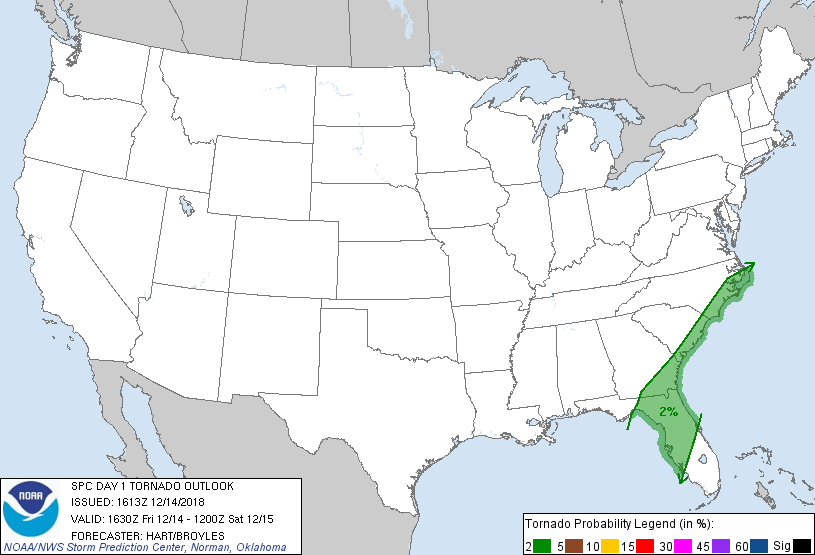
...THERE IS A SLIGHT RISK OF SEVERE THUNDERSTORMS OVER PARTS OF THE
FLORIDA PENINSULA...
...SUMMARY...
Isolated severe thunderstorms will be possible across the
western/north-central Florida Peninsula through the afternoon and
evening, and possibly across southeastern Georgia and the coastal
Carolinas tonight. Locally damaging winds should be the main threat.
...FL...
No changes have been made to the ongoing forecast. Morning radar
loop shows widespread showers and thunderstorms affecting the west
coast of the FL Peninsula, with activity spreading eastward across
the SLGT risk region. This will significantly limit
heating/destabilization. Nevertheless, forecast soundings show weak
but sufficient CAPE values and strong deep-layer shear today into
tonight. This may result in a few organized cells within the
broader precipitation shield. Rotating/bowing segments capable of
damaging winds, or perhaps a tornado spinup are the main concerns
today. The threat should end from west to east across the FL
Peninsula this afternoon and evening.
..Carolina Coast...
Strong surface pressure-falls are forecast over the eastern
Carolinas later today. This will result in strengthening southerly
low level winds and rapid destabilization along the immediate coast.
Model solutions suggest multiple clusters of thunderstorms offshore
this evening and tonight. If a few of these stronger storms can
spread inland, a marginal risk of damaging winds would be present.
..Hart/Broyles.. 12/14/2018
CLICK TO GET WUUS01 PTSDY1 PRODUCT
NOTE: THE NEXT DAY 1 OUTLOOK IS SCHEDULED BY 2000Z