Virginia Beach, VA...Norfolk, VA...Chesapeake, VA...Newport News, VA...Hampton, VA...
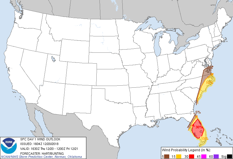
Probabilistic Damaging Wind Graphic
Probability of damaging thunderstorm winds or wind gusts of 50 knots or higher within 25 miles of a point. Hatched Area: 10% of greater probability of wind gusts 65 knots or greater within 25 miles of a point.
Day 1 Wind Risk
Area (sq. mi.)
Area Pop.
Some Larger Population Centers in Risk Area
30 %
21,180
5,973,842
Orlando, FL...Cape Coral, FL...Port St. Lucie, FL...Lakeland, FL...Brandon, FL...
Virginia Beach, VA...Tampa, FL...St. Petersburg, FL...Norfolk, VA...Chesapeake, VA...
Probabilistic Large Hail Graphic
Probability of hail 1" or larger within 25 miles of a point. Hatched Area: 10% or greater probability of hail 2" or larger within 25 miles of a point.
Day 1 Hail Risk
Area (sq. mi.)
Area Pop.
Some Larger Population Centers in Risk Area
No Risk Areas Forecast
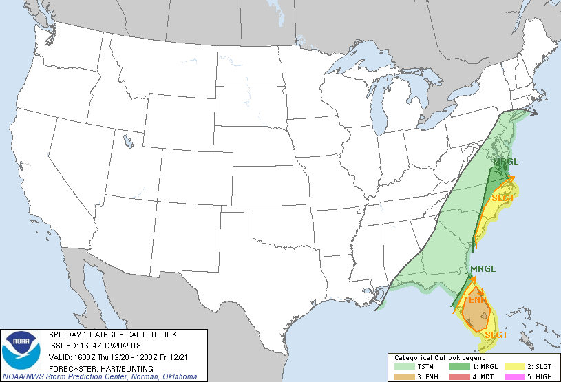
SPC AC 201604
Day 1 Convective Outlook
NWS Storm Prediction Center Norman OK
1004 AM CST Thu Dec 20 2018
Valid 201630Z - 211200Z
...THERE IS AN ENHANCED RISK OF SEVERE THUNDERSTORMS OVER PARTS OF
CENTRAL FLORIDA...
...THERE IS A SLIGHT RISK OF SEVERE THUNDERSTORMS FROM FLORIDA INTO
THE EASTERN CAROLINAS...
...SUMMARY...
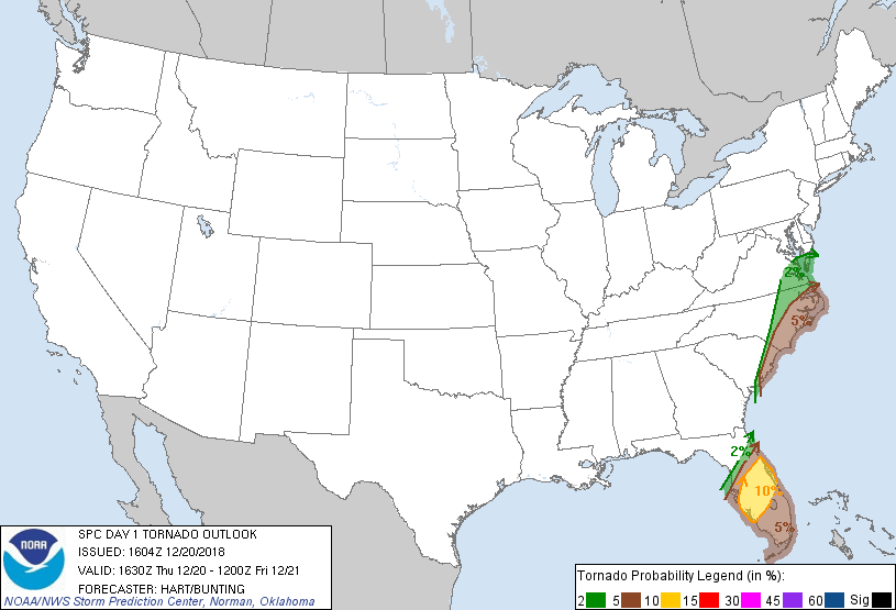
Damaging thunderstorm winds and tornadoes are possible across much
of the Florida Peninsula today, and in eastern portions of the
Carolinas late afternoon into tonight.
...FL...
A band of strong/severe storms is affecting parts of the central FL
Peninsula this morning, with several transient mesocyclones noted in
the past few hours. Given the strong low level shear in place in
this region, a few tornadoes and locally damaging wind gusts will
remain possible through mid-afternoon. Please refer to Mesoscale
Discussion #1717 for further details.
Meanwhile, the primary squall line remains offshore but will begin
to move inland soon. The air mass ahead of the line is generally
undisturbed and is heating/destabilizing. Forecast soundings across
the southern Peninsula suggest MLCAPE values of 1000-1500 J/kg will
be common. Shear profiles are also quite impressive with 40-50 kt
winds as low as 1000-1500m. This will support a risk of embedded
bows and supercells along the line, capable of damaging wind gusts
and a few tornadoes. Therefore have adjusted the ENH area slightly
southward and may include the remainder of south FL in later
updates.
...SC/NC/VA...
No changes have been made to this portion of the outlook. Rapid
strengthening of the surface low will result in impressive wind
fields over the eastern Carolinas later today, but most storms are
forecast to remain offshore. Nevertheless, the conditional threat
of an organized storm affecting the coastal counties is sufficient
to maintain the SLGT risk.
..Hart/Bunting.. 12/20/2018
CLICK TO GET WUUS01 PTSDY1 PRODUCT
NOTE: THE NEXT DAY 1 OUTLOOK IS SCHEDULED BY 2000Z