SPC AC 091608
Day 2 Convective Outlook
NWS Storm Prediction Center Norman OK
1008 AM CST Tue Jan 09 2018
Valid 101200Z - 111200Z
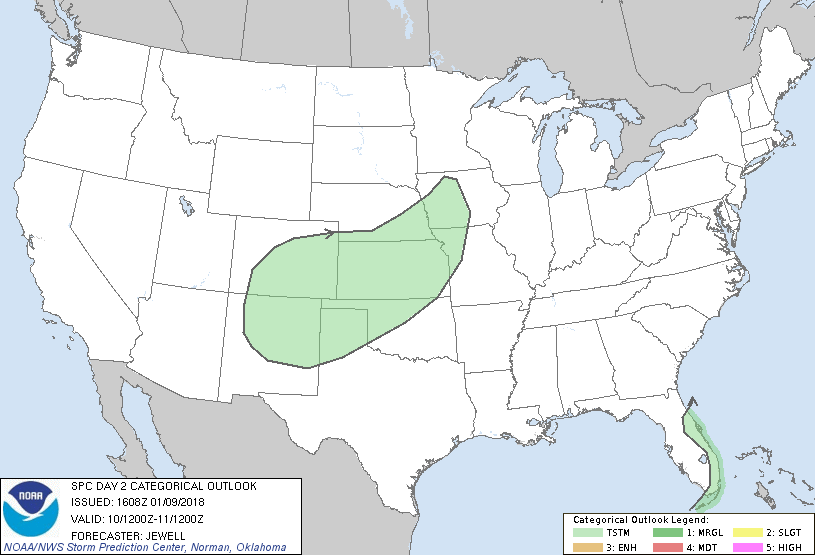
...NO SEVERE THUNDERSTORM AREAS FORECAST...
...SUMMARY...
A few weak thunderstorms are possible from New Mexico and Colorado
eastward across the central Plains, and over the eastern Florida
Peninsula.
...Synopsis and Discussion...
A highly amplified upper trough will move from the Rockies into the
Plains on Wednesday, with upper ridges across the east and west
coasts. Within the central U.S. trough, an embedded wave will move
northeastward from the southern Plains toward the lower Missouri
Valley, with a primary jet max digging into northern Mexico on the
backside of the trough. At the surface, only gradual moistening will
occur from TX into the lower and middle MS Valleys due to southerly
surface winds around a surface high over the East. A cold front
will drive southeastward across the Plains late in the day, with
lift north of the front. Low amounts of elevated instability will
likely materialize, sufficient for a few weak thunderstorms, the
greatest concentration of which should be from KS into IA as a low
develops along the front. However, these storms will not be severe.
Elsewhere, a weak upper low will meander across the Florida Straits,
with cool air aloft aiding in weak destabilization as modestly moist
low-level easterlies persist. A few of the deeper showers may become
thunderstorms over the Atlantic, and perhaps affecting the eastern
Florida coast and Keys.
..Jewell.. 01/09/2018
CLICK TO GET WUUS02 PTSDY2 PRODUCT
NOTE: THE NEXT DAY 2 OUTLOOK IS SCHEDULED BY 0700Z
|