SPC AC 260646
Day 2 Convective Outlook
NWS Storm Prediction Center Norman OK
1246 AM CST Mon Feb 26 2018
Valid 271200Z - 281200Z
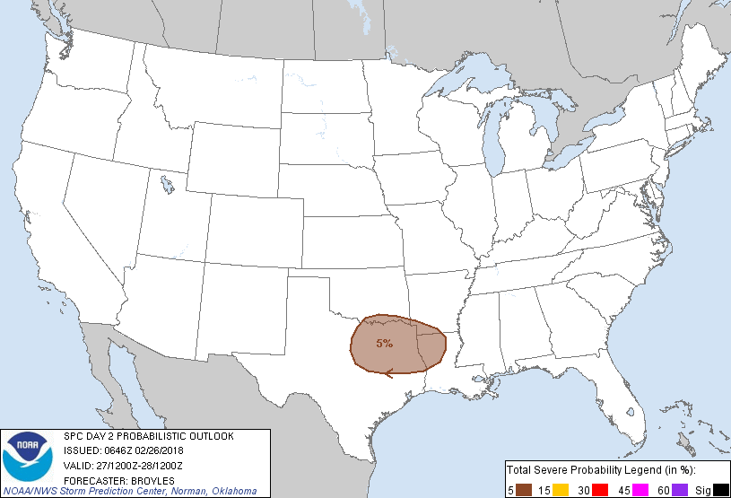
...THERE IS A MARGINAL RISK OF SEVERE THUNDERSTORMS ACROSS PARTS OF
NORTH AND NORTHEAST TEXAS EASTWARD INTO THE ARKLATEX...
...SUMMARY...
Thunderstorms accompanied by hail will be possible on Tuesday across
parts of north-central and northeast Texas eastward into the
Arklatex.
...Southern Plains/Arklatex...
An upper-level ridge is forecast to be in place on Tuesday from the
Gulf Coast States northward into the Great Lakes with southwest
mid-level flow over the southern Plains. A strong mid-level jet is
forecast to move across northwestern Mexico on Tuesday. The exit
region of the mid-level jet will overspread the southern Plains
enhancing lift. This combined with moisture advection associated
with a low-level jet in east-central Texas will support thunderstorm
development. The models are in reasonable agreement that a cluster
of elevated thunderstorms will develop Tuesday afternoon on the nose
of the low-level jet in east-central Texas. This convection is
forecast to expand in coverage, moving north-northeastward into the
Arklatex by early evening. NAM forecast soundings in northeast Texas
at 21Z on Tuesday show MUCAPE values between 750 to 1000 J/kg with
strong effective shear profiles and steep mid-level lapse rates.
This should be enough for a marginal hail threat with the stronger
cells.
..Broyles.. 02/26/2018
CLICK TO GET WUUS02 PTSDY2 PRODUCT
NOTE: THE NEXT DAY 2 OUTLOOK IS SCHEDULED BY 1730Z