SPC AC 100517
Day 2 Convective Outlook
NWS Storm Prediction Center Norman OK
1117 PM CST Fri Mar 09 2018
Valid 111200Z - 121200Z
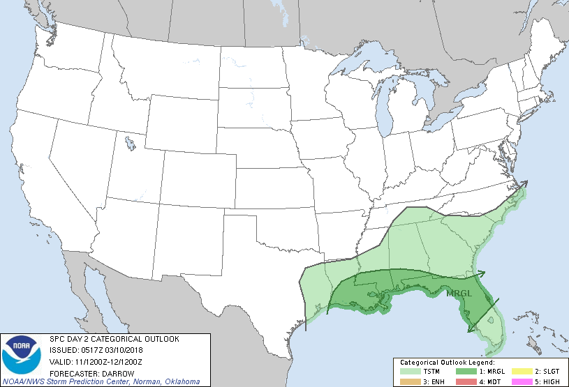
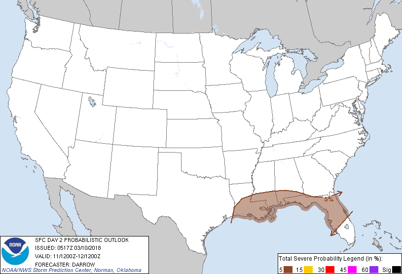
...THERE IS A MARGINAL RISK OF SEVERE THUNDERSTORMS NEAR THE GULF
COAST INTO THE CENTRAL FL PENINSULA...
...SUMMARY...
Some severe threat will exist near the Gulf Coast to the central
Florida Peninsula.
...Gulf Coast/FL...
Mid-level speed max associated with a strong short-wave trough over
MT is expected to dig southeast into the Ozark Plateau by Sunday
morning before translating into the central Gulf States by the end
of the period. This digging short wave should assist overall
strengthening of mid-level flow across lower latitudes of the US
with 500mb speeds expected to increase across the northern Gulf
basin into the northern half of the FL Peninsula. As surface
pressures build in its wake over the Plains, a notable cold front
will surge across TX/LA during the day before progressing into the
FL Panhandle by Monday morning. Latest model guidance suggests ample
buoyancy will exist ahead of the front for potential robust
convection, especially given the expected height falls and
strengthening shear. NAM forecast soundings near the Gulf coast
exhibit modest lapse rates and instability such that organized
convection is certainly possible as large-scale forcing for ascent
spreads southeast toward coastal regions. Greatest severe risk will
be isolated large hail and the potential for a few severe wind gusts
also exists.
..Darrow.. 03/10/2018
CLICK TO GET WUUS02 PTSDY2 PRODUCT
NOTE: THE NEXT DAY 2 OUTLOOK IS SCHEDULED BY 1730Z