SPC AC 011717
Day 2 Convective Outlook
NWS Storm Prediction Center Norman OK
1217 PM CDT Sun Apr 01 2018
Valid 021200Z - 031200Z
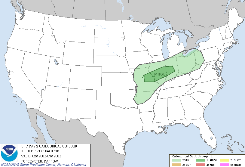
...THERE IS A MARGINAL RISK OF SEVERE THUNDERSTORMS ACROSS PARTS OF
THE MIDWEST...
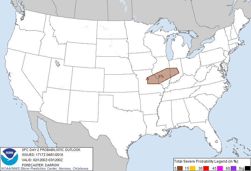
...SUMMARY...
Some hail may accompany thunderstorms across parts of the Midwest
Monday night.
...Midwest...
Strong short-wave trough is forecast to dig southeast across the
northern Rockies into the northern/central Plains region by the end
of the day2 period. Height falls, on the order of 150m in 12 hours,
will focus across NE during the latter half of the period which will
encourage a strengthening LLJ ahead of a pronounced cold front/lee
cyclone over KS. Continental air mass is currently wedged deep into
the Plains but by 02/12z this boundary is expected to stall,
extending from eastern TN into central TX. With time a warm front
will lift north across southern MO/IL/IN. High PW air mass will
begin surging atop the shallowing continental air and a very steep
mid-level lapse rate plume should overspread much of the Midwest
along the I-70 corridor during the latter half of the period. There
is increasing confidence that robust elevated thunderstorms could
develop along the nose of the strengthening LLJ where latest NAM
guidance depicts MUCAPE on the order of 1000-1500 J/kg for parcels
lifted near 850mb. For these reasons have introduced 5% severe probs
to account for the possibility of large hail with elevated
thunderstorms that develop primarily during the latter half of the
period.
..Darrow.. 04/01/2018
CLICK TO GET WUUS02 PTSDY2 PRODUCT
NOTE: THE NEXT DAY 2 OUTLOOK IS SCHEDULED BY 0600Z