Charlotte, NC...Atlanta, GA...Columbus, GA...Columbia, SC...Sandy Springs, GA...
Probabilistic Graphic
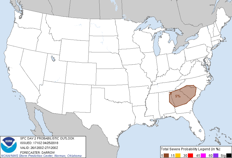
Probability of severe weather within 25 miles of a point. Hatched Area: 10% or greater probability of significant severe within 25 miles of a point.
Day 2 Prob. Risk
Area (sq. mi.)
Area Pop.
Some Larger Population Centers in Risk Area
5 %
60,833
12,679,023
Charlotte, NC...Atlanta, GA...Columbus, GA...Columbia, SC...Sandy Springs, GA...
SPC AC 251710
Day 2 Convective Outlook
NWS Storm Prediction Center Norman OK
1210 PM CDT Wed Apr 25 2018
Valid 261200Z - 271200Z
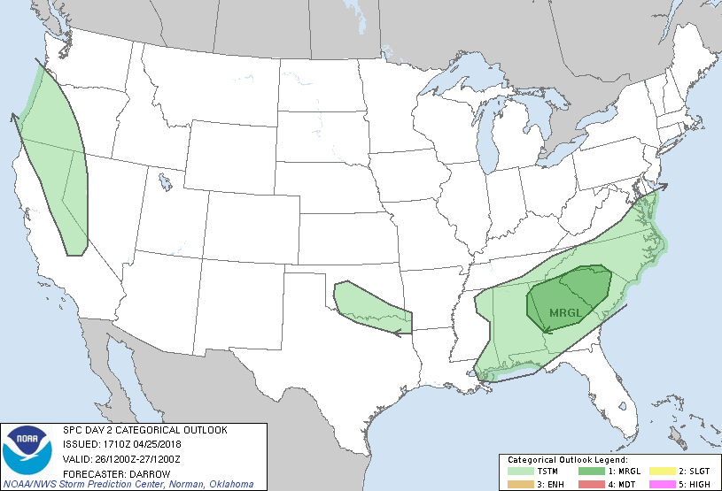
...THERE IS A MARGINAL RISK OF SEVERE THUNDERSTORMS ACROSS PARTS OF
THE SOUTHEAST...
...SUMMARY...
Isolated severe thunderstorms are expected across parts of the
Southeast Thursday.
...Southeast...
Upper low over the central Plains is expected to dig southeast into
northern AL by 18z Thursday before deamplifying during the overnight
hours and ejecting into NC. Notable drying will surge into AL by mid
day as this feature progresses across the northern Gulf States.
Latest guidance suggests convection will be ongoing at the beginning
of the period along the cold front and this boundary should remain
convectively active as it progresses into the Carolinas. Air mass
will not be particularly unstable early in the period but partial
breaks in cloud cover will allow for some boundary-layer heating
beneath a cooling mid-level profile. With 500mb temperatures <-20C
beneath the upper low, it appears a corridor of instability will
evolve from portions of northern AL into SC during the day. Forecast
soundings suggest robust updrafts may develop immediately ahead of
the upper low and shear profiles will favor sustained rotating
updrafts. For these reasons have introduced 5% severe probs to
account for isolated supercell development possibly as early as mid
day over AL. This activity should spread into the Carolinas during
the evening hours. Hail and perhaps locally damaging winds are the
primary threats.
...Elsewhere...
Weak convection may produce a few lightning strikes across parts of
the southern Plains during the latter half of the period ahead of
digging short-wave trough.
Isolated thunderstorms are also expected to develop across portions
of the western US from the Sierra Nevada into western OR. It appears
instability will be a bit too weak to warrant severe probs across
these regions.
..Darrow.. 04/25/2018
CLICK TO GET WUUS02 PTSDY2 PRODUCT
NOTE: THE NEXT DAY 2 OUTLOOK IS SCHEDULED BY 0600Z