SPC AC 081730
Day 2 Convective Outlook
NWS Storm Prediction Center Norman OK
1230 PM CDT Fri Jun 08 2018
Valid 091200Z - 101200Z
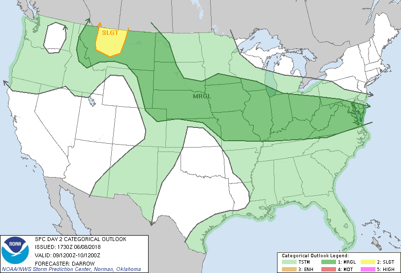
...THERE IS A SLIGHT RISK OF SEVERE THUNDERSTORMS ACROSS PARTS OF
MT...
...SUMMARY...
Severe thunderstorms are expected on Saturday across the northern
Rockies, while pockets of other strong to severe thunderstorms are
possible from a portion of the central and northern Plains through
the Ohio Valley and Middle Atlantic states.
...Northern Rockies/Northern High Plains...
Strong mid-level height falls are forecast to spread across the
northern inter-mountain region into western MT during the latter
half of the period. Associated cold front will surge across western
MT to a position near CTB-BTM by 10/00z. This boundary is expected
to serve as a focus for robust thunderstorm development as strong
large-scale forcing should easily induce deep convection within a
strongly sheared and steep lapse rate environment. Initial
thunderstorm development may be somewhat high based, and possibly
supercellular in nature. However, subsequent movement toward central
MT should allow for lowering cloud bases and upscale convective
growth as boundary layer will be more moist/buoyant across this
region. While large hail should accompany this activity, it appears
damaging wind threat will increase with late-night squall line.
...Central Plains to Middle Atlantic...
Generally weak large-scale steering currents will prevail across the
Midwest into the Middle Atlantic region Saturday. As a result,
predictability will necessarily be low regarding possible
thunderstorm clusters that could generate locally severe
hail/damaging winds. Even so, there is some confidence that a late
day1 MCS, or strong thunderstorm clusters, could migrate into the
Mid-MO Valley region by daybreak Saturday. Remnants of this
convective activity should influence potential thunderstorm
development downstream later in the day. Latest guidance suggests
the most likely corridor for robust thunderstorm development will be
across portions of the Mid-MS Valley immediately ahead of early-day
thunderstorm complex. Hail/wind may be noted with renewed convection
from IA into IL.
Other isolated robust thunderstorms may be noted along a corridor
from southern OH into VA where strong surface heating is expected to
induce buoyancy sufficient for deep convection. Despite weak
deep-layer shear there is reason to believe gusty winds and perhaps
some hail could occur given the seasonally steep lapse rates.
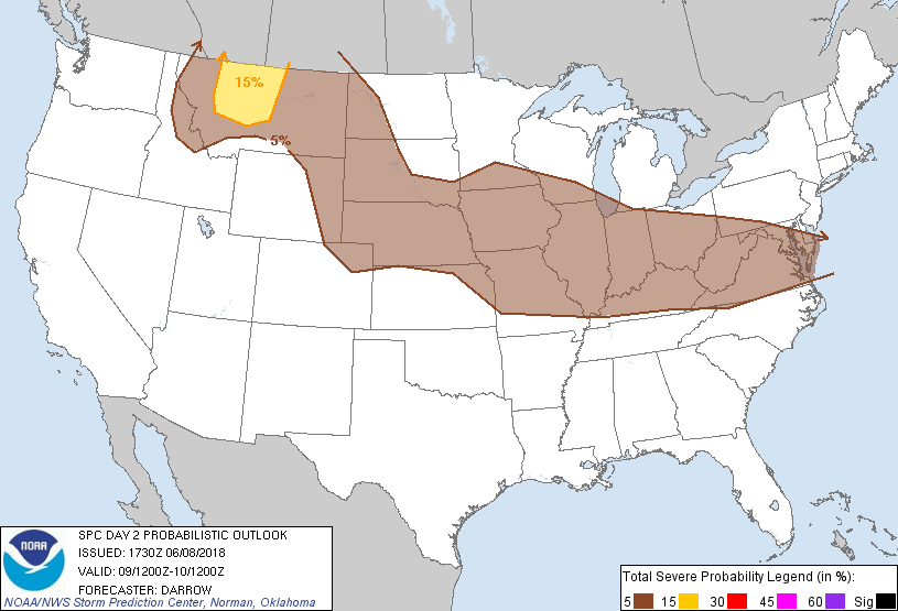
...MAXIMUM RISK BY HAZARD...
Tornado: 2% - Marginal
Wind: 15% - Slight
Hail: 15% - Slight
..Darrow.. 06/08/2018
CLICK TO GET WUUS02 PTSDY2 PRODUCT
NOTE: THE NEXT DAY 2 OUTLOOK IS SCHEDULED BY 0600Z