SPC AC 070454
Day 2 Convective Outlook
NWS Storm Prediction Center Norman OK
1154 PM CDT Thu Sep 06 2018
Valid 081200Z - 091200Z
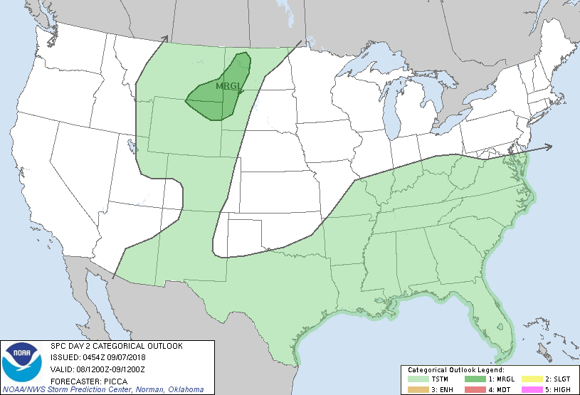
...THERE IS A MARGINAL RISK OF SEVERE THUNDERSTORMS ACROSS THE
NORTHERN HIGH PLAINS...
...SUMMARY...
A couple severe storms, capable of isolated damaging winds and hail,
may be possible over the northern High Plains Saturday afternoon and
evening.
...Northern High Plains...
Within a belt of enhanced west/southwesterly 500mb flow, a shortwave
trough will approach the region Saturday afternoon. As it does so, a
lee trough will gradually spread east towards the Montana / North
Dakota border. Meanwhile, despite modest low-level moisture return
(e.g., surface dew points in the 40s to lower 50s), steep mid-level
lapse rates and diurnal heating should foster weak/moderate buoyancy
along/ahead of the surface trough. Isolated to widely scattered
storms should be able to develop within this environment. Organized
by winds veering with height, a few updrafts may become strong
enough to support marginally severe hail. Steep lapse rates will
also encourage gusty winds in stronger cores.
...Lower Ohio Valley...
The remnant circulation of Gordon is forecast to lift
north/northeast Saturday across parts of the mid Mississippi Valley
and vicinity. In response, a low-level jet is expected to strengthen
over portions of the lower Ohio Valley. A related increase in
warm-air advection should support widespread showers and
thunderstorms through the day. Although instability will be weak,
sufficient low-level shear could develop to yield a couple of
stronger gusts or even a brief tornado. While a marginal risk was
considered for this outlook, continued uncertainty regarding the
placement of the surface low/front and low-end/focused nature of any
potential threat preclude severe probabilities at this time.
...MAXIMUM RISK BY HAZARD...
Tornado: <2% - None
Wind: 5% - Marginal
Hail: 5% - Marginal
..Picca.. 09/07/2018
CLICK TO GET WUUS02 PTSDY2 PRODUCT
NOTE: THE NEXT DAY 2 OUTLOOK IS SCHEDULED BY 1730Z