SPC AC 071650
Day 2 Convective Outlook
NWS Storm Prediction Center Norman OK
1150 AM CDT Fri Sep 07 2018
Valid 081200Z - 091200Z
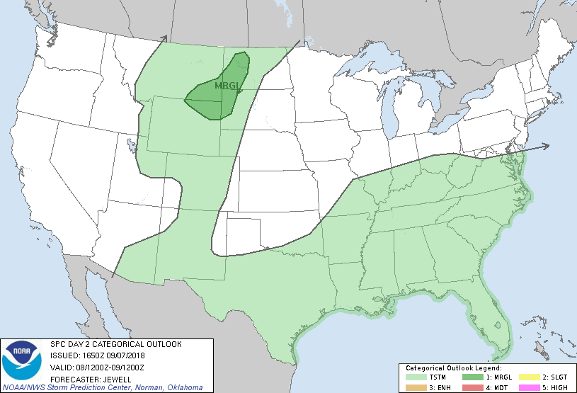
...THERE IS A MARGINAL RISK OF SEVERE THUNDERSTORMS ACROSS PARTS OF
THE NORTHERN HIGH PLAINS...
...SUMMARY...
Isolated severe storms capable of damaging winds or hail are
possible over the northern High Plains Saturday afternoon and
evening. A few strong wind gusts cannot be ruled out over parts of
the lower Ohio and mid Mississippi Valleys as well.
...Synopsis...
High pressure will move from Ontario into Quebec, with a front
extending roughly along the I-70 corridor from MO to the Mid
Atlantic with a moist air mass supporting scattered storms. Weak
cyclogenesis will occur across the lower OH Valley, in association
with the remnants of Gordon as it interacts with the front. This too
will provide a focus for numerous thunderstorms and heavy rain, from
eastern MO across IL, IN, and western KY.
To the west, a low-amplitude progressive shortwave trough will move
east across the northern Rockies, with an associated lee-trough from
SK southward across the northern High Plains which will provide a
focus for at least isolated afternoon and evening thunderstorms.
...Northern High Plains...
Strong heating will occur near the developing lee-trough, with steep
lapse rate profiles resulting in weak instability and a narrow zone
of uncapped air mass. This may support a few high-based storms
capable of gusty winds, or support mainly small hail with any
cellular activity. Given a strong southerly low-level jet, a storm
or two may persist into the night across the western Dakotas.
...Mid MS/Lower OH Valleys...
Widespread rain and storms are expected to be ongoing across
southeast MO Saturday morning, and will develop into IL during the
day and across parts of IN and KY by evening. This activity will be
associated with a gradually deepening surface low as the warm moist
air mass interacts with the synoptic front. While flow aloft will be
weak, substantial low-level warm advection will develop over this
area, with increasing SRH mainly along and north of the front where
most of the diurnal and evening storms are expected to be
concentrated. More isolated afternoon activity may occur south of
the main east-west cold front, most likely in close proximity to the
surface low. Thus, a short lived strong storm or two cannot be ruled
out, with either damaging wind gust or weak/brief tornado potential.
An upgrade to Marginal risk for isolated severe storms could be
added in later outlooks as predictability issues related to early
convection, potential outflow, air mass quality and low-level shear
are better known.
...MAXIMUM RISK BY HAZARD...
Tornado: <2% - None
Wind: 5% - Marginal
Hail: 5% - Marginal
..Jewell.. 09/07/2018
CLICK TO GET WUUS02 PTSDY2 PRODUCT
NOTE: THE NEXT DAY 2 OUTLOOK IS SCHEDULED BY 0600Z