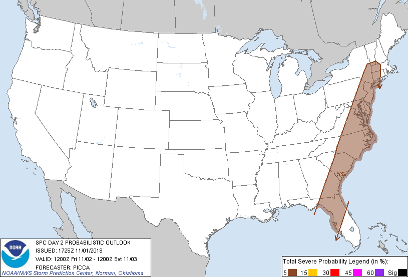
New York, NY...Philadelphia, PA...Jacksonville, FL...Baltimore, MD...Washington, DC...
Probabilistic Graphic
Probability of severe weather within 25 miles of a point. Hatched Area: 10% or greater probability of significant severe within 25 miles of a point.
Day 2 Prob. Risk
Area (sq. mi.)
Area Pop.
Some Larger Population Centers in Risk Area
5 %
172,129
63,535,024
New York, NY...Philadelphia, PA...Jacksonville, FL...Baltimore, MD...Washington, DC...
SPC AC 011725
Day 2 Convective Outlook
NWS Storm Prediction Center Norman OK
1225 PM CDT Thu Nov 01 2018
Valid 021200Z - 031200Z
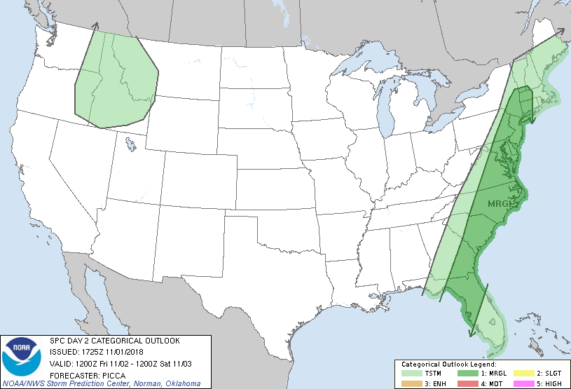
...THERE IS A MARGINAL RISK OF SEVERE THUNDERSTORMS ACROSS PARTS OF
THE EAST COAST...
...SUMMARY...
A few strong to locally severe storms, capable of isolated wind
damage, will be possible across parts of the East Coast through
Friday night.
...Discussion...
A highly amplified mid/upper trough will advance towards the East
Coast Friday, as one shortwave impulse dives southeast towards the
lower Mississippi Valley and another upstream impulse crosses the
Pacific Northwest. Along the eastern flank of the longwave trough,
increasing south/southwesterly mid-level flow will overspread the
East Coast, and multiple, convectively augmented impulses will
likely be embedded within this flow regime. Each of these systems
will provide some focus for convective enhancement and a related
threat of gusty winds, through the period.
The initial perturbation, likely associated with ongoing convection
across the Southeast, will be lifting across the Mid-Atlantic and
southern New England Friday morning. Despite surface
temperatures/dew points in the 60s and weak buoyancy, a few deeper
convective elements may be capable of transporting this stronger
momentum to the surface, offering a marginal risk of locally
damaging gusts from the Mid-Atlantic to southern New England through
late morning.
A secondary impulse will lift northeast across the Appalachians
during the afternoon. Its associated warm conveyor will be
characterized by strengthening 850mb flow from eastern North
Carolina to the Delmarva. Ascent related to warm advection, combined
with low-level confluence along the surface front, may yield a few
deeper cells during the afternoon/evening hours from Virginia to New
Jersey. These cells may also be capable of locally damaging gusts.
From Florida to the Carolinas, an initial round of gusty winds will
be possible Friday morning. Lingering showers and storms will be
pushing east early in the period, and some continued enhancement of
0-3km flow on the southern end of the low-level jet may yield a few
damaging gusts. Thereafter, a second round of strong storms may be
possible late Friday night across coastal North Carolina, given the
influence of the primary shortwave trough traversing the region.
Isolated damaging winds would be the main threat with these cells as
well.
...MAXIMUM RISK BY HAZARD...
Tornado: 2% - Marginal
Wind: 5% - Marginal
Hail: <5% - None
..Picca.. 11/01/2018
CLICK TO GET WUUS02 PTSDY2 PRODUCT
NOTE: THE NEXT DAY 2 OUTLOOK IS SCHEDULED BY 0600Z