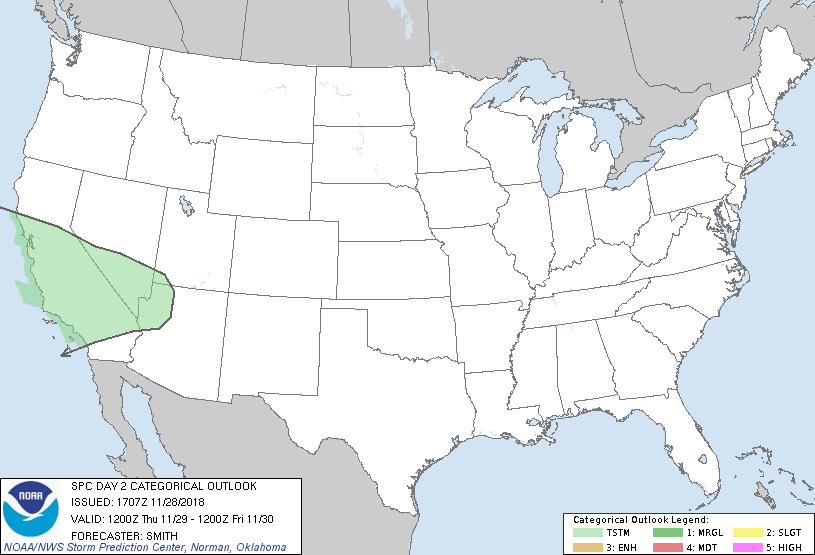
| Categorical Graphic |
|---|

|
| Probabilistic Graphic |
 |
| Probability of severe weather within 25 miles of a point. Hatched Area: 10% or greater probability of significant severe within 25 miles of a point. |
   SPC AC 281707

   Day 2 Convective Outlook
   NWS Storm Prediction Center Norman OK
   1107 AM CST Wed Nov 28 2018

   Valid 291200Z - 301200Z

   ...NO SEVERE THUNDERSTORM AREAS FORECAST...

   ...SUMMARY...
   No severe thunderstorms are expected across the U.S. Thursday.

   ...California into northwest AZ...
   A progressive shortwave trough will continue east-southeast through
   CA and southern NV accompanied by cooling aloft and steepening
   mid-level lapse rates.  A few thunderstorms are likely where pockets
   of weak instability develop during the day over CA before this
   activity spreads east into southern NV and northwest AZ during the
   latter part of the day 2 period.

   ...Southeast Texas into the lower Mississippi Valley...
   Modifying Continental Polar air with trajectories from the Gulf will
   advect through the lower MS Valley as winds return to southerly in
   wake of a retreating surface ridge. This process will result in
   destabilization, but instability will remain marginal due to weak
   mid-level lapse rates. Moreover, forecast soundings indicate
   presence of an inversion around 700 mb. Scattered showers are
   expected to develop within an evolving, broad warm advection regime.
    Given likelihood of modest mid-level inversions and at best weak
   forcing for ascent through the capping layers, it still appears most
   updrafts will remain too shallow or weak for more than very sparse
   lightning activity at best.

   ...MAXIMUM RISK BY HAZARD...
   Tornado:  <2%     - None
   Wind:     <5%     - None
   Hail:     <5%     - None

   ..Smith.. 11/28/2018

   CLICK TO GET WUUS02 PTSDY2 PRODUCT

   NOTE: THE NEXT DAY 2 OUTLOOK IS SCHEDULED BY 0700Z
|