SPC AC 260628
Day 2 Convective Outlook
NWS Storm Prediction Center Norman OK
1228 AM CST Wed Dec 26 2018
Valid 271200Z - 281200Z
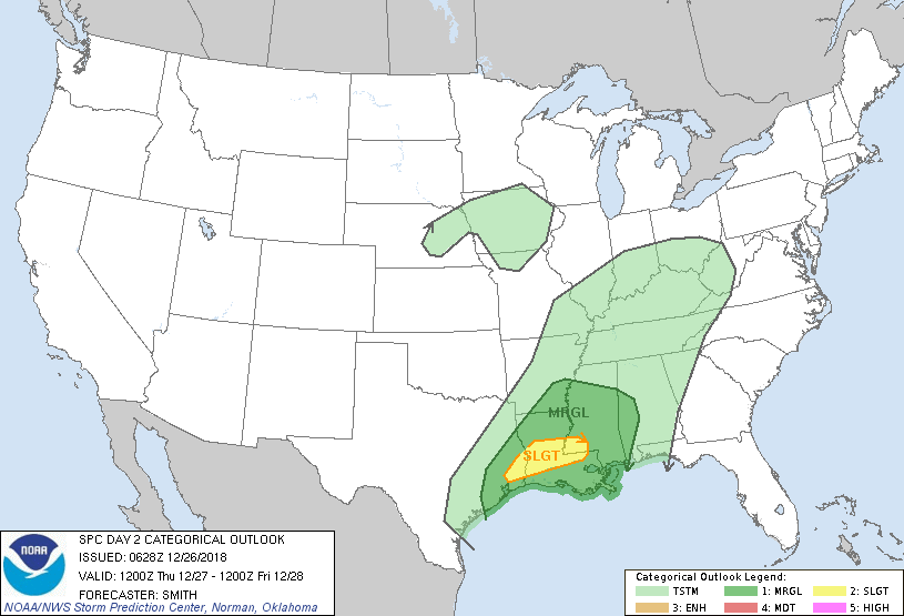
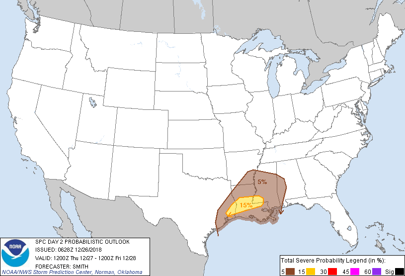
...THERE IS A SLIGHT RISK OF SEVERE THUNDERSTORMS FROM SOUTHEAST
TEXAS ACROSS CENTRAL LOUISIANA INTO SOUTHWEST MISSISSIPPI...
...SUMMARY...
Scattered severe thunderstorms are possible Thursday over southeast
Texas into central Louisiana and southern Mississippi. Damaging
winds and a tornado or two are the primary severe risks.
...Synopsis...
A potent mid-level trough --featuring a 100kt 500mb speed max-- will
move from the southern Plains northeast into the lower MO Valley by
evening, and subsequently moving into the western Great Lakes states
and weakening substantially late Thursday night. In the low levels,
a surface low will move from the KS/NE border to Green Bay during
the period. A trailing cold front will push across the Ozarks while
an effective boundary over eastern TX will move through a large part
of LA and MS.
...Southeast TX and central Gulf Coast states...
On Thursday morning, an extensive squall line will be ongoing from
southeast TX north-northeast into AR. A risk for damaging gusts and
perhaps a tornado or two will accompany the line in association with
rear inflow jets and embedded mesovortices. A strong southerly LLJ
(45-60kt) will gradually weaken through the day over the lower MS
Valley as the deep-layer cyclone becomes increasingly displaced from
the lower MS Valley. It appears the greatest risk for damaging
gusts and a weak tornado is bounded by the northern extent of middle
60s surface dewpoints where surface-based CAPE will develop. As the
squall line moves farther east into eastern MS by early evening, a
less unstable airmass and the lack of additional diurnal
destabilization ahead of the line will probably lead to a waning in
the coverage and magnitude of the severe risk.
...MAXIMUM RISK BY HAZARD...
Tornado: 5% - Slight
Wind: 15% - Slight
Hail: <5% - None
..Smith.. 12/26/2018
CLICK TO GET WUUS02 PTSDY2 PRODUCT
NOTE: THE NEXT DAY 2 OUTLOOK IS SCHEDULED BY 1730Z