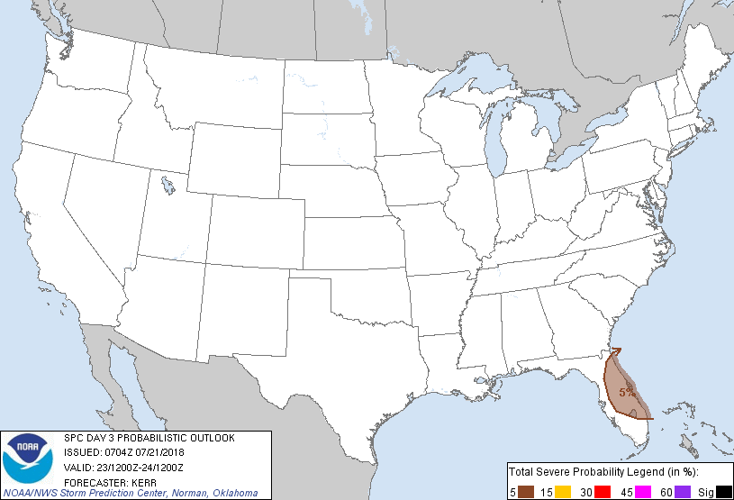
Orlando, FL...Port St. Lucie, FL...Lakeland, FL...Palm Bay, FL...Deltona, FL...
Probabilistic Graphic
Probability of severe weather within 25 miles of a point. Hatched Area: 10% or greater probability of significant severe within 25 miles of a point.
Day 3 Prob. Risk
Area (sq. mi.)
Area Pop.
Some Larger Population Centers in Risk Area
5 %
20,081
6,649,459
Orlando, FL...Port St. Lucie, FL...West Palm Beach, FL...Lakeland, FL...Palm Bay, FL...
SPC AC 210704
Day 3 Convective Outlook
NWS Storm Prediction Center Norman OK
0204 AM CDT Sat Jul 21 2018
Valid 231200Z - 241200Z
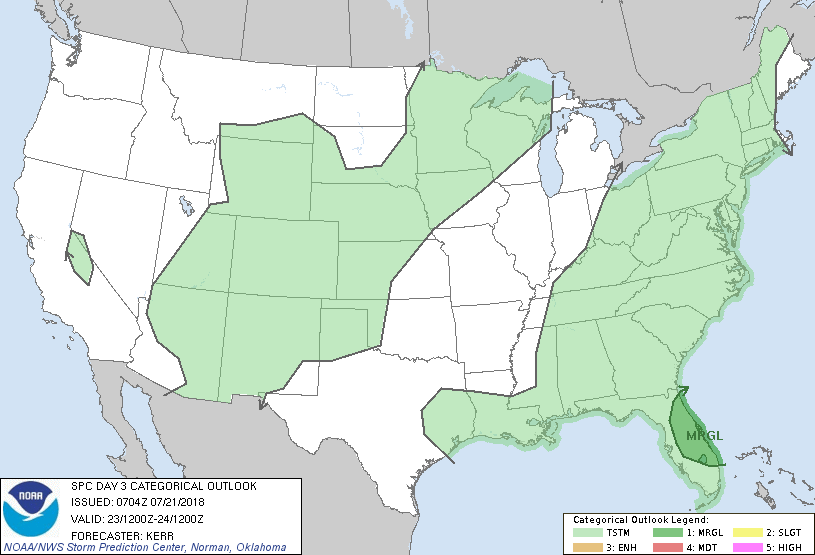
...THERE IS A MARGINAL RISK OF SEVERE THUNDERSTORMS MONDAY ACROSS
INTERIOR AND ATLANTIC COASTAL AREAS OF THE FLORIDA PENINSULA...
...SUMMARY...
Strong thunderstorms may impact interior and Atlantic coastal areas
of the Florida Peninsula Monday, accompanied by some risk for severe
weather.
...Discussion...
South of the far northern tier of the western into central U.S.,
subtropical ridging appears likely to remain prominent through this
period, with the highest mid-level heights becoming centered near
the Arizona/New Mexico border. Mid/upper ridging also appears
likely to remain strong across much of the Northeast. The ridging
may begin to pinch off the northern portion of lingering troughing
east of the Mississippi Valley, within an elongated mid-level
cyclonic circulation within the troughing redeveloping southward
across the Tennessee Valley into the eastern Gulf states.
Modest cyclonic mid-level flow on the southeastern periphery of this
circulation may enhance diurnal thunderstorm development across
interior and Atlantic coastal areas of the Florida Peninsula, where
moderately large CAPE may develop with insolation by midday Monday.
This activity may pose some severe weather potential, mostly in the
form of potentially damaging wind gusts, before diminishing late
Monday afternoon or evening.
Otherwise, generally weak to modest instability and weak/uncertain
synoptic forcing currently seems likely to minimize severe weather
potential elsewhere across the nation.
..Kerr.. 07/21/2018
CLICK TO GET WUUS03 PTSDY3 PRODUCT
NOTE: THE NEXT DAY 3 OUTLOOK IS SCHEDULED BY 0730Z