SPC AC 180741
Day 3 Convective Outlook
NWS Storm Prediction Center Norman OK
0241 AM CDT Sat Aug 18 2018
Valid 201200Z - 211200Z
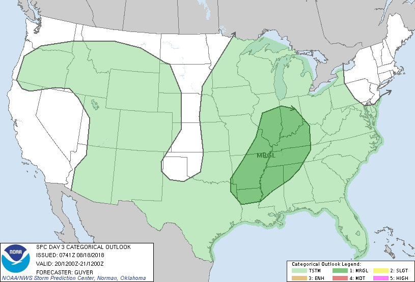
...THERE IS A MARGINAL RISK OF SEVERE THUNDERSTORMS ACROSS THE
LOWER/MIDDLE MISSISSIPPI RIVER VALLEY TO TENNESSEE VALLEY...
...SUMMARY...
Isolated severe thunderstorms will be possible on Monday across the
Lower/Middle Mississippi River Valley to Tennessee Valley.
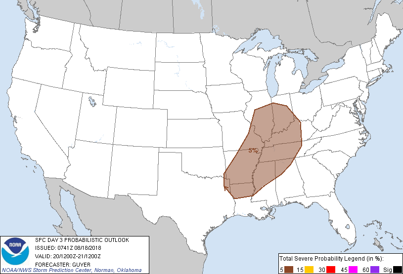
...Lower/Middle Mississippi Valley to Tennessee/Ohio Valleys...
A shortwave trough will continue to spread east-northeastward over
the middle Mississippi River Valley and Midwest on Monday. Even
while this system will begin to lose amplitude, a belt of seasonally
strong low/mid tropospheric winds will continue to overspread parts
of the Mid-South, Tennessee Valley into the Lower Ohio Valley. The
potential for relatively widespread cloud cover and precipitation
should limit the overall magnitude of the severe risk. Regardless,
potentially influenced by differential heating and outflows, storms
should diurnally redevelop and intensify along, or more so, ahead of
a cold front amidst moist/confluent low-level flow during the
afternoon. While considerable uncertainty exists regarding the exact
degree of destabilization, especially with northward extent into the
Midwest/Ohio Valley, flow fields generally characterized by 30-35 kt
effective shear magnitudes would support sustained multicells and a
few supercells capable of primarily wind damage Monday afternoon and
evening.
..Guyer.. 08/18/2018
CLICK TO GET WUUS03 PTSDY3 PRODUCT
NOTE: THE NEXT DAY 3 OUTLOOK IS SCHEDULED BY 0730Z