Baltimore, MD...Charlotte, NC...Washington, DC...Cleveland, OH...Virginia Beach, VA...
SPC AC 190729
Day 3 Convective Outlook
NWS Storm Prediction Center Norman OK
0229 AM CDT Sun Aug 19 2018
Valid 211200Z - 221200Z
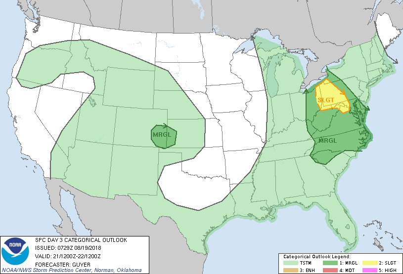
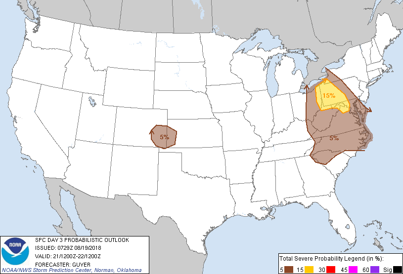
...THERE IS A SLIGHT RISK OF SEVERE THUNDERSTORMS ACROSS THE UPPER
OHIO RIVER VALLEY AND NORTH-CENTRAL APPALACHIANS...
...SUMMARY...
Severe thunderstorms will be possible on Tuesday especially across
portions of the Appalachians and Mid-Atlantic States.
...Appalachians/Upper Ohio River Valley and Mid-Atlantic/Northeast
States...
Although the primary surface cyclogenesis will be focused north of
the International border, a semi-amplified belt of seasonally strong
westerlies will overspread much of the region on Tuesday coincident
with an eastward-moving cold front. While the possibility of
relatively widespread early-day convection and cloud cover limits
confidence in appreciable destabilization, relatively strong
low-level shear and upwards of 35-40 kt effective shear suggests the
potential for sustained multicells and some supercells where
adequate diurnally enhanced destabilization occurs. This currently
appears most probable across the north-central Appalachians and
upper Ohio River Valley vicinity. That said, at least isolated
severe storms may occur as far south as the Carolinas under a more
modestly strong flow regime.
...Central High Plains...
At least a few severe thunderstorms may occur across the region
Tuesday afternoon into evening. This will be in association with
enhanced moist low-level upslope flow to the north of a southern
High Plains surface low and in conjunction with a moderately strong
belt of westerlies to the north of the southern High Plains-centered
upper-level ridge.
..Guyer.. 08/19/2018
CLICK TO GET WUUS03 PTSDY3 PRODUCT
NOTE: THE NEXT DAY 3 OUTLOOK IS SCHEDULED BY 0730Z