SPC AC 220642
Day 3 Convective Outlook
NWS Storm Prediction Center Norman OK
0142 AM CDT Sat Sep 22 2018
Valid 241200Z - 251200Z
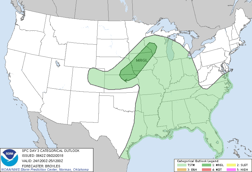
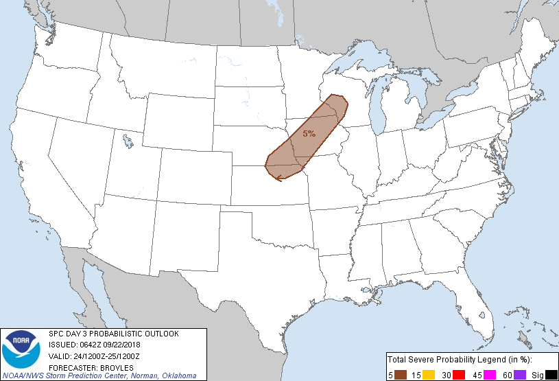
...THERE IS A MARGINAL RISK OF SEVERE THUNDERSTORMS ACROSS PARTS OF
THE CENTRAL PLAINS...MID MISSOURI VALLEY AND UPPER MISSISSIPPI
VALLEY...
...SUMMARY...
Marginally severe thunderstorms with hail and strong gusty winds
will be possible on Monday from parts of the central Plains
northeastward into the Upper Mississippi Valley.
...Central Plains/Mid Missouri Valley/Upper Mississippi Valley...
An upper-level trough will move eastward across the northern High
Plains and central Rockies on Monday. At the surface, a cold front
will advance southeastward across the central Plains and mid
Missouri Valley. Surface dewpoints ahead of the front are forecast
to increase into the upper 50s and lower 60s F as weak instability
develops along the front during the late afternoon. It seems most
likely that thunderstorms will develop by early evening along the
front from the central Plains northeastward into the upper
Mississippi Valley with this convection spreading eastward during
the evening. Forecast soundings Monday evening from southeast
Nebraska into southeast Minnesota have enough instability for an
isolated severe threat suggesting hail and strong gusty winds will
be possible. However, weak buoyancy should keep any severe threat
marginal across the region Monday evening.
..Broyles.. 09/22/2018
CLICK TO GET WUUS03 PTSDY3 PRODUCT
NOTE: THE NEXT DAY 3 OUTLOOK IS SCHEDULED BY 0730Z