SPC AC 230736
Day 3 Convective Outlook
NWS Storm Prediction Center Norman OK
0236 AM CDT Sun Sep 23 2018
Valid 251200Z - 261200Z
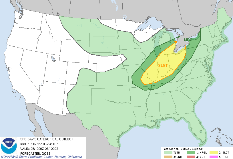
...THERE IS A SLIGHT RISK OF SEVERE THUNDERSTORMS FROM PARTS OF
EASTERN MISSOURI NORTHEASTWARD TO THE LAKE ERIE VICINITY...
...SUMMARY...
Severe risk -- mainly in the form of damaging winds -- is forecast
to evolve Tuesday from the Ozarks vicinity northeastward to the
Lower Great Lakes.
...Synopsis...
A long-wave upper trough is progged to reside over central NOAM at
the start of the period, with a shorter-wavelength trough embedded
therein to advance slowly eastward with time.
In conjunction with short-wave progression aloft, a seasonably
strong surface cold front -- initially expected to lie from the
Upper Great Lakes southwestward to the southern Rockies -- will
likewise advance eastward/southeastward, and should extend from
roughly the Lake Erie vicinity southwestward in an arcing manner
across the Mid-South, and then to central Texas.
Elsewhere, upper-level ridging will flank the large area of cyclonic
flow, while corresponding surface high pressure prevails both east
and west of the advancing surface front.
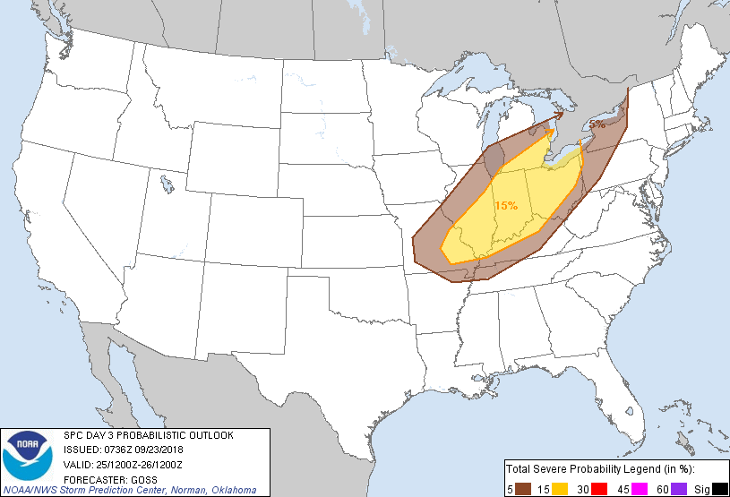
...The Ozarks vicinity northeastward to the Lower Great Lakes...
As a surface cold front sweeps across the Upper Great Lakes/Midwest
region during the day Tuesday, modest pre-frontal boundary-layer
heating/destabilization is expected. Robust large-scale ascent --
focused near the surface front -- should allow development of a
frontal or pre-frontal convective band, which will likely grow
upscale into an at least loosely continuous squall line through late
afternoon/early evening. With moderately strong west-southwest flow
aloft supporting both locally organized updrafts and fast storm
motion, locally damaging winds will likely affect a broad portion of
the Midwest vicinity as the system advances quickly eastward.
With the strongest flow over northern fringes of the outlook area,
some risk for damaging winds appears evident despite more limited
availability of CAPE with northward extent. Later, as instability
diminishes diurnally across the entire risk area, severe threat
should gradually decrease through the overnight hours.
..Goss.. 09/23/2018
CLICK TO GET WUUS03 PTSDY3 PRODUCT
NOTE: THE NEXT DAY 3 OUTLOOK IS SCHEDULED BY 0730Z