SPC AC 120826
Day 3 Convective Outlook
NWS Storm Prediction Center Norman OK
0226 AM CST Wed Dec 12 2018
Valid 141200Z - 151200Z
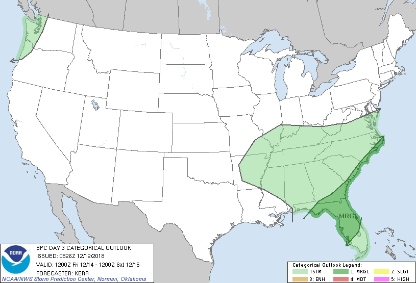
...THERE IS A MARGINAL RISK OF SEVERE THUNDERSTORMS FRIDAY INTO
FRIDAY NIGHT ACROSS PARTS OF NORTHERN AND CENTRAL
FLORIDA...SOUTHEASTERN GEORGIA AND THE COASTAL CAROLINAS...
...SUMMARY...
Strong thunderstorms may impact parts of northern and central
Florida, southeastern Georgia and the coastal Carolinas Friday into
Friday night, accompanied by at least some risk for severe weather.
...Synopsis...
Split westerlies will continue to emanate from the mid-latitude
Pacific, with several embedded amplified waves. A couple of these
are forecast to progress through one branch across the Pacific
Northwest into the Canadian Prairies during this period. A more
prominent perturbation within another branch, including a deep
lower/mid tropospheric cyclone, appears likely to progress more
slowly, east/northeastward across the lower Mississippi Valley.
In association with this latter feature, a plume of increasingly
moist air, emanating from a more substantively modifying boundary
layer over the central/eastern Gulf of Mexico, appears likely to
advect into much of the Southeast, with highest moisture content
overspreading southern and middle portions of the Atlantic Seaboard.
This may include mid/upper 60s+ surface dew points within the warm
sector of the cyclone, across much of Florida and perhaps parts of
adjacent southeast Georgia into coastal areas of the Carolinas.
Destabilization associated with the moistening, and large-scale
ascent, is expected to support areas of scattered thunderstorm
development Friday through Friday night.
...Southeast...
Considerable spread remains evident in model ensemble output, and
among the various deterministic model output, concerning the
evolution and progression of the cyclone, including possible
secondary surface wave development inland across northern Florida
into the Carolinas. Even where confidence is greatest concerning
the most substantive boundary layer moistening, questions remain
concerning the degree of associated boundary layer destabilization.
This may ultimately mitigate the overall severe weather potential,
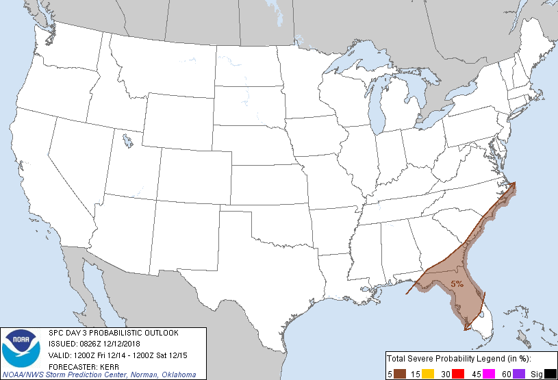
but at least isolated severe storms appear possible, particularly
Friday across parts of northern and central Florida.
To varying degrees, models indicate that strengthening of lower/mid
tropospheric wind fields coupled with boundary layer moistening and
destabilization will precede the inland advance of vigorous
thunderstorm activity off the northeastern Gulf of Mexico during the
day Friday. As this occurs, it appears at least possible that the
environment may become conducive to organized severe storm
development, including supercells and a risk for a tornado or two,
in addition to potential for severe hail and wind.
..Kerr.. 12/12/2018
CLICK TO GET WUUS03 PTSDY3 PRODUCT
NOTE: THE NEXT DAY 3 OUTLOOK IS SCHEDULED BY 0830Z