SPC AC 041254
Day 1 Convective Outlook
NWS Storm Prediction Center Norman OK
0654 AM CST Fri Jan 04 2019
Valid 041300Z - 051200Z
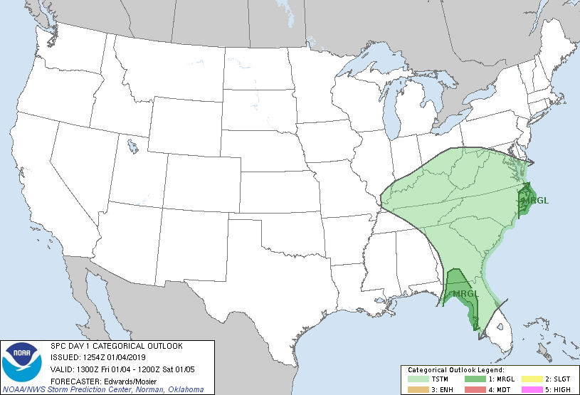
...THERE IS A MARGINAL RISK OF SEVERE THUNDERSTORMS OVER PORTIONS OF
SOUTHERN GEORGIA...NORTHWESTERN FLORIDA AND EASTERN NORTH
CAROLINA...
...SUMMARY...
Isolated strong-severe cells are possible within a band of showers
and thunderstorms today over parts of Florida and Georgia, and
tonight over eastern North Carolina.
...Synopsis...
A split-flow pattern remains over the CONUS in mid/upper levels, the
main overland perturbation being a compact, well-defined cyclone now
located over the Arklatex region and moving into the Mid-South. The
500-mb low is forecast to pivot east-northeastward across the
Tennessee Valley region this afternoon into early evening, ending up
over central/western VA by 12Z, with slight filling of central
height, but nonetheless forcing a well-defined area of height falls
and DCVA in its eastern semicircle.
At the surface, 11Z analysis showed a low over western TN roughly
between MEM-MKL, with occluded front to north-central AL and cold
front southward from there across the western FL Panhandle, to the
north-central/southwestern Gulf. A diffuse/synoptic warm front was
evident over central GA and the extreme southern SC coast, then
offshore eastern SC/southern NC. A secondary/marine warm front was
evident in weakening form over the northeastern Gulf, south of
Apalachee Bay and west of the Peninsula on shelf waters.
The initial surface low is expected to occlude/fill further and
follow beneath or just ahead of the mid/upper cyclone track toward
WV this evening. Meanwhile the cold front will advance eastward
over FL, GA and the Carolinas. A newer/triple-point low should form
late tonight over VA and move toward Chesapeake Bay, with cold front
arching southeastward offshore from the Carolinas, GA, and most or
all the FL Peninsula by the end of the period.
...FL Gulf Coast...southwestern GA...
A narrow band of mostly showers, with thunderstorms near the
immediate coast and sporadic/embedded cyclonic-shear areas and small
bow/LEWP features well inland, continues to move eastward into the
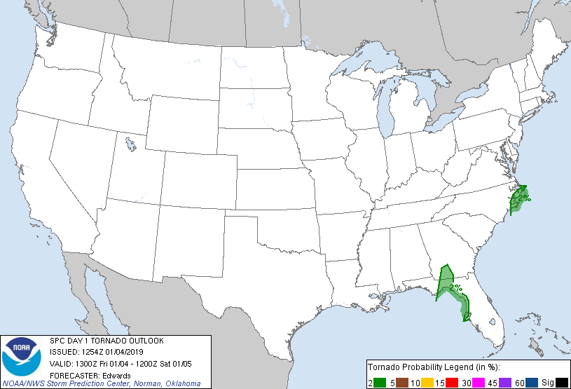
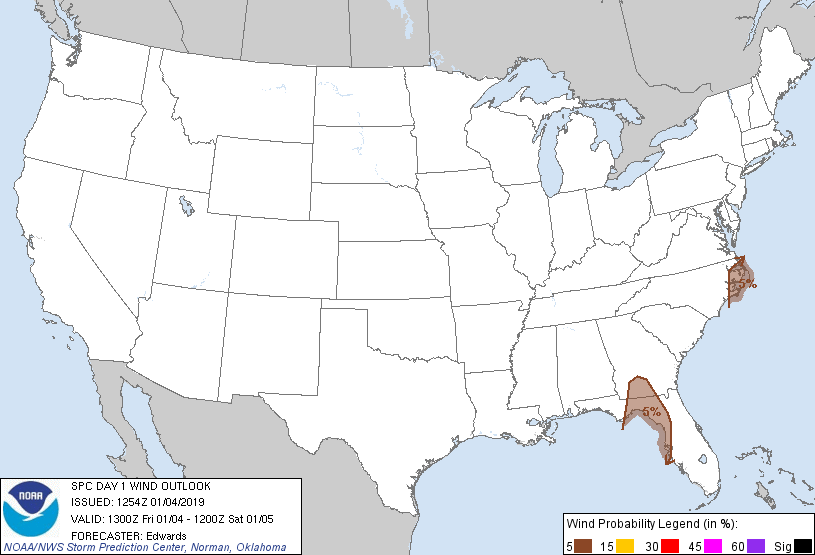
eastern Panhandle and southwestern GA. A brief tornado or damaging
gust cannot be ruled out the next couple hours. See SPC mesoscale
discussion 8 for details on the near-term scenario.
A narrow, marginal plume of surface-based buoyancy has shifted
inland ahead of this feature, associated with surface dew points
mainly upper 60s F, with MLCAPE 100-500 J/kg and areas of 200-300
effective SRH. This regime will shift eastward across the outlook
area through the remainder of the morning, then onshore northwest/
west-central FL this afternoon. Though low/middle-level lapse rates
will remain weak, the modest buoyancy and strong low-level/
convective-scale lift may support a continued coherent quasi-linear
band of strong convection with isolated embedded thunder, strong/
damaging gusts, and marginal tornado risk. Veering preconvective
boundary-layer flow with time is expected mid/late afternoon,
reducing low-level shear, hodograph size and convergence, with
inland extent. The convective band also will encounter more-stable
trajectories over south-central/southeastern GA, and with eastward
extent from northwestern FL and the eastern Panhandle across the
northern peninsula.
...Eastern NC...
One or two bands of thunderstorms should cross this region this
evening and overnight. Isolated damaging gusts are possible, and a
brief tornado cannot be ruled out. The leading activity likely
would represent a northward extension of the activity now over parts
of GA and FL Panhandle, with additional convection possible closer
to the cold front. Potential with trailing convection is
conditional on mesoscale processes, primarily recovery behind the
initial activity.
Mass response to the approaching, still-strong cyclone aloft will
result in strengthening deep-layer shear and low-level hodographs,
with a 50-60-kt LLJ expected to develop over the outlook area prior
to most of the convection. As is most often the case in wintertime,
the predominant modulator for severe-storm potential will be
instability. The most favorably buoyant low-level airmass will
remain offshore, over the Gulf Stream and perhaps some shelf waters.
However, a southerly boundary-layer flow component will lead to
inland advection of a partially marine-modified, but also perhaps
precip-affected, marine layer. Despite weak midlevel lapse rates,
this may support patches or narrow corridors of 200-500 J/kg MLCAPE
near the coast, decreasing northward/inland ahead of the cold front.
..Edwards/Mosier.. 01/04/2019
CLICK TO GET WUUS01 PTSDY1 PRODUCT
NOTE: THE NEXT DAY 1 OUTLOOK IS SCHEDULED BY 1630Z
|