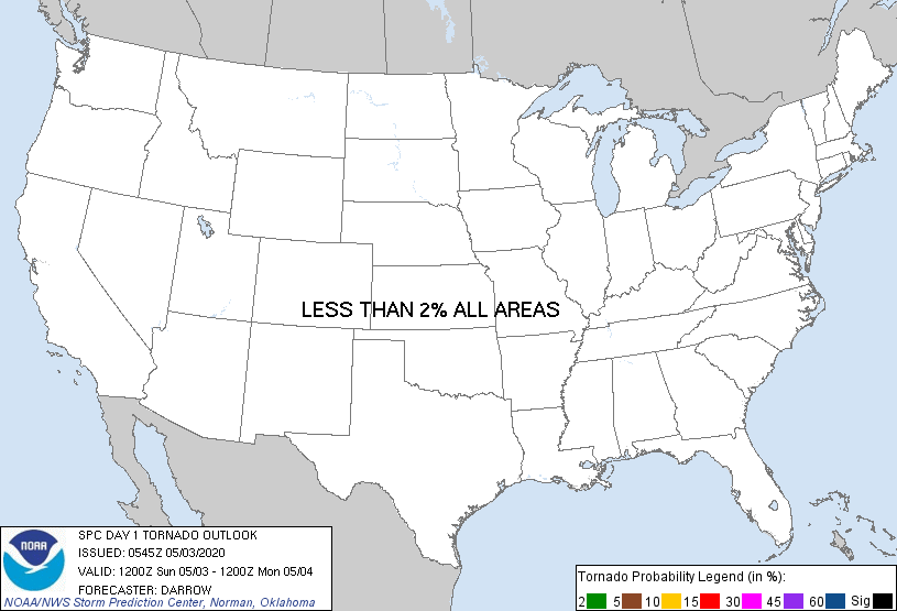
Probability of a tornado within 25 miles of a point. Hatched Area: 10% or greater probability of EF2 - EF5 tornadoes within 25 miles of a point.
Day 1 Tornado Risk
Area (sq. mi.)
Area Pop.
Some Larger Population Centers in Risk Area
No Risk Areas Forecast
Probabilistic Damaging Wind Graphic
Probability of damaging thunderstorm winds or wind gusts of 50 knots or higher within 25 miles of a point. Hatched Area: 10% of greater probability of wind gusts 65 knots or greater within 25 miles of a point.
SPC AC 030545
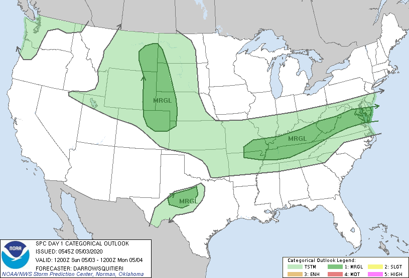
Day 1 Convective Outlook
NWS Storm Prediction Center Norman OK
1245 AM CDT Sun May 03 2020
Valid 031200Z - 041200Z
...THERE IS A MARGINAL RISK OF SEVERE THUNDERSTORMS ACROSS PARTS OF
THE HIGH PLAINS AND FROM THE OZARKS TO THE SOUTHERN DELMARVA...
...SUMMARY...
A few severe thunderstorms are possible later today from the Ozarks
eastward across Kentucky, Tennessee and toward the southern
Delmarva. Additional isolated severe storms are possible across the
northern and central High Plains, and over a small portion of
west-central Texas.
...Northern/Central High Plains...
Early-morning water-vapor imagery depicts a well-defined short-wave
trough over WA/OR. This feature is forecast to eject across the
northern Rockies later today suppressing heights to near I-70 by the
end of the period. Latest model guidance suggests a notable lee
trough will evolve across eastern MT - northeast WY - northeast CO.
Along and east of this boundary, surface dew points are expected to
hold in the low-mid 40s through peak heating. As surface
temperatures warm to near 70F, low-level lapse rates will steepen
such that convective temperatures will be breached within a
favorably buoyant regime for robust updrafts. Forecast soundings
suggest adequate deep-layer shear for organized rotating storms and
a few supercells may ultimately evolve ahead of the approaching
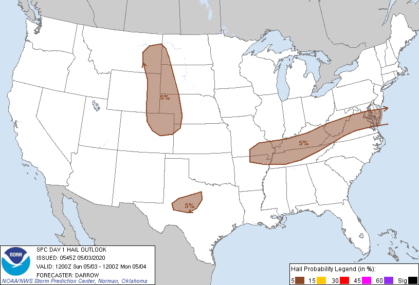
trough. Hail/wind are the primary threats due to marginal low-level
moisture.
...West-Central TX...
Surface front is expected to continue surging south across the High
Plains to a position from central OK - northwest TX by 18z. The
boundary should stall across the TX South Plains and serve as the
focus for thunderstorm development as temperatures soar through the
90s to near 100F south of the front. Convective temperatures should
be realized around 21z and weak vertical shear should result in
high-based multi-cell updrafts. Hail and wind can be expected with
this strongly diurnal activity.
...Ozarks to the Southern Delmarva...
Surface front will settle south across the TN Valley during the
early afternoon while a frontal passage should occur later in the
evening over the southern Middle Atlantic. Southern influence of
Great Lakes short-wave trough will aid convective development along
the wind shift as high-level diffluent flow overspreads this region.
While deep-layer flow will be sufficiently strong for sustaining
organized severe updrafts, forecast soundings across the TN Valley
exhibit substantial warm nose near 700mb and profile adjustments
ahead of the trough maintain relatively poor surface-3km lapse rates
through the period. Given the less-than-ideal lower-thermodynamic
profiles, will maintain 5% hail/wind probs to account for scattered
multi-cell frontal clusters.
..Darrow/Squitieri.. 05/03/2020
CLICK TO GET WUUS01 PTSDY1 PRODUCT
NOTE: THE NEXT DAY 1 OUTLOOK IS SCHEDULED BY 1300Z