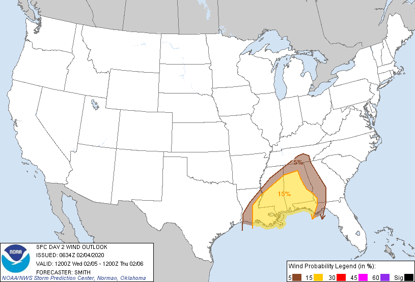
Probability of damaging thunderstorm winds or wind gusts of 50 knots or higher within 25 miles of a point. Hatched Area: 10% of greater probability of wind gusts 65 knots or greater within 25 miles of a point.
Day 2 Wind Risk
Area (sq. mi.)
Area Pop.
Some Larger Population Centers in Risk Area
15 %
103,113
9,188,366
New Orleans, LA...Birmingham, AL...Baton Rouge, LA...Montgomery, AL...Mobile, AL...
SPC AC 040634
Day 2 Convective Outlook
NWS Storm Prediction Center Norman OK
1234 AM CST Tue Feb 04 2020
Valid 051200Z - 061200Z
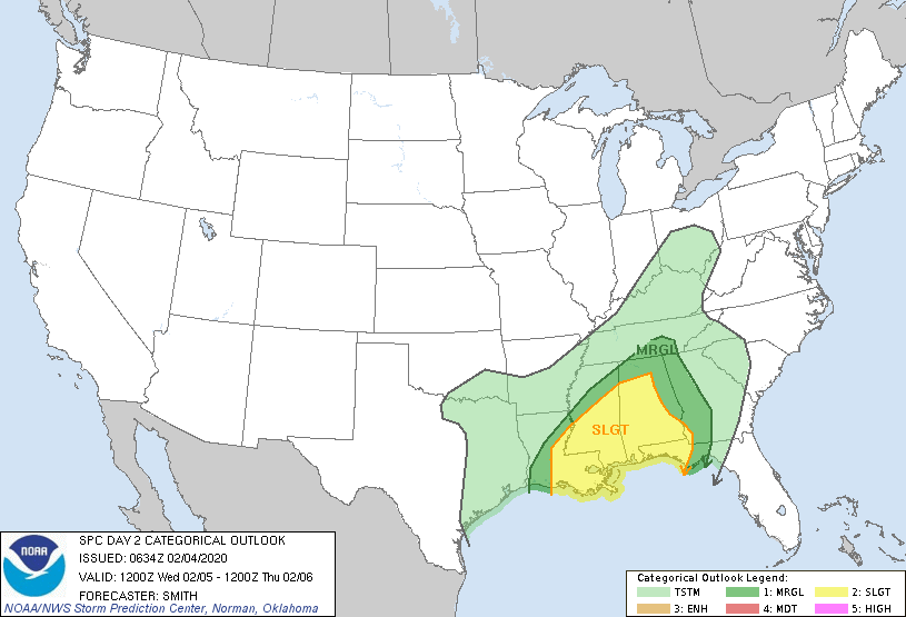
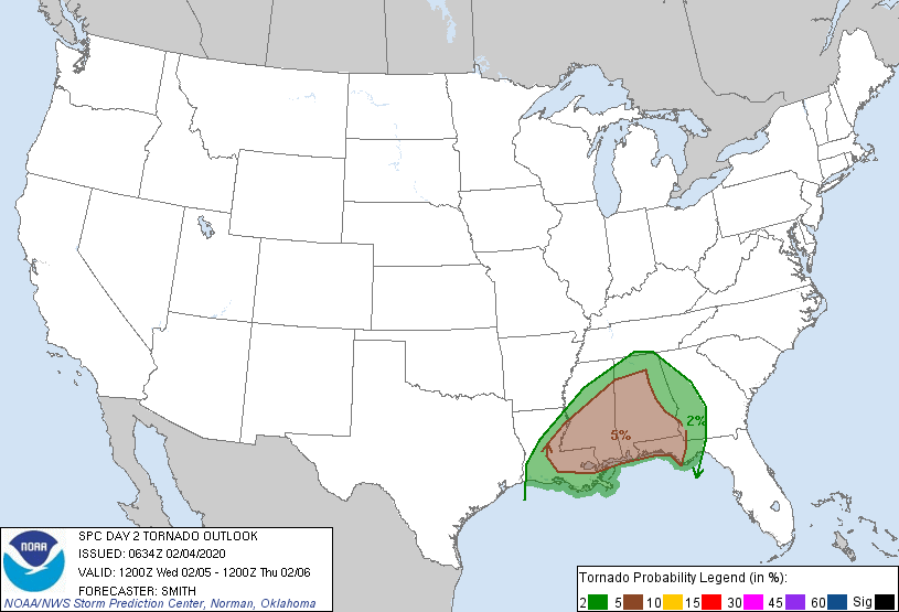
...THERE IS A SLIGHT RISK OF SEVERE THUNDERSTORMS PARTS OF EASTERN
AND SOUTHEAST LOUISIANA INTO MISSISSIPPI AND ALABAMA AND THE WESTERN
FLORIDA PANHANDLE...
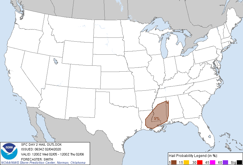
...SUMMARY...
Scattered severe thunderstorms are probable Wednesday across the
central Gulf Coast states with possible severe weather extending
east into western Georgia and the Florida Panhandle overnight
Wednesday. A few tornadoes are possible from parts of Louisiana
eastward into Mississippi and Alabama. Wind damage may accompany
the more intense storms.
...Central Gulf Coast states...
A large-scale mid-level trough initially over the central High
Plains extending southward into northwestern Mexico will gradually
translate east into the Plains states during the period. A
disturbance moving through the base of the trough will move from
southwest TX to the Ozark Plateau by early evening and subsequently
to the southwest Great Lakes. Accompanying this mid-level impulse,
strengthening southwesterly flow fields will overspread a
destabilizing warm sector across the central Gulf Coast states. In
the low levels, surface cyclogenesis is progged over northern LA by
midday Wednesday with the low developing northeastward along a
stalled frontal zone into the OH Valley late Wednesday night.
Model guidance is in good agreement on the relative placement of the
frontal zone extending from LA northeast into middle TN. South of
this boundary, low-level moisture is forecast to gradually increase
with surface dewpoints expected to rise into the lower-middle 60s
deg F. Coincident with surface cyclogenesis, sufficient heating
forecast during the diurnal heating cycle will likely lead to a
weakly to moderately unstable airmass from central LA northeast into
MS/AL. Models appear to favor a few convective scenarios which may
play out on Wednesday with 1) initial storm development over LA near
the boundary in proximity to stronger forcing to the west/northwest,
and 2) potential warm-sector development farther east in southern MS
in between I-10 and I-20 near a maritime front. Forecast hodographs
vary slightly between different model guidance but a general
supercell-wind profile would support the stronger warm-sector
initiating storms to develop into supercells with all severe hazards
possible. The strengthening 700-mb flow during the day lends some
confidence in storm evolution featuring a mix of cells and
convective bands. As storms move east during the evening and
overnight, a gradual decrease in instability will probably favor the
greatest severe risk becoming confined closer to the coastal plain
as the activity moves into eastern AL/western GA and the FL
Panhandle.
..Smith.. 02/04/2020
CLICK TO GET WUUS02 PTSDY2 PRODUCT
NOTE: THE NEXT DAY 2 OUTLOOK IS SCHEDULED BY 1730Z