Probability of a tornado within 25 miles of a point. Hatched Area: 10% or greater probability of EF2 - EF5 tornadoes within 25 miles of a point.
Day 2 Tornado Risk
Area (sq. mi.)
Area Pop.
Some Larger Population Centers in Risk Area
No Risk Areas Forecast
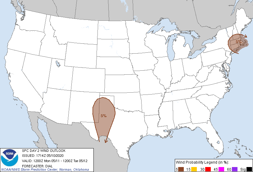
Probabilistic Damaging Wind Graphic
Probability of damaging thunderstorm winds or wind gusts of 50 knots or higher within 25 miles of a point. Hatched Area: 10% of greater probability of wind gusts 65 knots or greater within 25 miles of a point.
SPC AC 101714
Day 2 Convective Outlook
NWS Storm Prediction Center Norman OK
1214 PM CDT Sun May 10 2020
Valid 111200Z - 121200Z
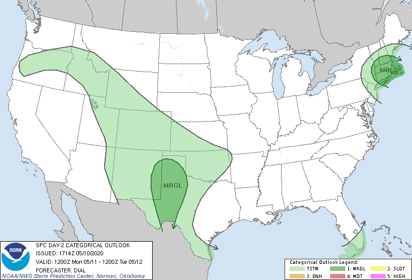
...THERE IS A MARGINAL RISK OF SEVERE THUNDERSTORMS OVER SOUTHERN
NEW ENGLAND AND THE SOUTHERN HIGH PLAINS...
...SUMMARY...
Isolated severe thunderstorms are possible across southern New
England as well as portions of the southern High Plains on Monday.
...Southern New England...
Moisture will remain limited in advance of a progressive shortwave
trough and its attendant cold front Monday with near-surface
dewpoints generally in the upper 30s to low 40s F. However, cold air
aloft with -26 C at 500 mb and likelihood of some diabatic warming
of the surface layer should result in MLCAPE from 300-400 J/kg.
Shallow thunderstorms are expected to develop along and just ahead
of the front toward mid day in association with deeper ascent
accompanying the vorticity maximum. Vertical shear and wind profiles
within the convective layer will be modest and supportive of
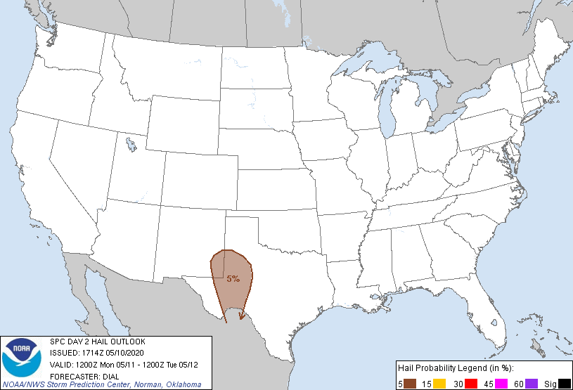
multicells. However, a few locally strong wind gusts and small hail
might accompany the stronger storms through mid afternoon.
...Southern High Plains...
A slow-moving shortwave trough currently approaching western AZ will
reach the southern High Plains Monday afternoon. Preceding this
feature, dewpoints in the upper 40s to low 50s F will advect through
the High Plains warm sector beneath steep lapse rates. As the
surface layer warms, a corridor of MLCAPE up to 1000 J/kg will
likely evolve. Numerous storms are expected to develop over the
mountains of NM through southwest TX during the afternoon and spread
east through eastern NM and west TX. Activity may eventually
congeal into line segments during the evening. Wind profiles will
remain modest with 25-35 kt effective bulk shear supportive of
multicells. However, the thermodynamic environment will support some
threat for a few instances of locally strong to damaging wind gusts
and hail through early evening.
..Dial.. 05/10/2020
CLICK TO GET WUUS02 PTSDY2 PRODUCT
NOTE: THE NEXT DAY 2 OUTLOOK IS SCHEDULED BY 0600Z